After 3-5″ late last week, and the forecast for more heavy showers Monday night, then another round of t-storms possible Tuesday, the last thing Southern New Englanders are looking for is another soaking rainstorm. Unfortunately, the computer models are trending toward a late-workweek scenario that brings a small, potent system close enough to bring a period of moderate to heavy rain Thursday night into Friday.
At this point, the forecast leans toward strong potential for another inch of rain from the coast to I-95 between late Thursday night and midday Friday. That will be close to enough for more flooding – especially if there is upwards of an inch of precipitation Monday night and Tuesday. This is a forecast that may go back and forth a bit this week because of the sharp cutoff that is expected between moderate/heavy rain and dry weather with this system.
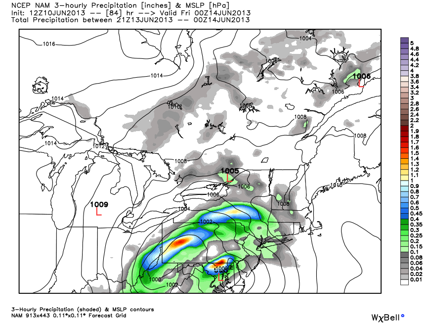
NAM – North American Model
This model only goes out to 84 hours so it’s impossible to see exactly where the storm will be on Friday morning, but the look of the 84 hour panel suggests a decent soaking for SNE.
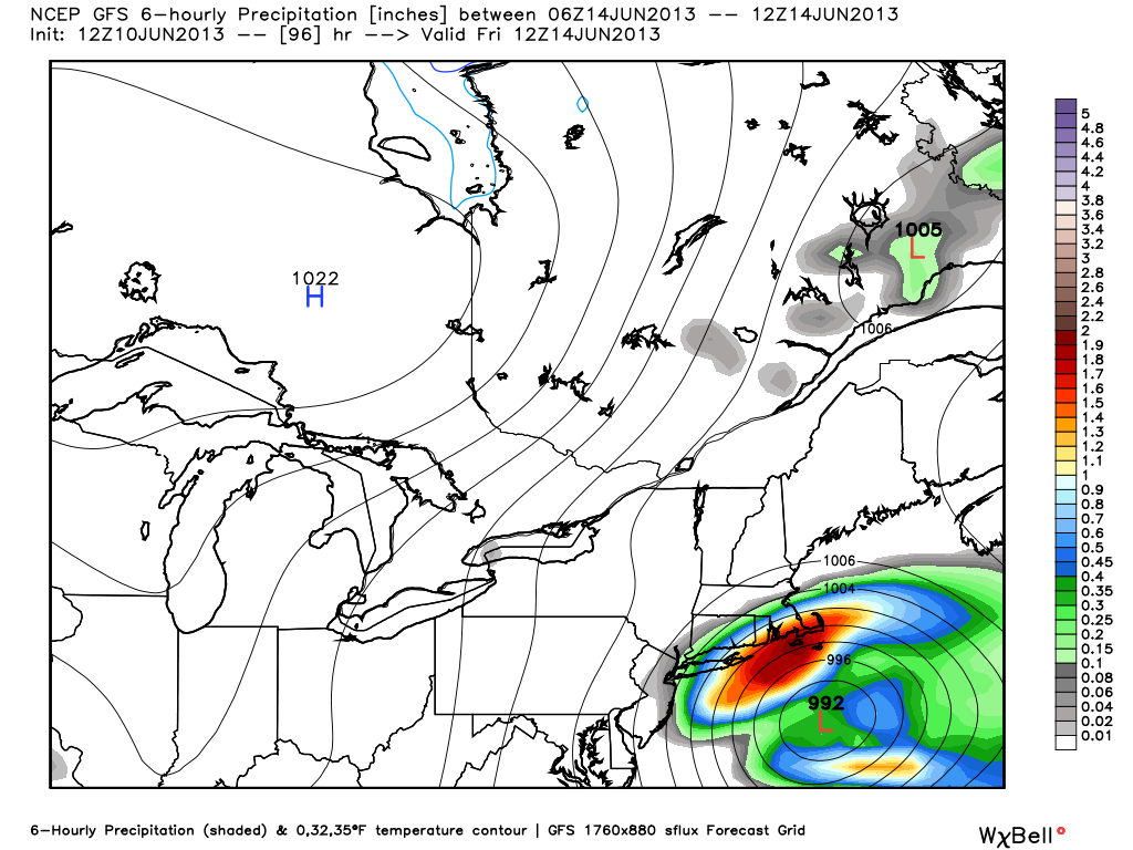
GFS Model
The GFS model brings a robust storm south of Southern New England Thursday night into Friday. The result is another 1-2″ rainfall in 12-18 hours in Southern New England. It would most likely be enough for some renewed flooding on area rivers and streams.

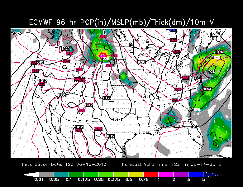
ECMWF – European Model
The European model, while not as ominous as the GFS, brings about an inch of rain from the coast to the I-95 corridor. It would be borderline for any renewed flooding concerns, but would certainly make for a soggy end to the workweek.
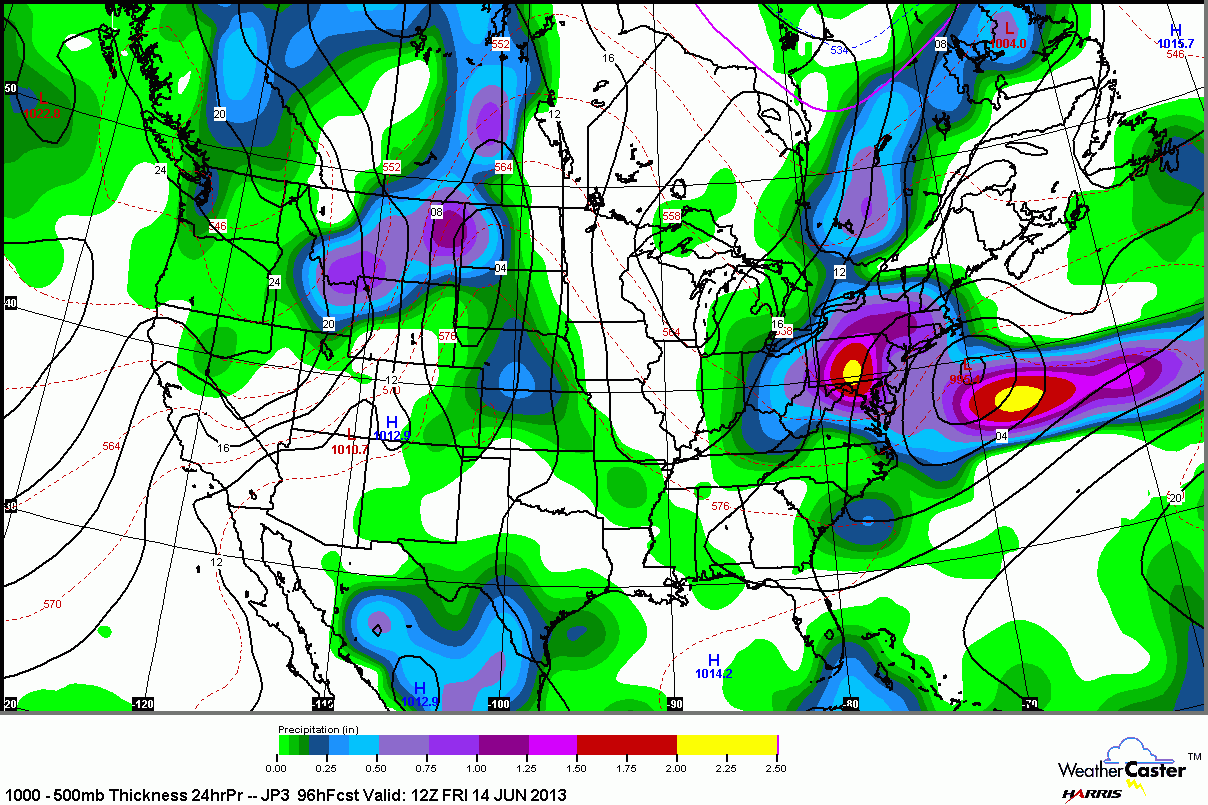
JMA – Japanese
The latest run of the JMA shows the storm cutting to the south of Southern New England similar to the GFS and ECMWF. It’s rainfall totals are more in line with the ECMWF.
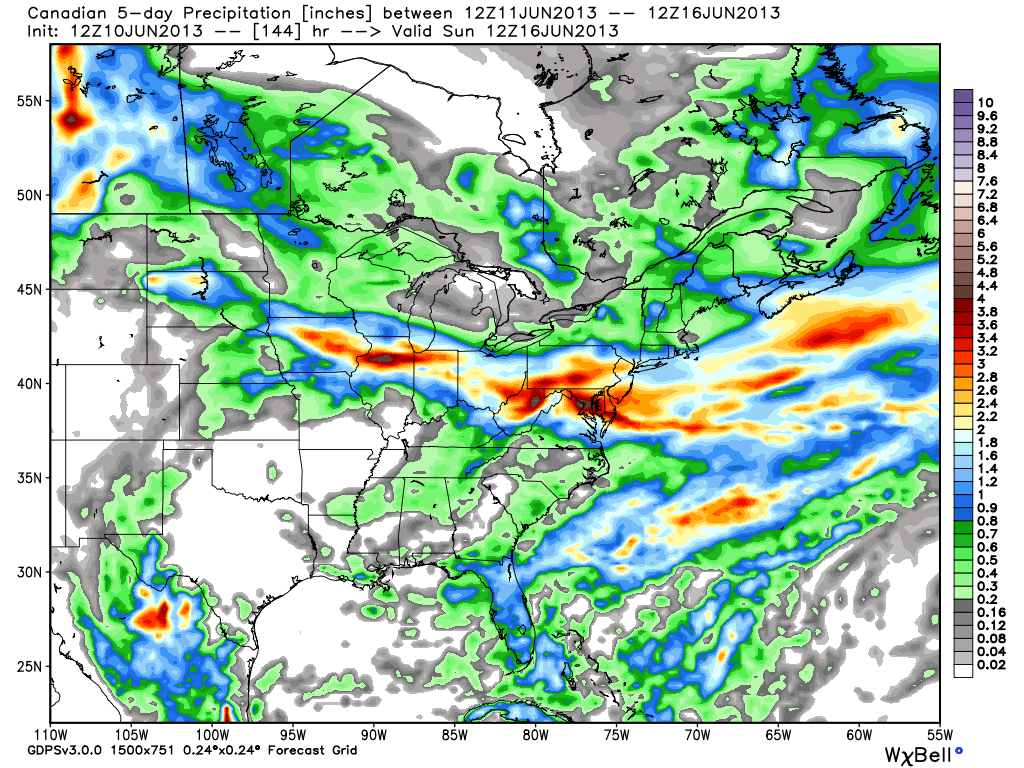
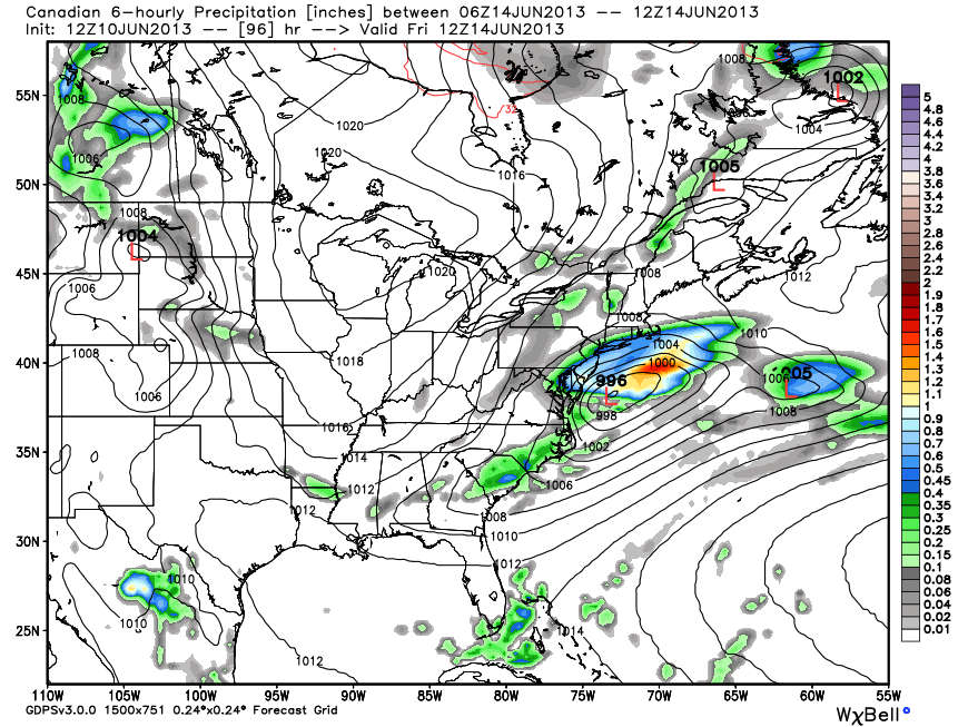
Canadian
The Canadian model had the storm as a complete non-factor with last night’s run. It has since come around to a solution that is similar to the rest of the models
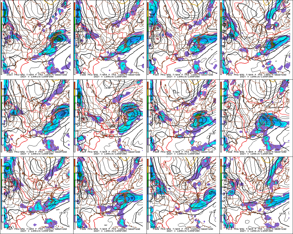
GEFS Ensembles
Only 4 of 12 ensemble members show a direct hit with more rain late in the workweek. That’s the good news. The bad news is some of the other solutions that don’t bring rain look totally out to lunch.