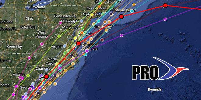
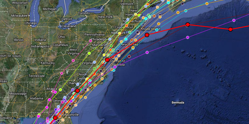
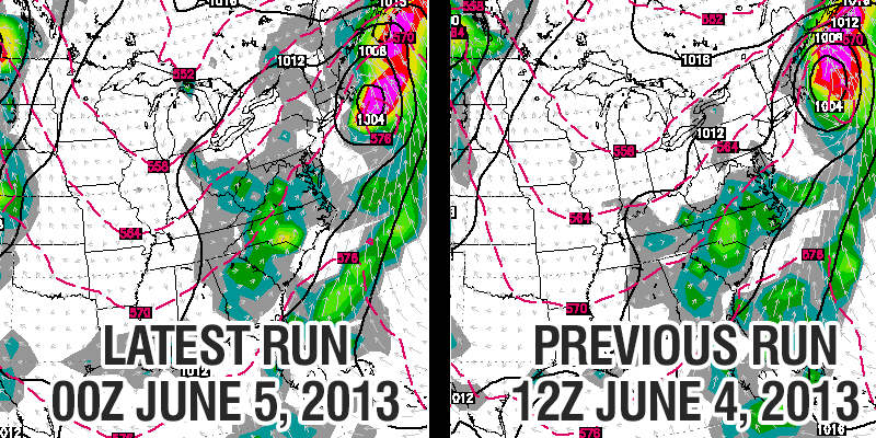
The big computer model trend on Tuesday was for the storm to move through faster than previously forecast. The computer models still show the bulk of the rain occurring Friday afternoon and night, but there are some new trends regarding the track of the storm – which would have an impact on the axis of heaviest rainfall.
Most models have trended east and bring the center of the storm over or just east of Southern New England. This shifts the axis of heaviest rainfall into Southern New England.
The storm will be progressive, and, although there will be heavy or torrential showers near the center of the track, the speed of the system will help to limit the flooding threat – although, some street, river, stream flooding is still possible.
The consensus of the computer models has the rain winding down by 8am Saturday, but there are still some slower tracks. A 6-12 hour timing difference can have a huge impact on Saturday’s outdoor plans. The storm is still 60-84 hours away, and the timing could change slightly.
The window for the storm to become a tropical depression or storm closes by early to midday Friday. Once it starts to interact with the jet stream, the National Hurricane Center will not consider naming it.
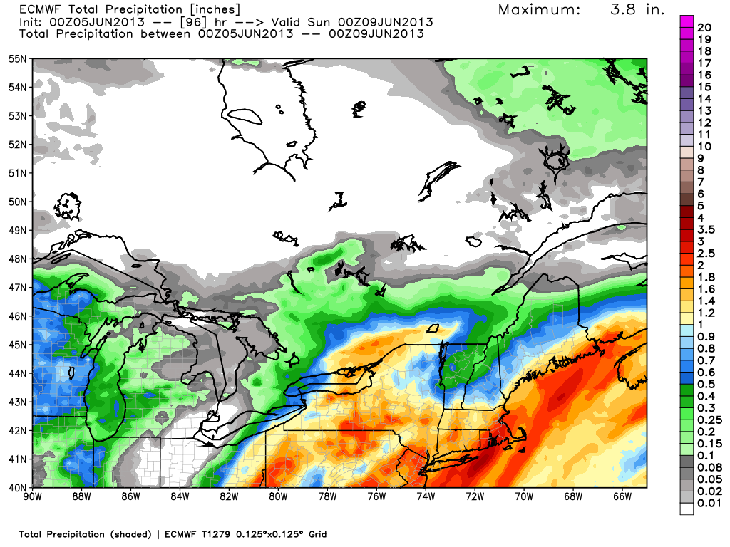
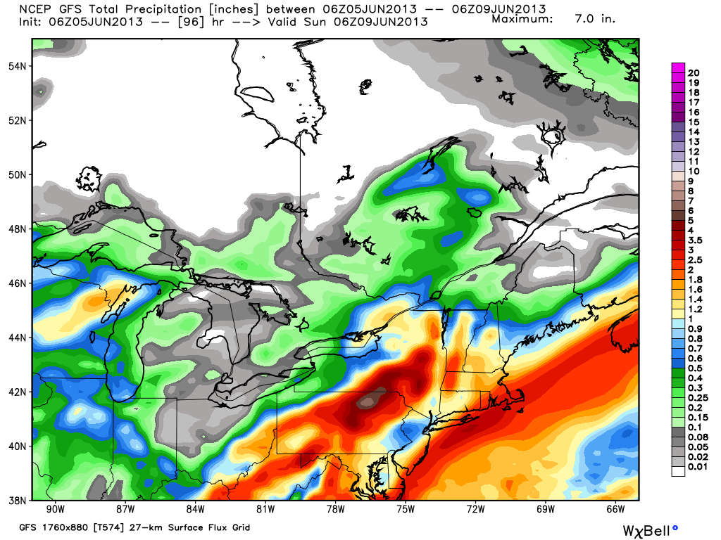
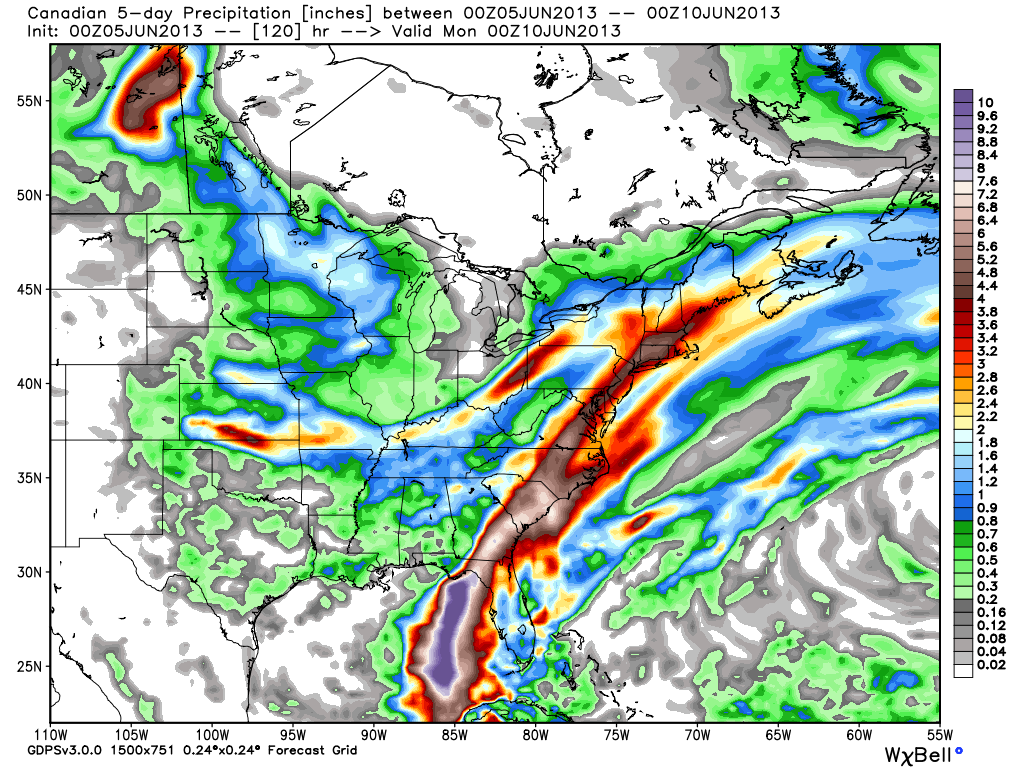
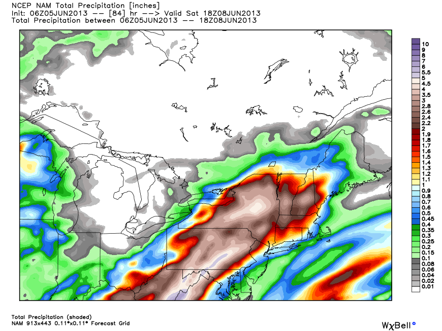
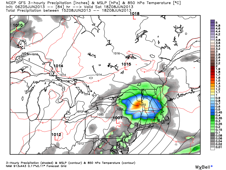
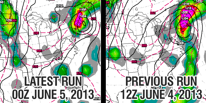
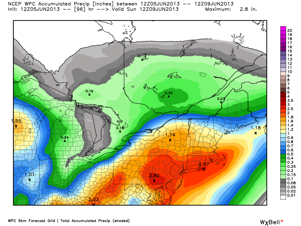
Consensus of tropical computer models has the storm near SNEECMWF showing 1.5-3″ rain in RI and SE MA based on the latest track a bit farther east. 3″ of rain would likely cause street and stream flooding in those areas.GFS operational has 1-2.5″ of rain in Southern New England – a soaker, but not enough for widespread flooding problemsHeaviest rain totals continue to be shown by the Canadian model. While not quite as high as last run, still showing 4″+ in CT and interior MA.The NAM rain forecast reflects its inland track that is an outlier compared to other models at this point.The NAM model is an outlier with a slow track that is well to the west of most other models.The ECMWF has shifted east to a track that is right over S RI and SE MA. A trend farther east would help to limit the flooding threat for, at least, Northern and Central New EnglandThe Canadian model continues to deliver the heaviest rain. The track has shifted slightly east in the most recent runThe GFS model was the farthest east on Tuesday morning, and it has not changed much in the latest run. Other models have trended to the GFS track.WPC precipitation bullseye over Southern New England – RI, CT, and SE MA receive around 2 inches of rain