Right Weather Pro

Computer Model Trends: Thursday-Friday storm

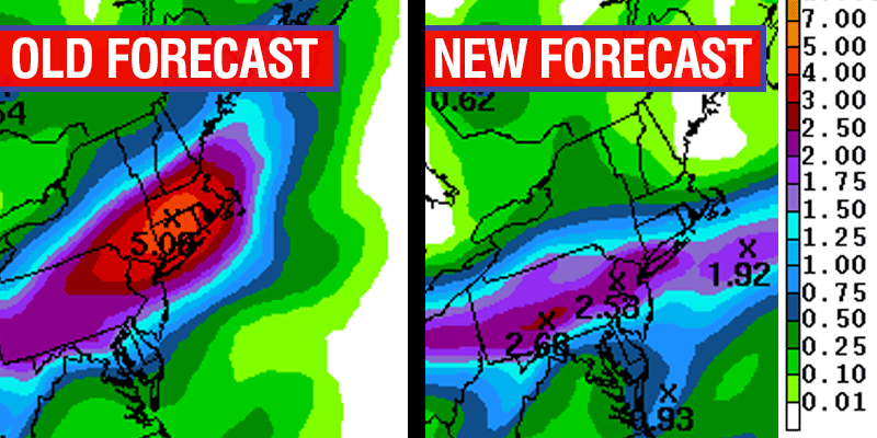
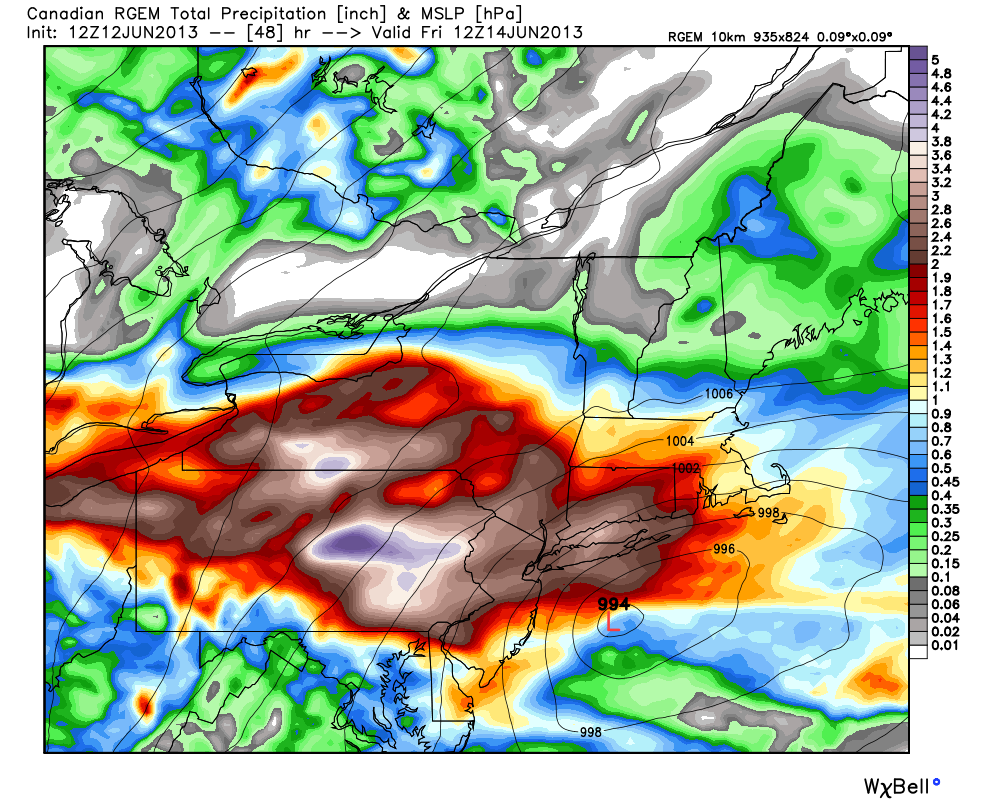
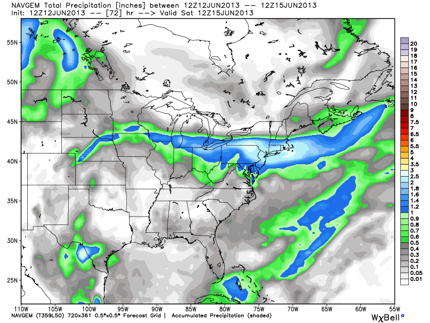
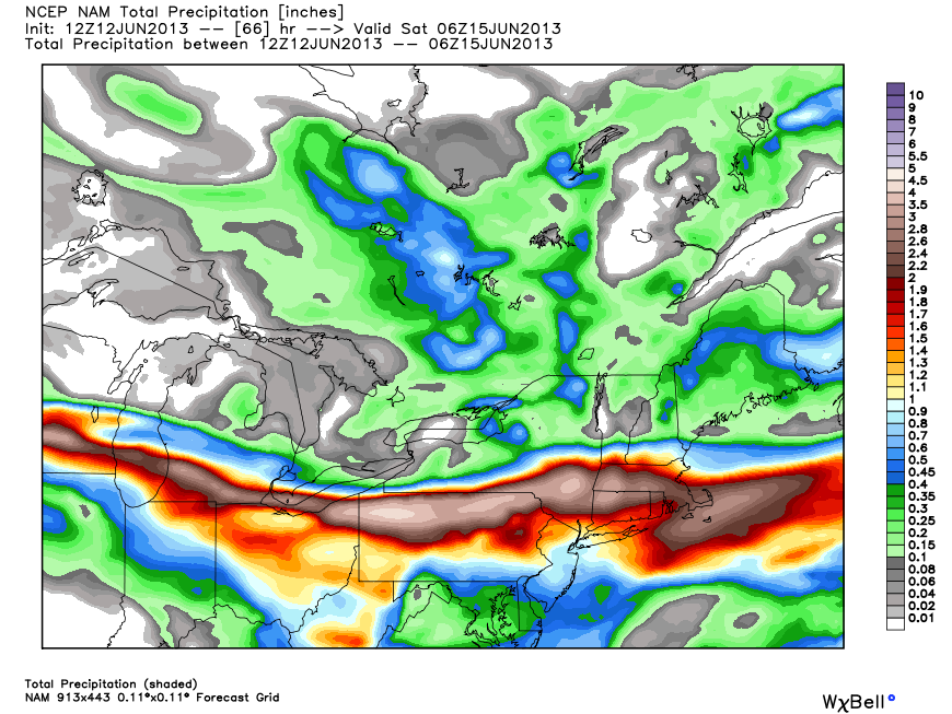
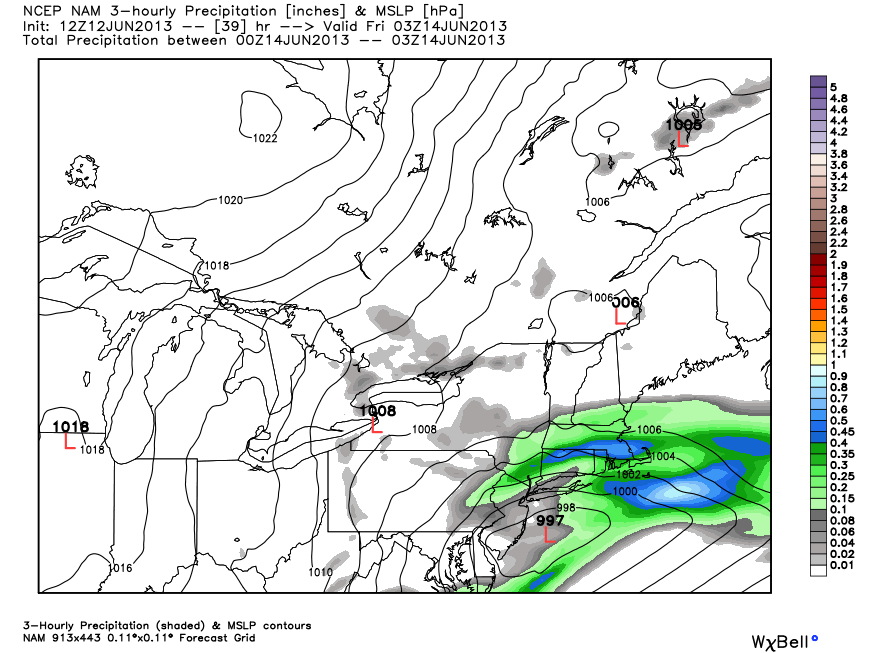
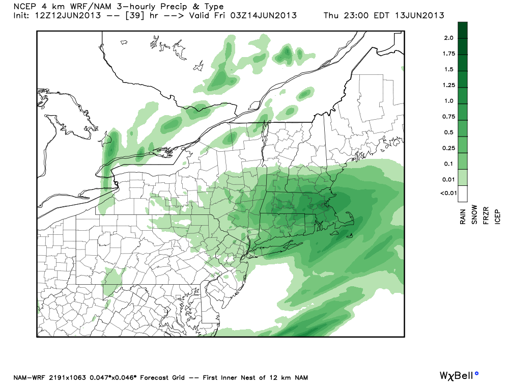
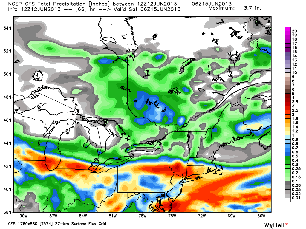
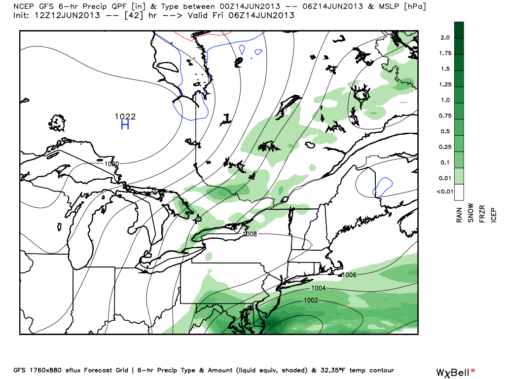
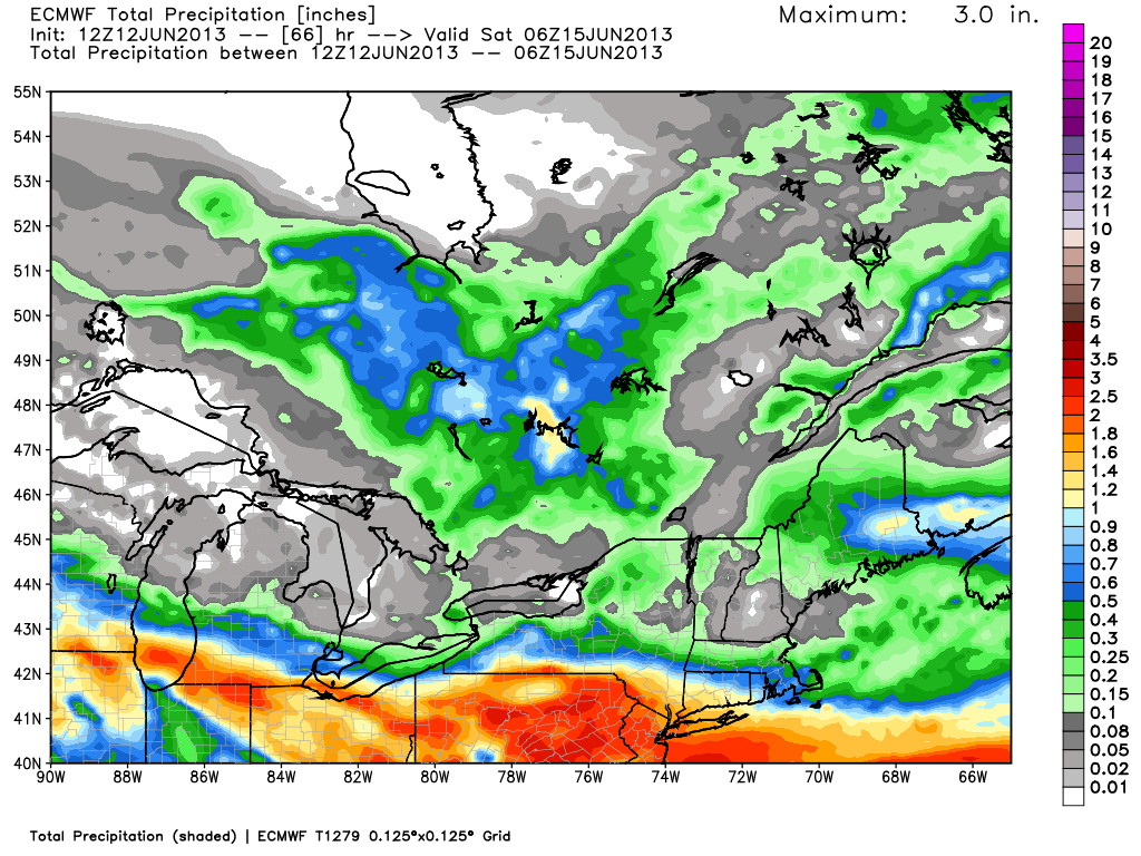
The general computer model trend regarding the Thursday-Friday storm is to shift the axis of heavier precipitation a bit farther south. Right now, the NAM model is the most robust in keeping the heavy rain over interior SNE. Some other models, like the ECMWF and GFS have taken the heavy rain south to the Mid-Atlantic and Atlantic Ocean – which would be a welcome sight for waterlogged Southern New Englanders. The NOAA Weather Prediction Center has made big changes to their rainfall forecast. Earlier this morning the forecast was for nearly 5″ of rain in the hardest hit areas of Southern New England. The current forecast is for 0.75-1.5″ of rain for most of SNE, with the higher totals near the coast. I’m a little leery of the current forecast overcompensating for a one run shift in the models. The NAM, WSI RPM, JMA, and NAVGEM models all still have a multi-inch rain event for most of SNE. The GFS and European are great scenarios, with 0.5-1.25″ in RI and SE MA. That’s still a decent soaking, but would lead to far fewer problems than 2″+

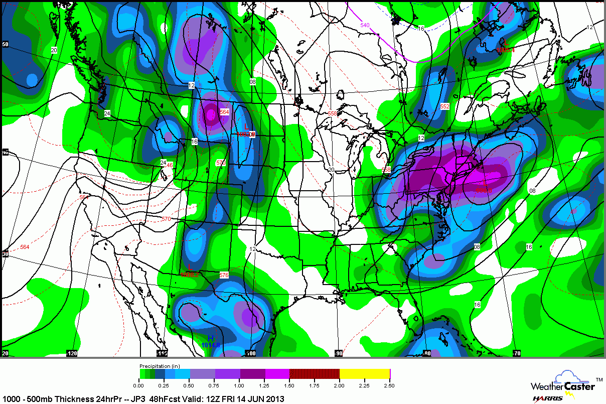
The models that are drier have the storm diving east-southeast to the Mid-Atlantic coast then redeveloping off the coast and moving well southeast of Nantucket. As a result, the northern edge of the rain shield moves south of Providence and Boston for a while as the storm redevelops. Some rain is possible as it passes Nantucket on Friday. The NAM keeps the storm center much farther north, and that keeps the steady rain going over SNE.

As of 5 am, the Short Range Ensemble Forecast had a mean QPF (rainfall) of 2.5″ for Providence. That is 2-3x what the GFS, ECMWF are showing as of their 12z (8am) runs. The new SREF run available late Wednesday afternoon had a mean QPF of about 1.5″ for the Providence area. That’s a good sign.

Big shift south with the heavy rain forecast from the NOAA Weather Prediction Center. This is based on the farther south track of the storm as it redevelops off the Mid-Atlantic coast

Canadian model 1.25-3" of rain in SNE, heaviest over W MA and W CT.
Canadian model 1.25-3″ of rain in SNE, heaviest over W MA and W CT.

The Canadian RGEM model only extends to Friday morning. The rainfall pattern is in line with the GFS and ECMWF, but a bit heavier, with some 2"+ amounts in CT and SW RI. Keep in mind, this model does not include rain that would fall on Friday. Based on the position of the low pressure on this map, there would still be additional rain for SNE
The Canadian RGEM model only extends to Friday morning. The rainfall pattern is in line with the GFS and ECMWF, but a bit heavier, with some 2″+ amounts in CT and SW RI. Keep in mind, this model does not include rain that would fall on Friday. Based on the position of the low pressure on this map, there would still be additional rain for SNE

The NAVGEM model has a widespread 1-3" rainfall, with the highest totals near the coast. This is a decent blend of the NAM and GFS solutions.
The NAVGEM model has a widespread 1-3″ rainfall, with the highest totals near the coast. This is a decent blend of the NAM and GFS solutions.

The NAM continues to show a farther northward track with the storm, and the result is 2+" of rain in interior SNE and in SE MA. This forecast would lead to street, river, stream flooding.
The NAM continues to show a farther northward track with the storm, and the result is 2+” of rain in interior SNE and in SE MA. This forecast would lead to street, river, stream flooding.

Notice how much farther north the NAM is than the GFS with the center of the storm

The RPM model brings very heavy rain to most of SNE - it is similar to the NAM
The RPM model brings very heavy rain to most of SNE – it is similar to the NAM

NAM hi-res model is similar to the 12km NAM. A big time soaking for most of SNE.

Hi-res NAM has moderate to heavy rain Thursday evening. It's at this point that the GFS and ECMWF have a lull as the storm develops in the Atlantic well south of SNE.
Hi-res NAM has moderate to heavy rain Thursday evening. It’s at this point that the GFS and ECMWF have a lull as the storm develops in the Atlantic well south of SNE.

GFS total precipitation is a manageable 0.5-1.25" for RI and SE MA
GFS total precipitation is a manageable 0.5-1.25″ for RI and SE MA

Notice how far south the center of the storm is with the latest GFS run

ECMWF total precipitation pattern is very similar to the GFS. Heaviest over the Mid-Atlantic - good news for SNE
ECMWF total precipitation pattern is very similar to the GFS. Heaviest over the Mid-Atlantic – good news for SNE

JMA model brings soaking rain to SNE. This is a heavier rain forecast than prior runs of the JMA.

Fred Campagna

President and Chief Meteorologist - Right Weather LLC AMS Certified Consulting Meteorologist #756 AMS Certified Broadcast Meteorologist #126

Related Articles

Back to top button