Right Weather ProTropical

Computer Model Trends: Tropical Storm Andrea

We have been advertising an early-season tropical system for weeks, so when (pat on back) Tropical Storm Andrea formed Wednesday evening in the Gulf of Mexico it should have come as no surprise. The storm was looking pretty wound up as it approached the Florida Panhandle Thursday morning. Winds were up to 60 mph, and there was at least one reported tornado in Florida as squally rain bands moved onshore. Here are some of the latest thoughts regarding the evolution of and impact from Andrea.

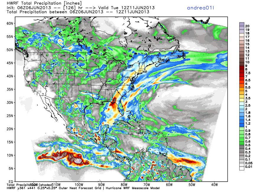
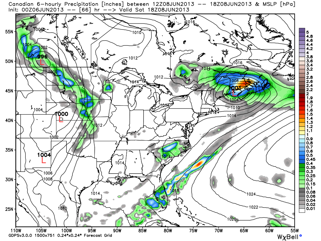
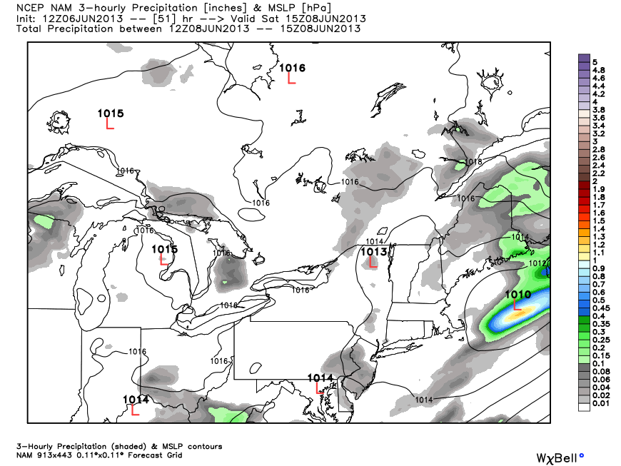
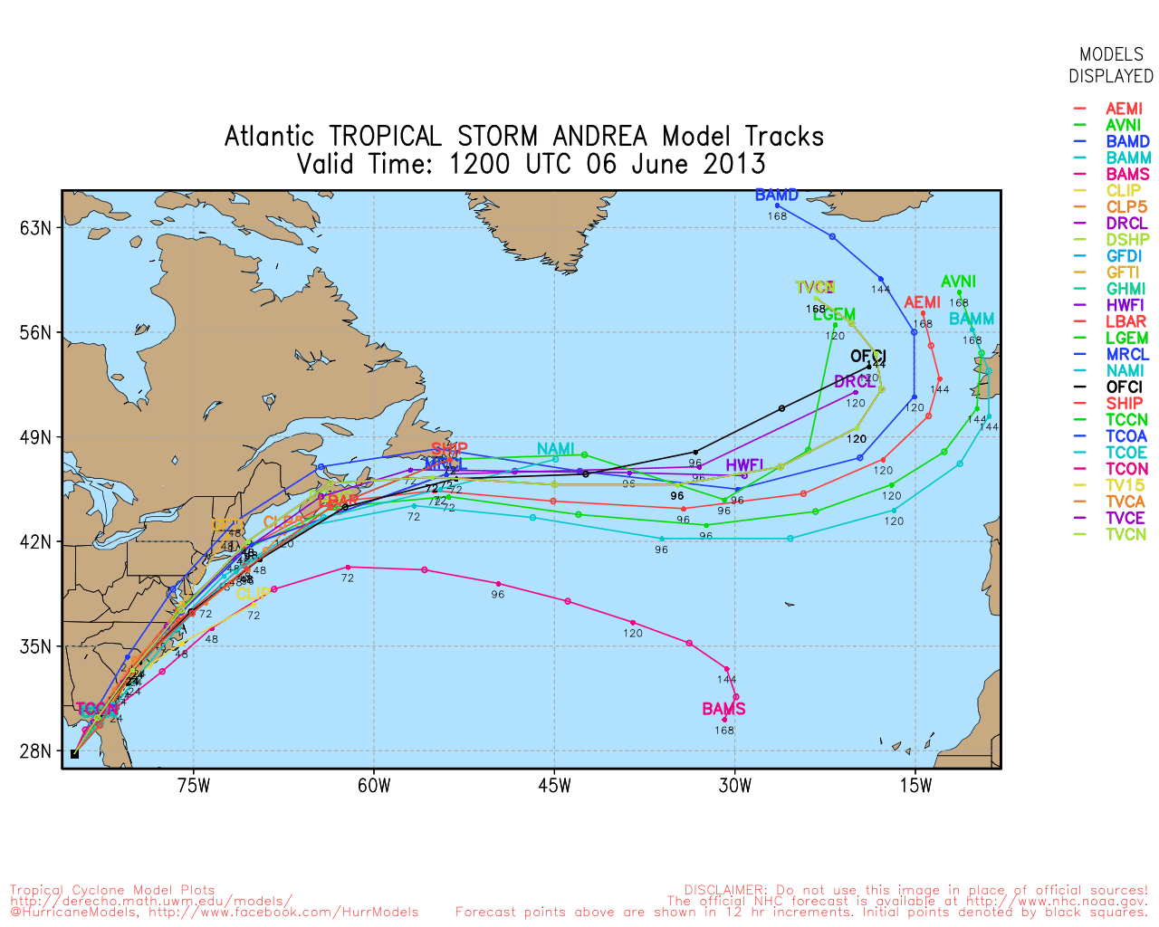
  • Models agree that the storm will move up the Eastern Seaboard and over or just east of Southern New England
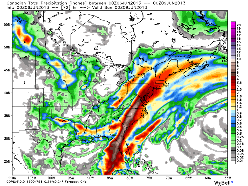
  • There is a significant heavy rain threat with the storm and moisture streaming ahead of it Friday into Saturday morning
  • The key to flooding concerns for SNE will be how much rain falls in advance of the system Friday into early Friday night
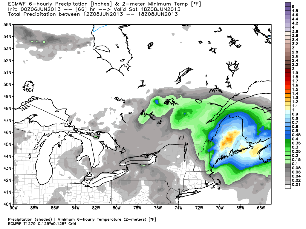
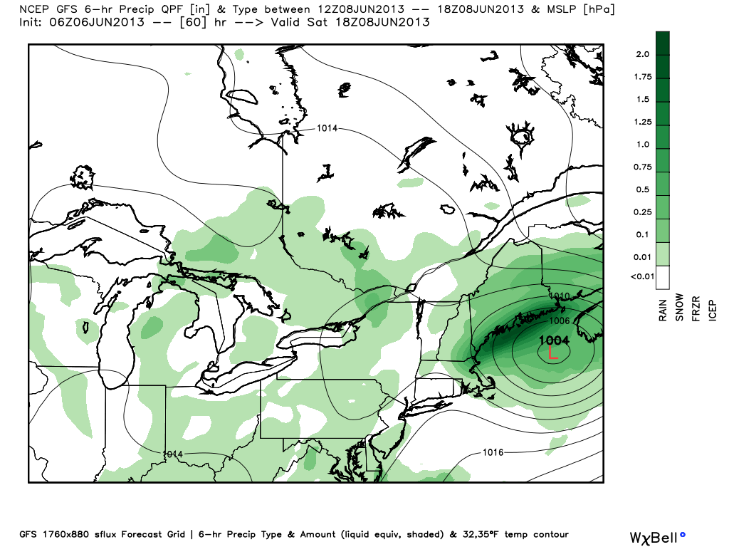
  • Heavy rain is likely as the storm quickly passes SNE late Friday night into early Saturday
  • The rain should shut off very quickly sometime between 5-10 am on Saturday
  • A passing shower is possible Saturday afternoon, but, overall, it will be much nicer with some sun and highs in the 70s
  • Although there is a tornado threat in Florida and the Southeast, it looks like the track over or just east of SNE will limit the potential for severe weather in SNE
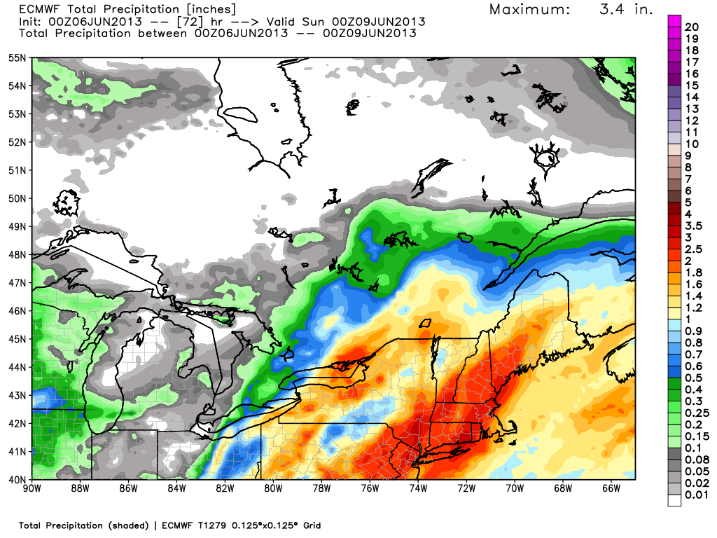
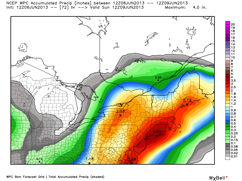
  • The heaviest rain is likely to be over CT, RI, and interior MA.
  • The potential exists for the hardest hit areas to receive 4″ of rain
  • Wind will be a non-factor for most of SNE based on the current forecast track. There may be a brief period of strong winds on the Cape/Islands if the storm travels a bit farther west than currently forecast. Weakening tropical systems carry most of their wind on the east side of the storm.
HWRF Hurricane Model precipitation forecast - a large swath of 1.5-3" rain totals up the Eastern Seaboard
HWRF Hurricane Model precipitation forecast – a large swath of 1.5-3″ rain totals up the Eastern Seaboard

ECMWF deterministic model with a storm total of 1.5-3.5" for SNE - enough to cause some street, stream, and possibly river flooding
ECMWF deterministic model with a storm total of 1.5-3.5″ for SNE – enough to cause some street, stream, and possibly river flooding

ECMWF shows heavy rain late Friday night. This forecast is for 2am-8am Saturday. 1-1.5" in most of RI, E CT, and interior SE MA
ECMWF shows heavy rain late Friday night. This forecast is for 2am-8am Saturday. 1-1.5″ in most of RI, E CT, and interior SE MA

ECMWF - rain shuts off very quickly after 8 am Saturday
ECMWF – rain shuts off very quickly after 8 am Saturday

European Ensemble Prediction System has a widespread 2-2.5" in most of SNE
European Ensemble Prediction System has a widespread 2-2.5″ in most of SNE

GFS showing the storm moving into the Gulf of Maine by midday Saturday

Canadian rain totals are down from where they were a couple of days ago, but still significant at 2-3"
Canadian rain totals are down from where they were a couple of days ago, but still significant at 2-3″

Canadian model has the storm accelerating out of the picture Saturday morning

The latest NAM model has the storm pulling away from SNE very quickly Saturday morning. That's good since the NAM had been an outlier with a slower track.
The latest NAM model has the storm pulling away from SNE very quickly Saturday morning. That’s good since the NAM had been an outlier with a slower track.

NOAA Weather Prediction Center has a bullseye of very heavy rain over SNE. This is at the higher end of the computer model suite.

Another look at the consensus of hurricane models

Hurricane model consensus is over or east of SNE. Notice the timing, too. The 48 indicates where the center of the storm will be at 8am Saturday

Fred Campagna

President and Chief Meteorologist - Right Weather LLC AMS Certified Consulting Meteorologist #756 AMS Certified Broadcast Meteorologist #126

Related Articles

Back to top button