Right Weather Pro

Computer Model Trends: Very wet pattern ahead

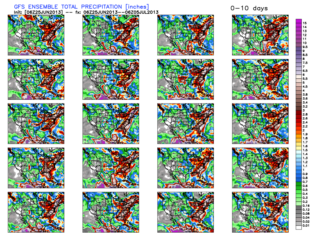
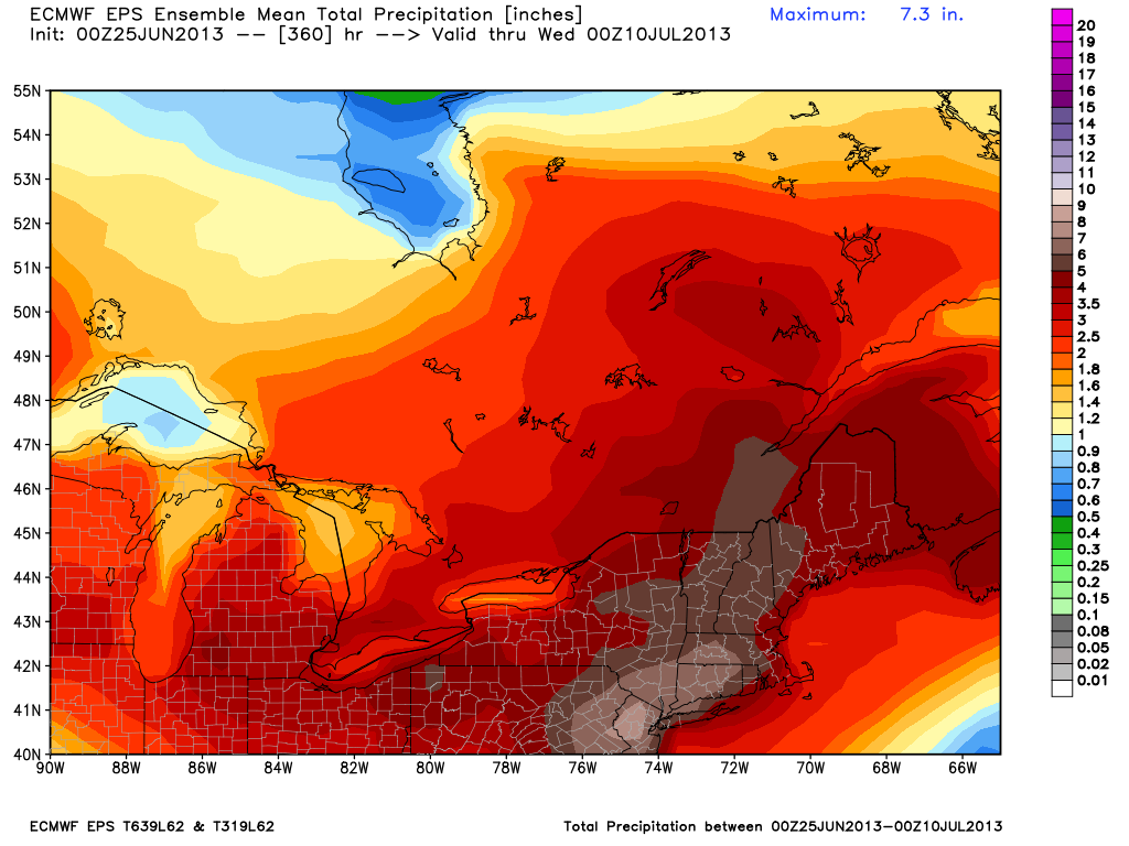
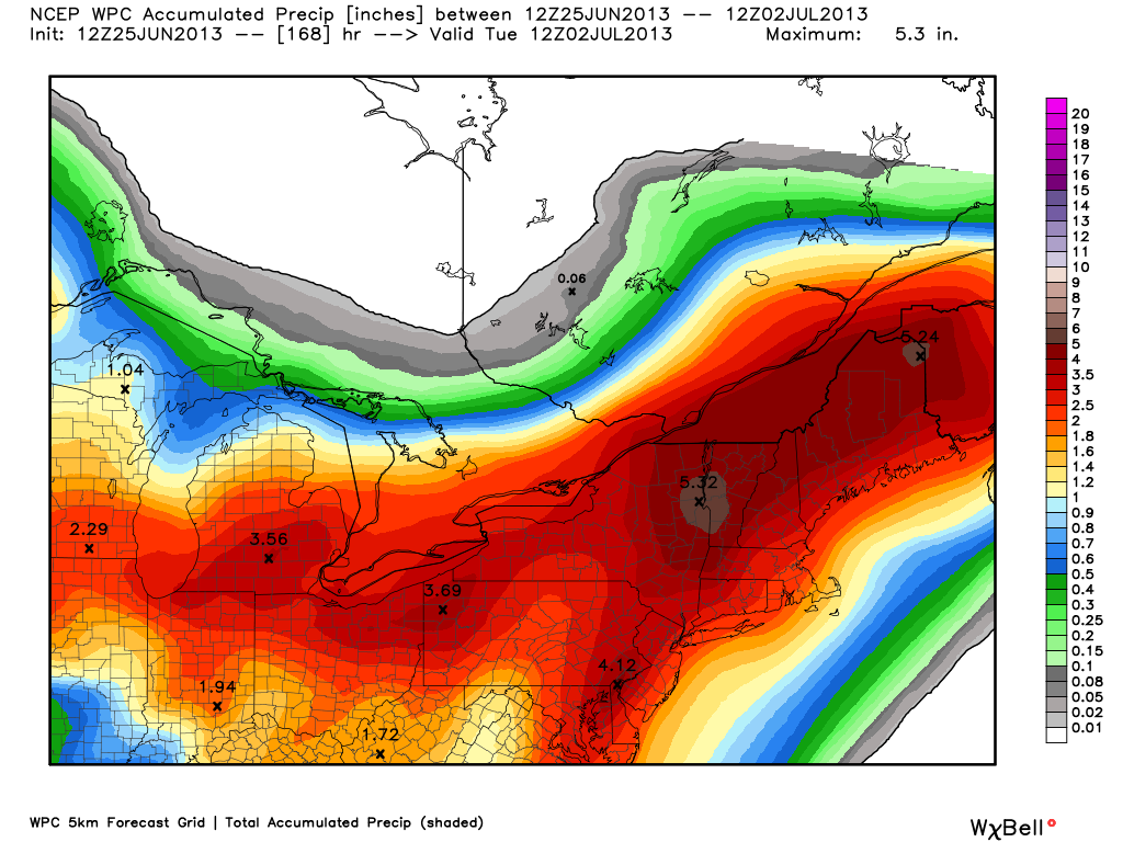
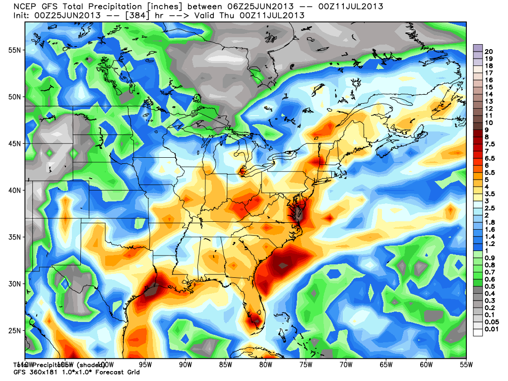
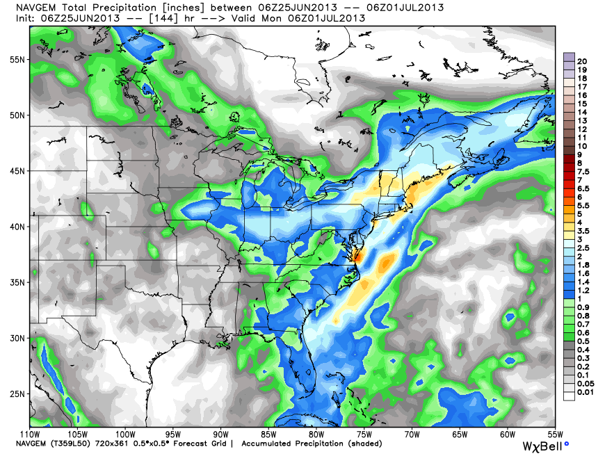
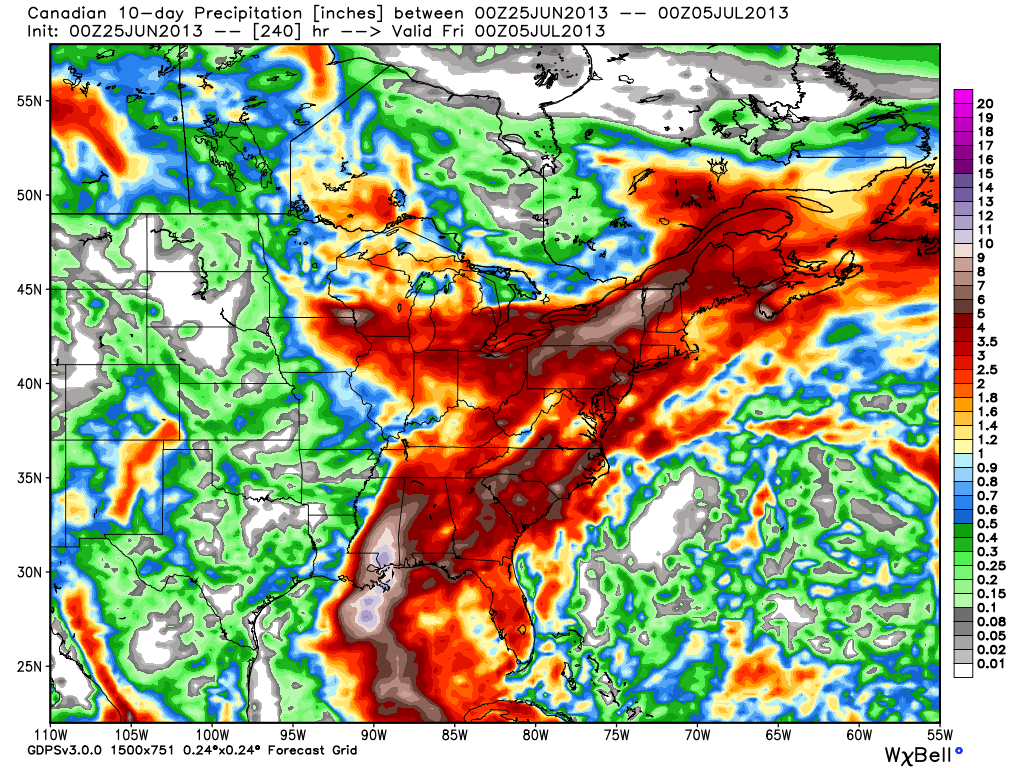
For the past week we have been warning your about the unsettled weather pattern heading for the East Coast for late June and early July. Not much has changed on that front, and in a worst-case scenario it will be a very wet weather pattern in Southern New England through the first week of July. When you look at the maps below, you will see that that most of the models favor the heaviest rain falling to the west of RI and SE MA, but the totals over  Southeastern New England are still impressive with 200-300% of the normal rain in the next 10-14 days.

The bottom-line is it will be wetter than normal in the next 10-14 days, with the chance for flooding rain if the “rain train” sets up a bit farther east than currently forecast. The rain will come in bursts, and the humidity levels will be quite high, although it will not be as hot as it is early this week. A safe estimate for rain in the next 10 days is 2-3″ – about 250% of the normal.

It’s too early to talk specifics on when it will rain during the weekend and the week of the fourth. Hopefully, the showers will time out ok to not interfere with too many outdoor plans.

GEFS members all show a rain train for the Eastern United States in the next 10 days. Hardest hit areas receive 6"+ rain. Axis of heaviest precipitation varies.
GEFS members all show a rain train for the Eastern United States in the next 10 days. Hardest hit areas receive 6″+ rain. Axis of heaviest precipitation varies.

ECMWF operational model has the axis of heaviest precipitation west of Southeastern New England, with 2-4" of rain over RI and SE MA in the next 10 days. Totals to the west are 4-8"!
ECMWF operational model has the axis of heaviest precipitation west of Southeastern New England, with 2-4″ of rain over RI and SE MA in the next 10 days. Totals to the west are 4-8″!

ECMWF Ensemble Mean has ver heavy rain in Southern New England and near NYC between now and July 10. 5-8" from NW RI through W SNE and NYC area. 3-5" elsewhere. This would probably cause minor flooding on area rivers and streams.
ECMWF Ensemble Mean has ver heavy rain in Southern New England and near NYC between now and July 10. 5-8″ from NW RI through W SNE and NYC area. 3-5″ elsewhere. This would probably cause at least minor flooding on area rivers and streams.

NWS Weather Prediction Center 7 day total ending early Tuesday has 2-3" in RI and SE MA, 3-5" in Western New England.
NWS Weather Prediction Center 7 day total ending early Tuesday has 2-3″ in RI and SE MA, 3-5″ in Western New England.

GFS Operational model has heavy totals over the Hudson River Valley, with only about 2" of rain in Southeastern New England in the next two weeks - a best-case scenario
GFS Operational model has heavy totals over the Hudson River Valley, with only about 2″ of rain in Southeastern New England in the next two weeks – a best-case scenario

Navy NAVGEM model through Sunday evening has 1-3" of rain in SNE
Navy NAVGEM model through Sunday evening has 1-3″ of rain in SNE

Canadian model brings 2-4" of rain to SNE between now and the 4th of July
Canadian model brings 2-4″ of rain to SNE between now and the 4th of July

Fred Campagna

President and Chief Meteorologist - Right Weather LLC AMS Certified Consulting Meteorologist #756 AMS Certified Broadcast Meteorologist #126

Related Articles

Back to top button