Monday came as advertised with showery, humid weather in Southeastern New England. Some areas picked up more than an inch of rain from Sunday night through the day on Monday as heavy showers and a few thunderstorms passed by. The temperature reached the upper 60s to low 70s, and it stayed muggy all day. The cold front responsible for the showers will slowly ease offshore Monday night, with the shower and t-storm threat coming to an end by midnight. Skies will clear by dawn Tuesday, and the temperature will tumble into the upper 40s to mid 50s by dawn Tuesday. The cooler readings will be away from the coast.
Abundant sunshine returns Tuesday
Tuesday will feature a ton of sunshine, a northwesterly breeze, and dry, pleasant conditions. The high will be in the low to mid 70s, without any trace of the summer-like humidity that has been in Southern New England for the last several days. Tuesday night looks clear and comfortably cool. The temperature will drop into the upper 40s to low 50s, giving the air conditioners and dehumidifiers a break.
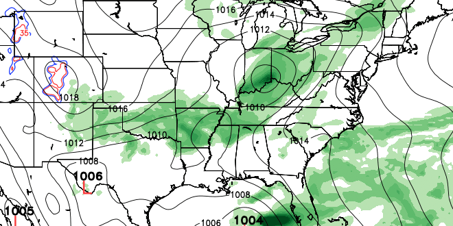
Fine weather will continue on Wednesday. Once again, there should be a lot of sunshine. The wind will be light in the morning, and turn onshore in the afternoon. Highs will be in the low to mid 70s. Clouds will increase on Thursday as a disturbance drops into the Ohio Valley. It should stay dry through Thursday evening. Look for high temperatures in the low 70s on Thursday.
Super soaker possible Friday into Saturday
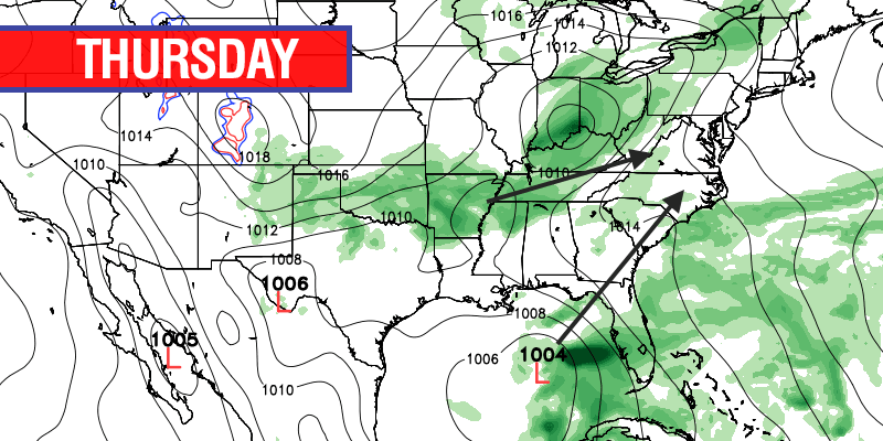
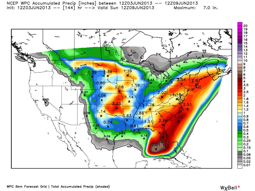
A storm will be strengthening in the Gulf of Mexico this week. The remnants of Eastern Pacific Hurricane Barbara will reorganize, and may become Atlantic Tropical Storm Andrea by the mid to late workweek. This storm, named or not, will be a prolific rainmaker as it is influenced by the jet stream disturbance that moves through the Eastern United States late in the workweek. The storm is likely to move across Florida and up the Eastern Seaboard Friday into Saturday. The result in Southern New England is the potential for soaking rain showers Friday and Saturday. Right now, it looks like the best chance of heavy rain is from Friday afternoon through Saturday morning. The wind will most likely be out of the south-southeast, and temperatures will be well into the 60s giving the showers a tropical feel.
With any luck, the system will move far enough north by late Saturday that the weather improves dramatically for the second half of the weekend. At this point, it looks like there is low potential for sunshine on Saturday afternoon, but Sunday will be a decent day with highs in the mid 70s to low 80s under partly sunny skies.


