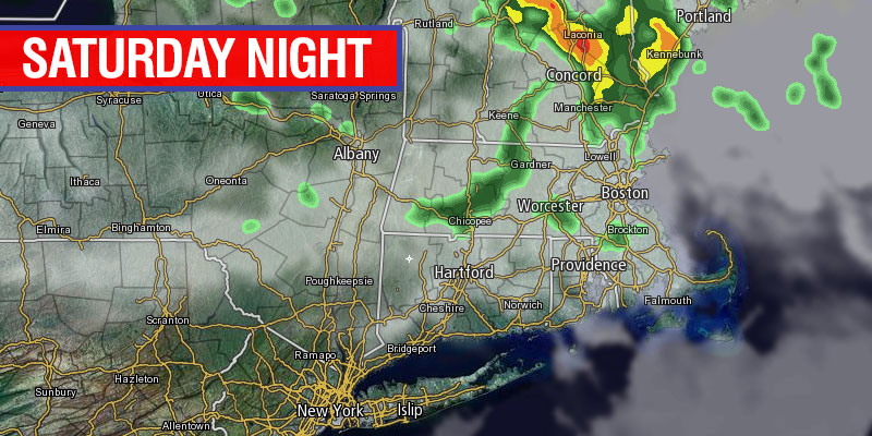
It has been a dry and gradually warmer stretch of weather in Southern New England for the past few days. By Sunday morning, with a persistent southwesterly breeze, there will be noticeably more humidity in the air. The leading edge of the muggier air may be accompanied by showers and thunderstorms – primarily inland, Saturday night. Low temperatures will be in the low to mid 60s Saturday night.

Sunday will be partly sunny, breezy, very warm and muggy. Highs will be in the mid 80s inland, and mid to upper 70s at the coast. There may be some clouds to burn off in the morning before sunshine wins the battle in the afternoon. Any thunderstorms on Sunday afternoon should be confined to Northern New England.
Warm to unsettled next week
The weather will be very warm to hot early in the week. The low temperature Sunday night will be in the mid to upper 60s, with high humidity. It may be a good idea to flip on the air-conditioner Sunday afternoon or comfort yourself with some good heating and cooling company, because the weather will stay warm and muggy for a few days. Monday afternoon should feature hazy sunshine and highs inland in the upper 80s. It will be in the low 80s near the coast. Pop-up showers and storms are possible late Monday afternoon – especially away from the coast. If you are like me and don’t like bulky air conditioners blocking sight through your window, this site: PortableACNerd.com may come in handy. I personally prefer the portable ones, since I can just hide them in a closet after using them.
Tuesday looks very similar to Monday. Monday night looks sultry with lows not too far below 70. Tuesday afternoon may reach 90° inland with a west-southwest breeze. It will be in the 80s near the coast. Once again, be on the lookout for pop-up afternoon showers and storms.
Wednesday could go either way depending on the position of a front. Right now, it looks like it will be very warm with the chance of thunderstorms. It may not be as hot as Tuesday, with highs expected to reach the mid to upper 80s. A sea breeze will cool the coast.
Odds are the warm stretch of weather will end with showers late next week. At this point, it appears that an unsettled pattern is in the cards for late-June and the first few days of July.


