Long Range Forecast – June 10

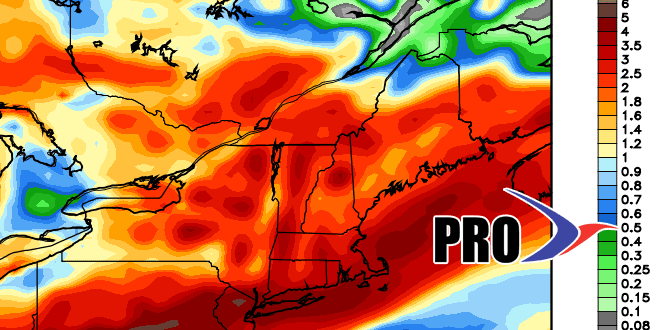
As we noted in past Long Range Forecasts and the Summer Outlook, there were plenty of signs that June would be a somewhat unsettled month in Southern New England. After 10 days, the pattern is teetering on the edge of very wet instead of just somewhat unsettled. There is a close call in the forecast for late in the workweek. If that system clips SNE with another inch or more of rain, then the flooding concerns continue. Right now, the consensus forecast has the storm staying just far enough away to spare most of SNE heavy rain. The coast has a better chance of seeing downpours.
The good news is the forecast is looking quite nice for Father’s Day weekend. It will be seasonable, with highs in the 70s. The normal high for the next two weeks ranges from 76° on June 10 to 80° on June 22. Overall, there are no big changes in the weather pattern over the next couple of weeks. There will most likely be some rain next week, with the early to midweek favored for wet weather. June has been 2° warmer than normal, but that has been buoyed by the first two days of the month which averaged 12.5° warmer than normal. Since then, it’s actually been a hair cooler than normal. We expect the next two weeks to average cooler than normal, brining the monthly average on June 24 to near normal.
JUN-13 FOR PROVIDENCE, RI (62')                     LAT=41.7N LON= 71.4W

                 TEMPERATURE                       PRECIPITATION
          ACTUAL           NORMAL
        HI   LO  AVG     HI   LO  AVG   DEPT     AMNT   SNOW SNCVR   HDD
 1      89   63   76     73   54   63    +13     0.00    0.0    0      0
 2      87   65   76     74   54   64    +12    trace    0.0    0      0
 3      73   64   69     74   54   64     +5     0.78    0.0    0      0
 4      73   54   64     74   55   64     +0     0.00    0.0    0      1
 5      72   50   61     74   55   65     -4     0.00    0.0    0      4
 6      71   52   62     75   55   65     -3    trace    0.0    0      3
 7      61   56   59     75   56   65     -6     3.23    0.0    0      6
 8      79   55   67     75   56   66     +1     0.88    0.0    0      0
 9      80   59   70     76   56   66     +4     0.00    0.0    0      0


