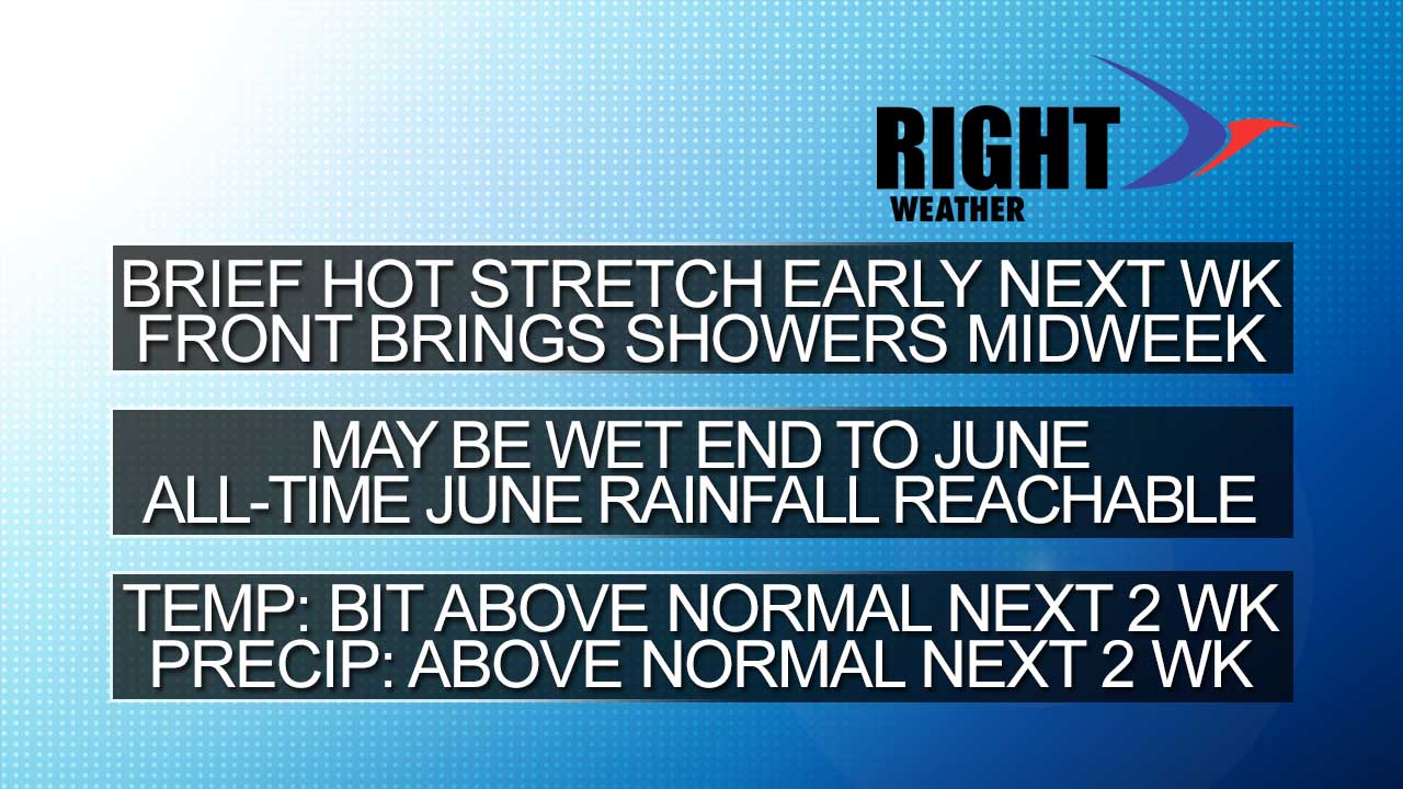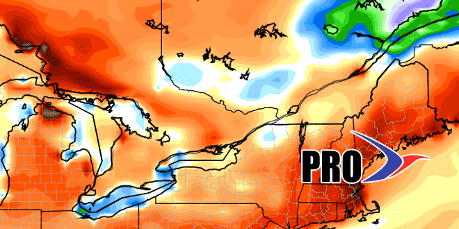
I don’t know about you, but I would like to keep the weather SNE has enjoyed for the past couple of days all summer long. Alas, there is some much warmer and muggier weather ahead. There will be bursts of heat this summer, but, as we explained in the summer outlook, we don’t expect them to last for too long. The heat early next week should be a 2-3 day event that ends with showers and thunderstorms either late Tuesday or on Wednesday.
Looking ahead to the end of the month, a big ol’ bowling ball of low pressure will come through the Great Lakes and trigger plenty of showers and thunderstorms in the Northeastern United States. It’s a bit unclear when this will arrive in SNE, but it could be as soon as late next week. The bottom-line is there will likely be a 2-4 day period of rather unsettled weather late this month. Showers and storms may be heavy enough to provide enough rain that the all-time June rain record is broken in parts of Southern New England. Providence needs 1.77″ of rain in the next 10 days to break the record.
The unsettled weather may carry over into early July, with the pattern hopefully shifting a bit in time for the 4th.