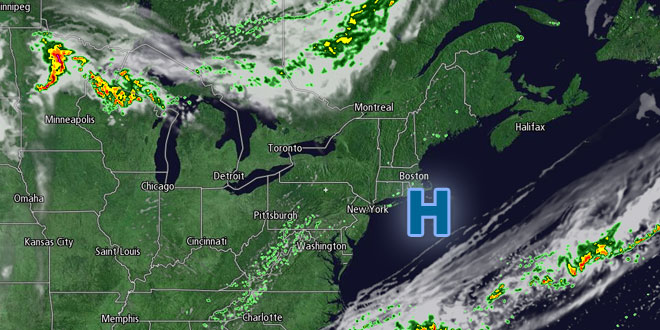
Although it was a bit cooler than normal, there was not much too complain about regarding Wednesday’s weather in Southern New England. Highs were in the low to mid 70s with scattered puffy cumulus clouds in the sky. The humidity was low, and the breeze out of the northeast turned onshore in the afternoon. The night will be clear and cool, with lows ranging from the upper 40s in the countryside to the low 50s near the coast and in the cities.
Thursday should be another stunner, with plenty of sunshine and highs in the mid to upper 70s. A light wind will shift to the south in the afternoon. The sea breeze will knock the temperature back to around 70° by late in the afternoon near the coast. Even though it will not be that warm, you can get a very quick sunburn because of the very high sun angle and lack of clouds. Friday is the first day of summer – the day where the sun is at its highest point in the sky. It is also the longest day of the year, with 15 hours and 13 minutes of possible sunshine in Southern New England. The sun rises at 5:11 am, and will not set until 8:24 pm.
Warmer weather into the weekend
The fine weather will continue into the first day of summer. Lows will be in the low to mid 50s Thursday night under clear skies. Friday afternoon looks partly to mostly sunny and a bit warmer. Highs will be in the low 80s inland, and mid 70s near the coast with a south-southwesterly 10-20 mph breeze. It will be a warm start to the weekend. Saturday will be partly to mostly sunny with lows near 60, and highs in the mid 80s inland. It will be in the mid to upper 70s at the coast because of a sea breeze.

The forecast is tricky for Saturday night into Sunday. A backdoor cold front may slide through Southern New England bringing the chance of showers and thunderstorms plus cooler weather on Sunday. Right now, it is uncertain if this front will make it through any, all, or part of Southern New England. If the front stays north of Southern New England, then it will be very warm and humid on Sunday. Looking ahead to next week, the early part of the week looks very warm to hot, with highs in the 80s or low 90s.


