There was a glimmer of sunshine early Thursday morning as clouds slowly spread from west to east through Southern New England. The clouds will thicken quickly by mid-morning, and rain will arrive by midday in RI before moving east into SE MA this afternoon. The rain should be steady in all of Southern New England by the evening commute. After starting the day with temperatures in the upper 40s to mid 50s, highs will be in the low to mid 60s with an increasing easterly breeze – especially near the coast.
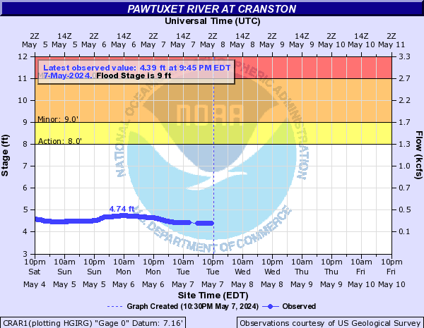
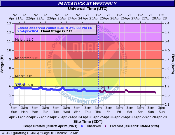
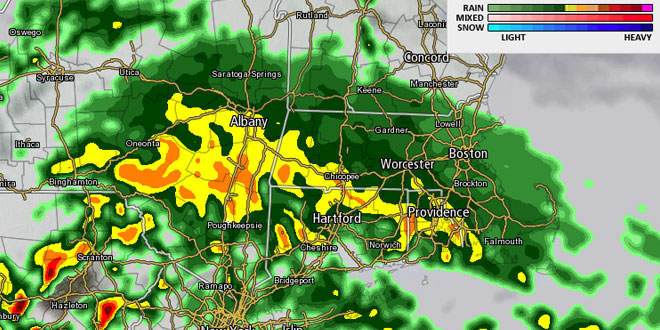
Rain is likely Thursday evening. It may be heavy at times, and street, stream and river flooding are concerns in Southern New England. Most of RI and SE MA has received roughly 6″ of rain in the past week leading up to this storm. The ground is saturated, and streams and rivers are running high or flooding. An additional 1-3″ of rain will exacerbate any flooding issues – especially in poor drainage areas. Minor flooding is likely on the Pawtuxet and Pawcatuck Rivers in RI. It is possible those rivers could reach moderate flood stage if the rainfall exceeds 2″. A Flood Watch is in effect for most of Southern New England into Saturday morning.
The wind will increase to 15-30 mph overnight, and the temperature will fall into the low to mid 50s. Rough surf is likely at area beaches as the storm develops south of Southern New England. Rain will continue through the night, but moderate to heavy rain may not be as widespread as it will be late Thursday afternoon through early Thursday evening. Because of the storm’s structure, there will likely be bands of heavy rain – similar to the snow bands that set up during winter storms. It is difficult to know exactly where those localized areas of heavier precipitation will form prior to the storm’s arrival. As a result, part of Southern New England may see 3″ of rain, while others receive just an inch.
After a soggy start, the rain will gradually taper off during the day on Friday. It will be breezy and unseasonably cool, with the temperature struggling to get out of the 50s. There may be some breaks in the clouds late in the day. The good news is the Father’s Day weekend weather is still looking fine. Highs will be in the 70s, with mostly sunny skies and low humidity.
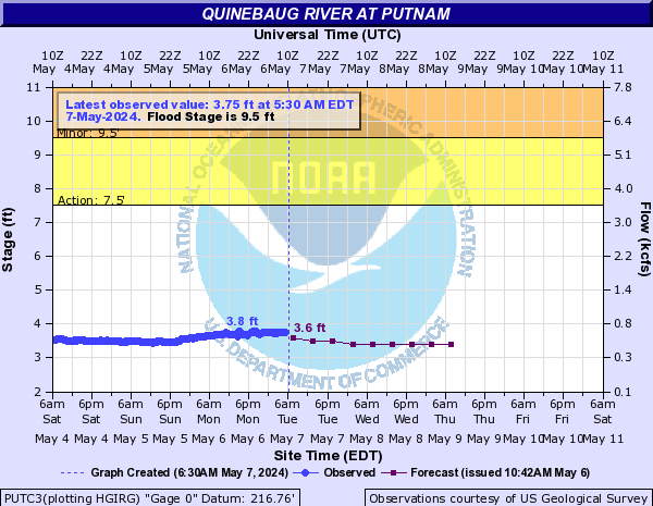
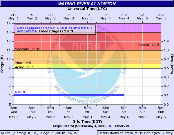
Updated Southeastern New England River Gauges