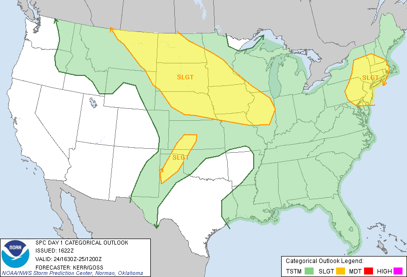
A weak disturbance approaching from the west may combine with the hot, humid weather in the Northeast to produce scattered strong to severe thunderstorms in part of New England Monday afternoon and evening. The conditions are marginal for strong to severe storm development, and overall thunderstorm coverage is not expected to be widespread. The best chance of seeing a strong/severe thunderstorm is away from the coast.

According to the National Weather Service Storm Prediction Center there is a 15% risk of severe storms containing damaging wind and large hail in CT, RI and all of MA except for Cape Cod and the islands. Keep an eye on the Interactive Radar Monday afternoon to see if any storms are popping up in your area.
The following technical discussion is taken from the National Weather Service Storm Prediction Center Monday morning update:
 ...NORTHERN MID ATLANTIC STATES INTO SOUTHERN NEW ENGLAND...
   INSTABILITY ASSOCIATED WITH STEEPER LAPSE RATES ACCOMPANYING THE
   WEAK MID-LEVEL COLD POOL SHIFTING EAST OF THE NORTH CENTRAL
   APPALACHIANS WILL ENHANCE CONVECTIVE POTENTIAL ACROSS THE REGION
   THIS AFTERNOON.  THE ENVIRONMENT MAY STILL BE SOMEWHAT MARGINAL FOR
   SEVERE STORM DEVELOPMENT...BUT IF FORCING ASSOCIATED WITH THE UPPER
   IMPULSE CAN SUPPORT STORM CONSOLIDATION...ANY ASSOCIATED COLD POOL
   MAY BE ACCOMPANIED BY POTENTIALLY DAMAGING WIND GUSTS.


