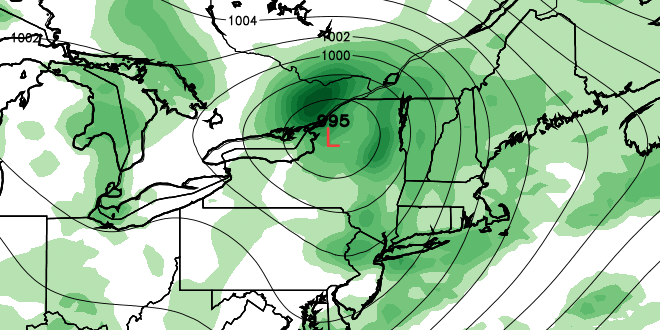
Showers and thunderstorms Wednesday afternoon and evening will put an end to the hot stretch of weather in Southern New England, but it will not mean the end of high humidity. With very humid air in place, and a strong storm system approaching from the west, there is a good chance of showers and thunderstorms Thursday into Friday. A Flood Watch is in effect for most of Southern New England.
Right now, it appears the best chance of heavy downpours is from late Thursday afternoon through Friday morning. Low temperatures Thursday morning will be in the mid to upper 60s. Highs will be in the mid 70s at the coast to low 80s inland with mostly cloudy skies when it is not raining. There will be a southerly breeze at 5-15 mph.
The best chance of rain on Friday is in the morning, but showers cannot be ruled out at any point during the day. It will be windy and muggy, with highs in the 70s to low 80s. The wind may gust to 30 mph near the coast.
The slow-moving weather system will continue to have an impact in Southern New England through the weekend. Saturday will feature scattered showers, mostly cloudy skies, a gusty southerly breeze, and highs in the 70s with high humidity. Sunday looks similar, with maybe a bit of sunshine and highs inland in the low 80s.
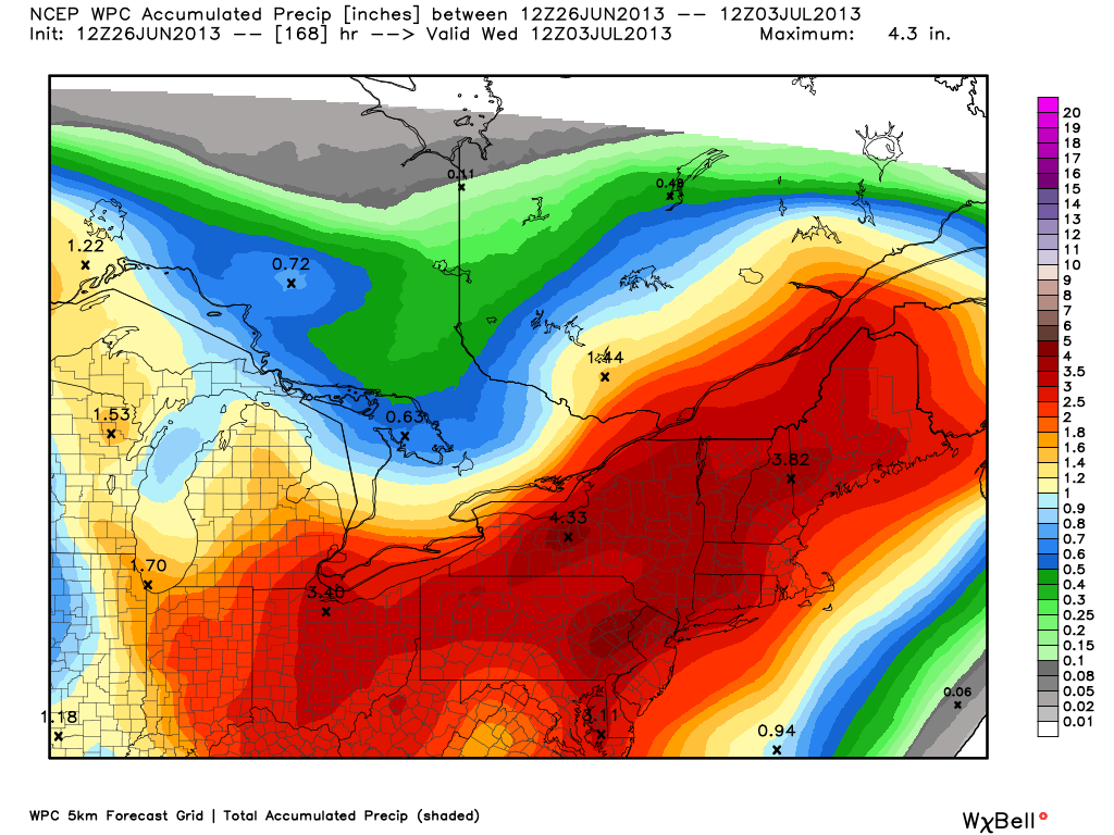
Looking further ahead, there is not going to be much change in the pattern early next week. Monday through Wednesday will continue to showery and very humid. There is the continued potential for heavy downpours. A persistent southerly breeze will churn up high seas offshore and big waves at the south coast.


