The weather pattern that has brought plenty of clouds and scattered showers will break down in the next couple of days, allowing for a mostly sunny, breezy and very warm Independence Day in Southern New England. The driving force for clouds, showers, and thunderstorms for the past several days has been a stationary boundary draped along the Eastern Seaboard. That boundary will move west as high pressure builds in from the Atlantic Ocean in the next couple of days.

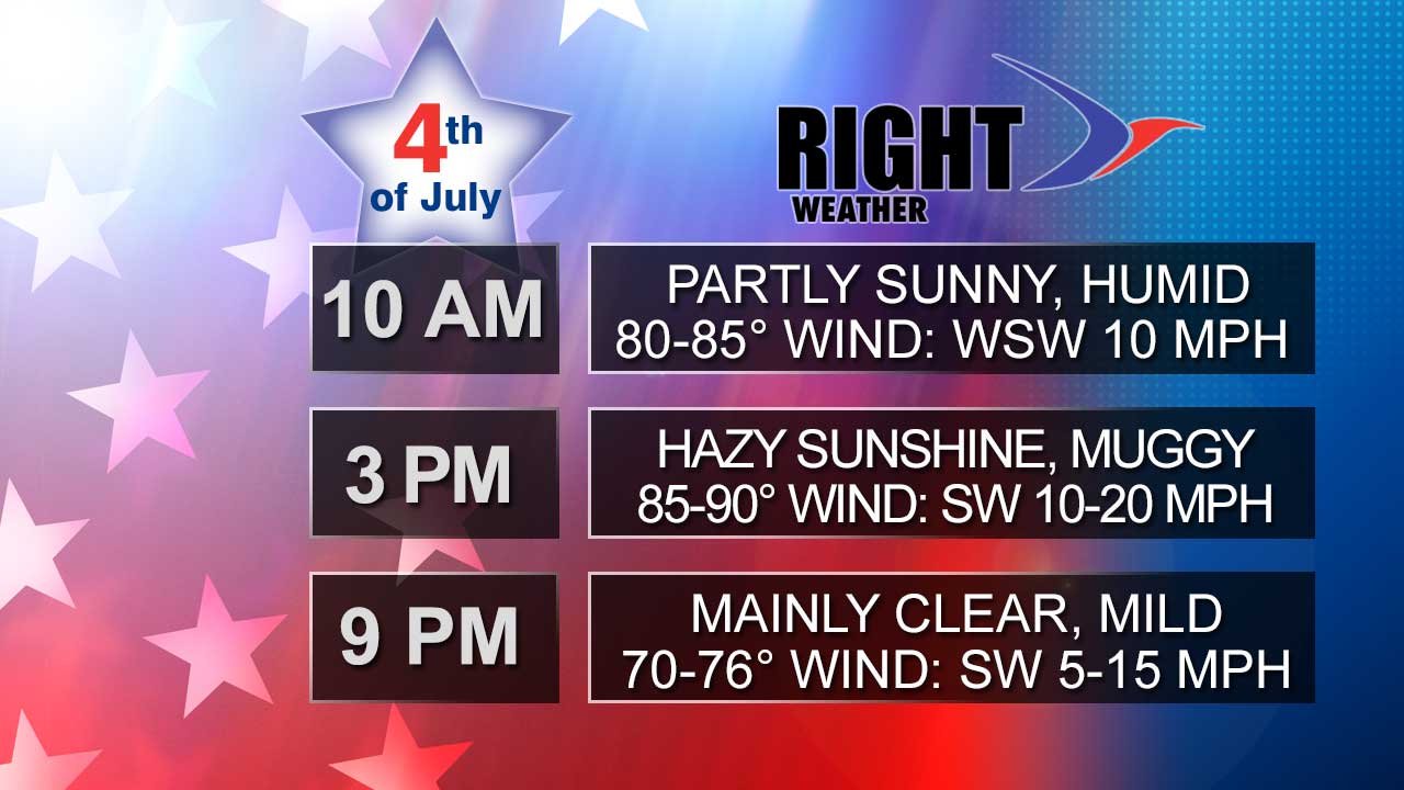
The Bermuda high pressure system, a typical mid-summer weather pattern, will be in firm control of the weather in Southern New England by Thursday. The result will be a southwesterly wind, some sunshine, and mid-summer heat and humidity for the 4th. The weather also looks good for fireworks displays on both the night before and night of the 4th.

If you’re looking to hit the beach on the 4th, you can expect a beautiful, but breezy to windy, day with plenty of sunshine and temperatures in the upper 70s to low 80s. The wind may gust to 25 mph at the coast. The past week-plus has featured a south or southwesterly breeze along the Atlantic coast, and there may be some lingering rough surf at area beaches.
Overall, it looks like the very warm and muggy weather pattern will last into the second week of July.


