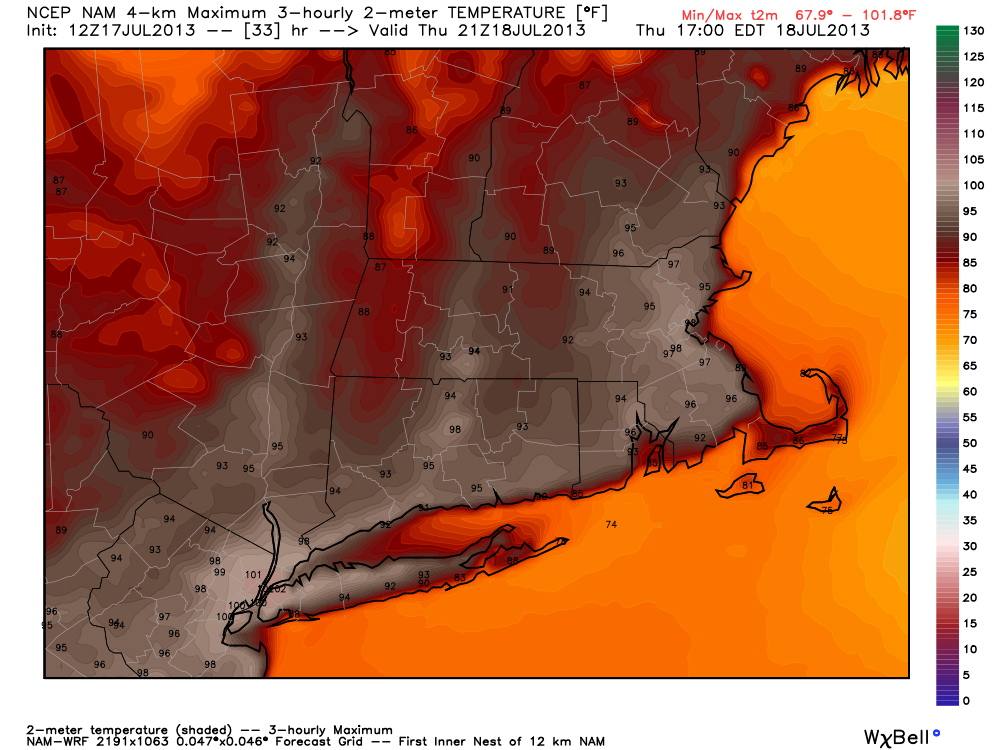
Thursday continues to look like the peak of the hot stretch of weather in the Northeast. The latest high-resolution modeling from the National Center for Environmental Prediction is calling for highs in the mid to upper 90s in the big cities of Southern New England, with 100°+ heat near New York City. This prediction aligns well with the Right Weather forecast.
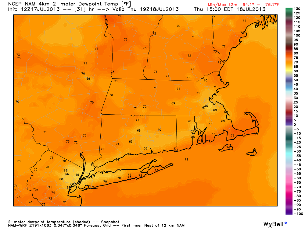
The humidity will remain fairly high, putting the heat index well above 100°. An Excessive Heat Watch is in effect for part of Southern New England. The low temperature Friday morning will be close to 80° in the big cities of the Northeast. Friday will also be a scorcher, with highs well into the 90s away from the coast.