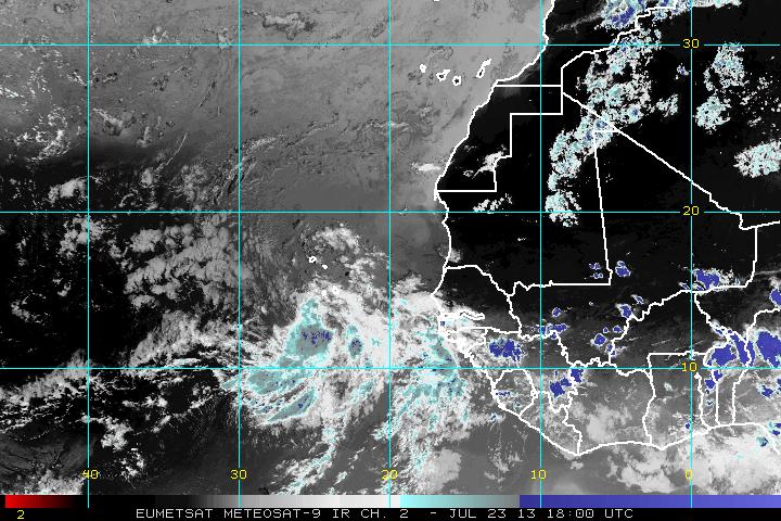
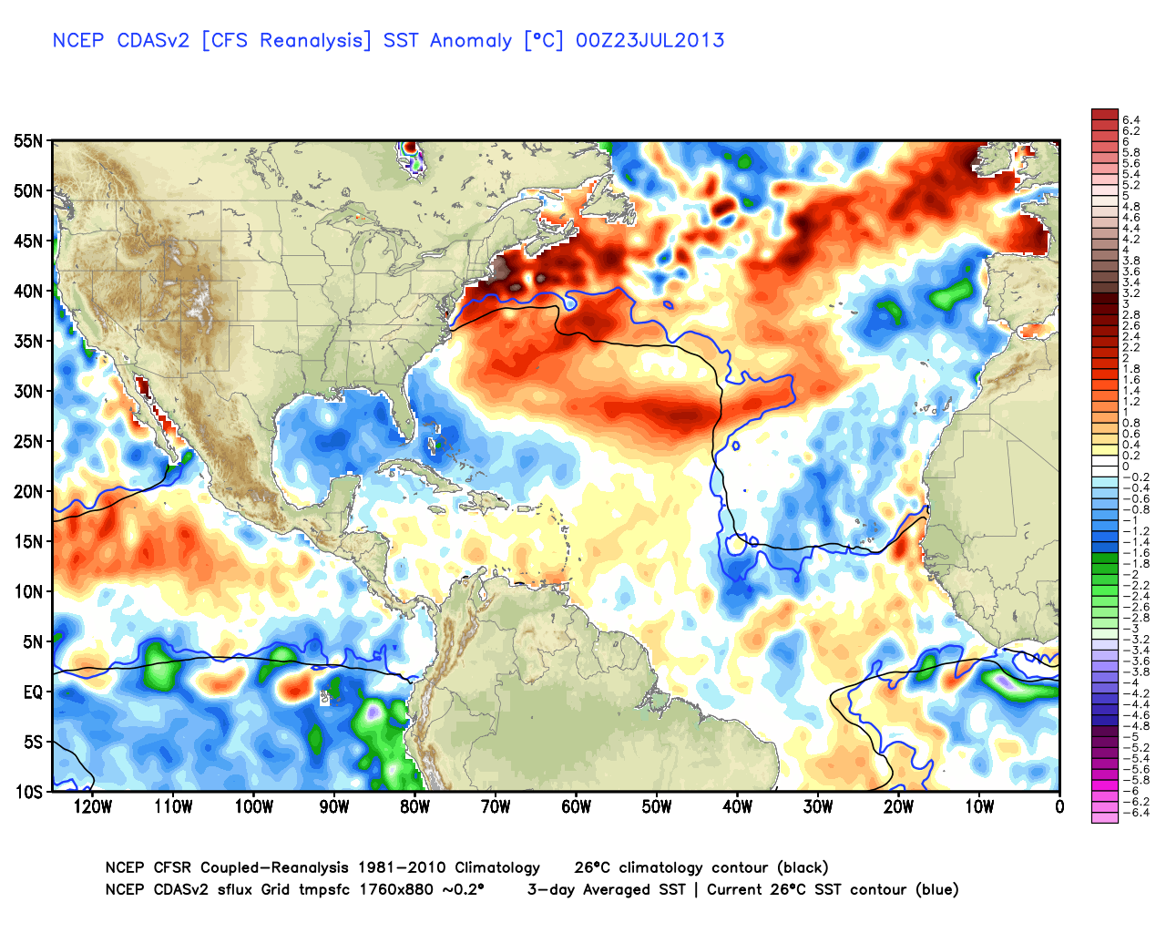
The strong tropical wave that emerged off the African coast earlier this week is likely to become a tropical cyclone in the next 48 hours. The system, which would be named Dorian, is moving west at about 10 mph. It is no threat to land at this point. Even if the disturbance intensifies, it will be encountering less favorable conditions in the next few days. The water to the west of the tropical wave is cooler than normal, and borderline for sustaining a tropical system.
Computer model forecasts for Invest 98
TROPICAL WEATHER OUTLOOK
NWS NATIONAL HURRICANE CENTER MIAMI FL
200 PM EDT TUE JUL 23 2013

FOR THE NORTH ATLANTIC...CARIBBEAN SEA AND THE GULF OF MEXICO...

1. A SURFACE LOW PRESSURE SYSTEM LOCATED A COUPLE OF HUNDRED MILES
SOUTH OF THE CAPE VERDE ISLANDS IS MOVING WESTWARD AT ABOUT 10 MPH.
THIS SYSTEM HAS A WELL-DEFINED CIRCULATION...AND ONLY A SMALL
INCREASE IN THE AMOUNT AND ORGANIZATION OF THE THUNDERSTORM
ACTIVITY WOULD RESULT IN THE FORMATION OF A TROPICAL DEPRESSION.
ENVIRONMENTAL CONDITIONS ARE EXPECTED TO BE FAVORABLE FOR
DEVELOPMENT DURING THE NEXT DAY OR SO BEFORE UPPER-LEVEL WINDS AND
OCEAN TEMPERATURES BECOME LESS CONDUCIVE BY THURSDAY. THIS SYSTEM
HAS A HIGH CHANCE...60 PERCENT...OF BECOMING A TROPICAL CYCLONE
DURING THE NEXT 48 HOURS.

ELSEWHERE...TROPICAL CYCLONE FORMATION IS NOT EXPECTED DURING THE
NEXT 48 HOURS.

FORECASTER STEWART


