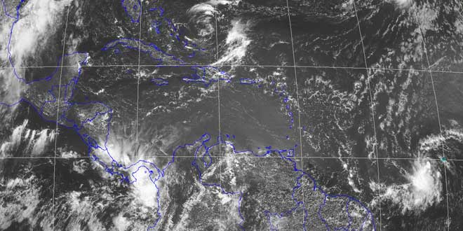
A strong tropical wave continues to move east through the Atlantic Ocean in the general direction of the Windward Islands. As of 2pm Sunday, the National Hurricane Center gave the system a 60% chance of becoming a tropical cyclone. Thunderstorm activity continues to get better organized, and a tropical depression or storm could form at any time. If the system becomes a tropical storm, it’s will be called Chantal – the third named storm of the Atlantic hurricane season.
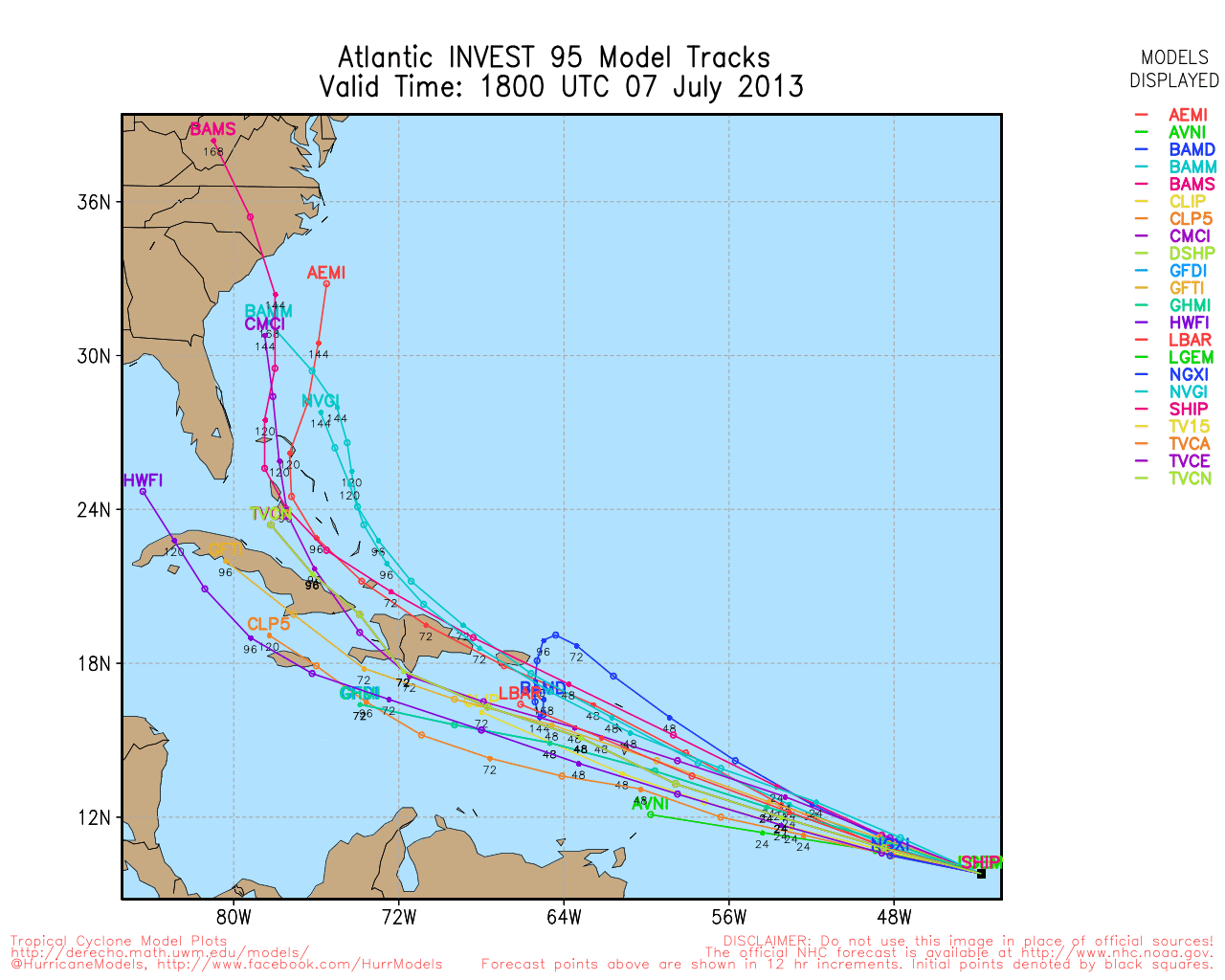
Computer model projections of Atlantic Invest 95
TROPICAL WEATHER OUTLOOK
NWS NATIONAL HURRICANE CENTER MIAMI FL
200 PM EDT SUN JUL 7 2013

FOR THE NORTH ATLANTIC...CARIBBEAN SEA AND THE GULF OF MEXICO...

1. A STRONG TROPICAL WAVE LOCATED ABOUT 1150 MILES EAST-SOUTHEAST OF
THE WINDWARD ISLANDS IS MOVING WESTWARD AT 25 MPH. SHOWER AND
THUNDERSTORM ACTIVITY CONTINUES TO SHOW SIGNS OF ORGANIZATION...
AND RECENT SATELLITE WIND DATA INDICATE THAT A CLOSED SURFACE
CIRCULATION MAY BE FORMING. ENVIRONMENTAL CONDITIONS ARE CONDUCIVE
FOR FURTHER DEVELOPMENT OF THIS DISTURBANCE...AND A TROPICAL
DEPRESSION OR A TROPICAL STORM COULD FORM AT ANY TIME...WHICH WOULD
REQUIRE A TROPICAL STORM WATCH OR WARNING FOR PORTIONS OF THE
LESSER ANTILLES. THIS SYSTEM HAS A HIGH CHANCE...60 PERCENT...OF
BECOMING A TROPICAL CYCLONE DURING THE NEXT 48 HOURS.

ELSEWHERE...TROPICAL CYCLONE FORMATION IS NOT EXPECTED DURING THE
NEXT 48 HOURS.

$$
FORECASTER STEWART


