Long Range Forecast – July 25

Did you know the temperature Thursday afternoon (low 60s) was farther from the normal high temperature for this time of year than anything that we saw during the heat waves earlier in the month? The normal high is 83°, so it would have needed to reach about 103° to be as extreme as the cool weather that SNE experienced on Thursday afternoon. The high for the date, however, will go into the books at 71° at TF Green Airport because that’s what it was shortly after midnight. In any event, this is still going to be the warmest month on record in the Providence area.
Anyway, what’s ahead for the next couple of weeks? It doesn’t look like the weather will be as extreme as the past couple of weeks. A cold front comes through late in the weekend. With any luck, showers hold off until late Sunday evening. The front moves offshore by midday Monday, and is followed by nice, warm weather in the midweek. It will not be too humid.
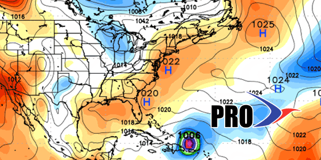
One of the things I’m noticing from the computer models is the propensity to spin up the kind of storms that we’re seeing tonight somewhere between the Ohio Valley and the Mid-Atlantic. They don’t always head for New England, but it’s a pattern with potential for wet weather along the Eastern Seaboard. Having said that, it looks like we’ll be in decent shape most of next week. My 6-14 day forecast is not as wet as the Climate Prediction Center’s.
Regarding Dorian, the storm has a long way to go before it’s any kind of a threat for the Eastern US. The ECMWF (European) model is not impressed and keeps it on a suppressed track without much intensification. The GFS model is showing scenarios where it flirts with the East Coast late next weekend or early the following week. The bottom line is I would not get too worked up about it right now. First thing’s first, let’s see how it handles the drier air and slightly increased wind shear as it gets closer to the Caribbean in the next few days.


