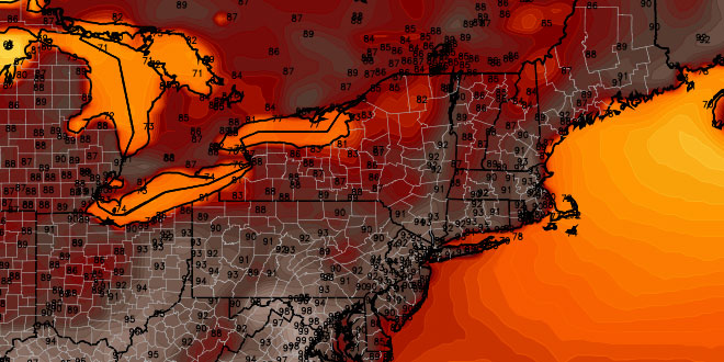
It was a very brief respite from the high humidity in Southern New England. Dew points in the 70s, and scattered showers, returned to CT, RI and MA on Saturday. The muggy weather will stick around most of next week, and there is more 90° heat in the forecast. Sunday will be a very warm and muggy day. Highs will be in the mid to upper 80s inland under partly sunny skies. It will be in the low 80s near the coast. Passing showers or thundershowers are possible.
Sunday night looks very mild and humid, with partly to mostly cloudy skies and lows in the low to mid 70s. Monday will feature hazy sunshine, with the chance of a thunderstorm. The high will be near 90 inland, and in the 80s near the coast. Temperatures will dip into the low to mid 70s again Monday night.

The mid to late workweek looks the hottest, with highs in the low to mid 90s inland, and in the mid to upper 80s near the coast. It will stay quite humid, and overnight low temperatures will stay in the 70s. The low temperature may not make it below 75° for a day or two in the cities during the hot stretch. While not a lock, there is a decent chance of the second heat wave this month occurring in most inland locations near the I-95 corridor.

Relief from the heat and humidity is slated to arrive late in the workweek or early next weekend. A cold front will move through bringing the chance of showers and thunderstorms. It will be followed by cooler temperatures and lower humidity.


