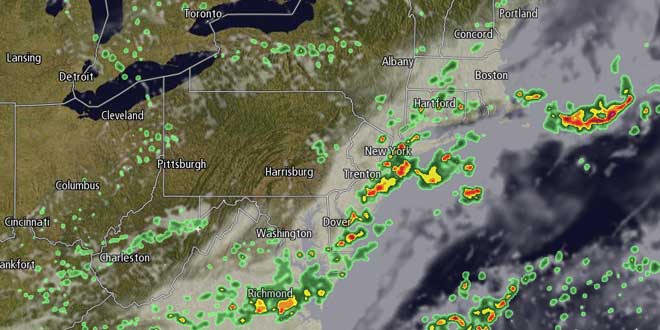
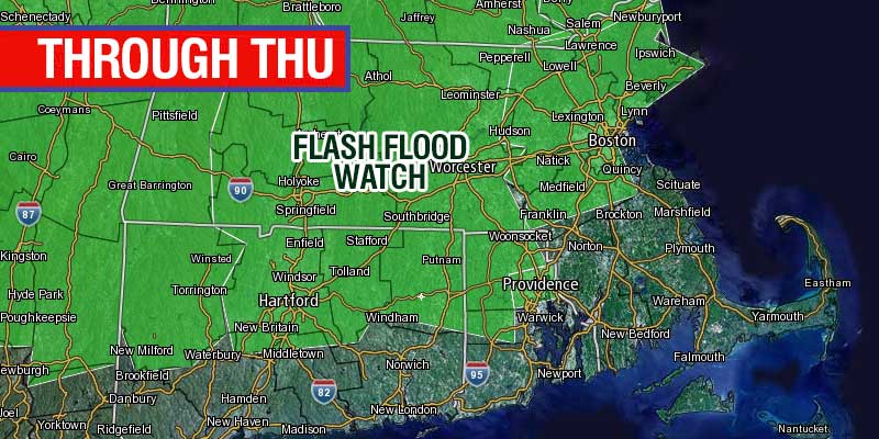
The unsettled weather pattern will continue, as expected, through Thursday. The new twist on the forecast is that the threat of showers may last through Friday into the weekend. A Flash Flood Watch is in effect for most of inland Southern New England through Thursday afternoon. A slow-moving cold front will bring heavy shower/t-storm threat Wednesday night and, especially, Thursday. The showers will be scattered, but some places could pick up 1-2″ of rain in and hour or two leading to localized street flooding.
It will be a warm, muggy day, with highs in the upper 70s to low 80s. The wind will be out of the west to southwest at 5-10 mph. Showers and thunderstorms are possible Thursday night as the front slowly eases offshore and the wind swings around to the northeast.
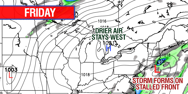
Earlier in the week, it looked like the front would get far enough offshore that drier air would move into Southern New England on Friday and last through the weekend. Unfortunately, it now appears that the front will stall just offshore, and a wave of low pressure will form along it, leading to more showers on Friday. It will be a cooler day with the temperature in the low to mid 70s. There will be a 5-15 mph northeasterly breeze.
The storm will move away from Southern New England early Saturday, but clouds may be stubborn during the morning. In a worst-case scenario, there could be some lingering showers – especially early in the day. Strong mid-summer sunshine should be able to burn through the clouds on Saturday afternoon. Highs will be in the upper 70s to low 80s.
Sunday is shaping up to be partly sunny with the chance of an inland thunderstorm as unstable air persists over Southern New England. Highs on Sunday will be in the low to mid 80s inland, and near 80 at the coast. It should not be quite as humid Friday through Sunday, with temperatures dropping into the low to mid 60s by late at night.
Given the uncertainty with the weekend forecast, we are hesitant to put a lot of stock in the forecast for early next week. Much warmer weather will build in the Ohio Valley, but it is unclear if it will make it into the Northeast in the early or middle part of next week. There are some signs that Monday may be unsettled before the hot, humid weather arrives Tuesday and/or Wednesday.


