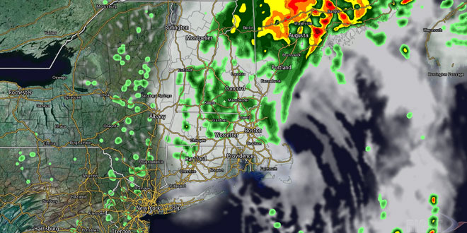
A storm system is passing by Southern New England on Friday. The heaviest rain stayed over the Atlantic Ocean and Nantucket, where more than 2″ fell by early Friday morning. The steadiest rain in mainland Southern New England will end before noon on Friday, but there is the chance of a few lingering, scattered showers Friday afternoon. Energy will rotate around the storm as the center moves into the Gulf of Maine. Look for partly to mostly cloudy skies, and a few passing showers. Highs will be in the low to mid 70s in RI, and upper 60s to low 70s in Eastern MA. It will become mainly clear Friday night, with lows in the low to mid 60s.
Warmer weather arrives Saturday
The weather should improve dramatically by Saturday morning. The temperature will drop into the 60s Friday night as skies partially clear. Saturday afternoon looks partly to mostly sunny with highs in the mid 80s inland, and near 80 at the coast. Sunday should be decent, with a southwesterly breeze, a few more clouds, and highs in the mid 80s inland, and upper 70s to low 80s at the coast. The breeze will increase to 10-25 mph in the afternoon ahead of a cold front that will bring showers and thunderstorms late Sunday into Monday morning. Right now, the best bet for showers/storms is from 6 pm Sunday to 10 am Monday.
Nice in the middle of next week
The sky will brighten Monday afternoon, and the temperature should jump through the 70s into the 80s inland. Seasonable, and not oppressively humid, weather is in the forecast for the middle of next week. Tuesday and Wednesday should both be nice days, with plenty of sunshine, and highs in the low to mid 80s. Lows will be in the 60s.


