Sunday morning update
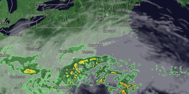
Sunday will be a mostly cloudy day in Southern New England. Showers in the Mid-Atlantic Sunday morning may overspread Southern New England Sunday afternoon. While not a washout, scattered showers could put a damper on outdoor activities after noon through the mid-evening. Highs will be in the low to mid 70s. The shower threat ends by late in the evening, and warmer weather is in the forecast for the week ahead.
Sunday evening update
Saturday was yet another delightful day in Southern New England. Highs were within a few degrees of 80, and the sun was in and out all day long. Clear skies Saturday evening will give way to partly cloudy skies by dawn Sunday. It will not be as cool as the past few nights, with lows in the upper 50s to low 60s – still pretty comfortable.

Sunday will feature partly to mostly cloudy skies, and a cooler southeasterly breeze. Highs will be in the low to mid 70s on Sunday, with the warmer conditions farther inland where there is less influence from the southeast wind, and where the clouds may be thinner. While not a bad day, it will not be as nice as the weather has been for the past several days.
A storm will scoot south of Southern New England Sunday night. It may come close enough for a round of showers on the islands and near the coast. It will most likely not bring any showers inland. Lows will be in the low to mid 60s Monday morning. Anyone who has longed for a return to summer-like heat will enjoy the weather in Southern New England next week. The warm-up will get underway Monday with mostly sunny skies and highs in the low to mid 80s inland, and near 80 at the coast. Even though it will be warmer, it will not be very humid, with dew points in the upper 50s to low 60s.
The middle of next week looks even warmer. Highs inland will be in the mid to upper 80s on Wednesday, and it may reach 90° inland on Thursday. Both days will be a bit cooler near the coast. There should be plenty of sunshine, and the humidity levels will creep up as dew points climb into the mid to upper 60s. The overnight low temperature will be in the mid to upper 60s – something we have not seen much of so far this month.
A cold front will likely pass Southern New England Thursday night or early Friday. Right now, it looks like it will be out of the picture by midday Friday, with sunshine Friday afternoon. The timing of the front is critical in determining how nice the weather is on Friday. We’ll continue to check on it during the week.


