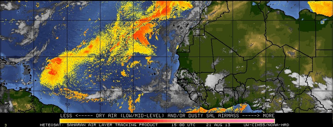
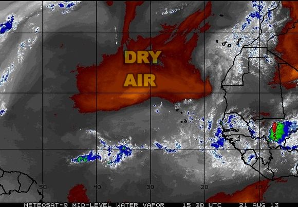
Dry air from the Saharan Desert (Saharan Air Layer) is playing a major role in squelching tropical cyclone development in the Eastern Atlantic Ocean. Right now, there is a large area of dry air over the Eastern Atlantic as analyzed by satellites. The dry air helps to limit developing tropical waves (disturbances) coming off the African coast near the Cape Verde Islands.

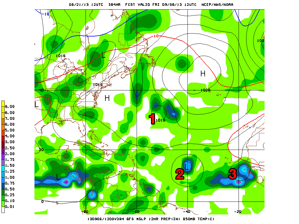
The National Hurricane Center is not anticipating any tropical cyclone formation in the next five days. After that, there are signs that the hurricane season will finally come to life. This particular projection from the GFS model has as many as three tropical cyclones in the Atlantic Ocean two weeks from now. It should be noted that a few days ago this same model had a tropical cyclone developing in the Eastern Atlantic before the weekend. At this point, it does not look like that will occur.