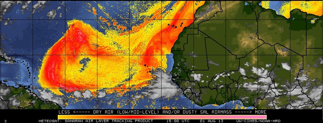
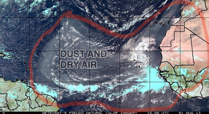
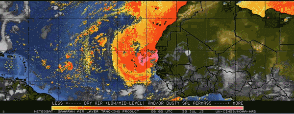
A large area of dry air and dust from a Sahara Desert dust storm has moved into the Eastern Atlantic Ocean. As a result, conditions are quite unfavorable for tropical cyclone development. The dry air extends all the way from the west coast of Africa to the eastern Caribbean islands. The dust cloud is likely to continue moving east into the Caribbean in the next few days. Tropical disturbances coming off of Africa have been suppressed southward by the dry air. The National Hurricane Center is not anticipating any tropical cyclone development in the next five days.
TROPICAL WEATHER OUTLOOK
NWS NATIONAL HURRICANE CENTER MIAMI FL
800 AM EDT THU AUG 1 2013

FOR THE NORTH ATLANTIC...CARIBBEAN SEA AND THE GULF OF MEXICO...

TROPICAL CYCLONE FORMATION IS NOT EXPECTED DURING THE NEXT FIVE
DAYS.

&&


