The fifth tropical storm of the season has degenerated into a tropical depression in the Atlantic Ocean. Erin was never expected to be a major player in the Caribbean or the United States, and the weakening has occurred a bit ahead of schedule. The storm will continue moving west-northwest, and the National Hurricane Center forecast keeps the storm as a tropical depression for the next five days.
Computer model forecasts for T.D. Erin
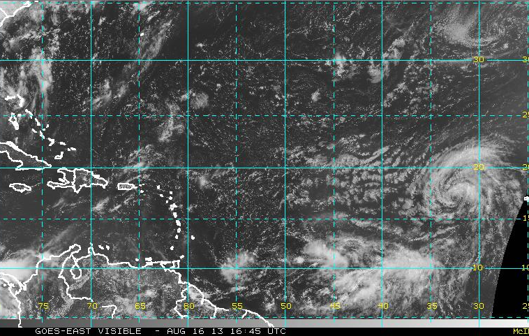
TROPICAL DEPRESSION ERIN ADVISORY NUMBER   7
NWS NATIONAL HURRICANE CENTER MIAMI FL       AL052013
1100 AM AST FRI AUG 16 2013

...ERIN WEAKENS TO A TROPICAL DEPRESSION...

SUMMARY OF 1100 AM AST...1500 UTC...INFORMATION
-----------------------------------------------
LOCATION...16.9N 32.1W
ABOUT 540 MI...870 KM W OF THE CAPE VERDE ISLANDS
MAXIMUM SUSTAINED WINDS...35 MPH...55 KM/H
PRESENT MOVEMENT...WNW OR 295 DEGREES AT 17 MPH...28 KM/H
MINIMUM CENTRAL PRESSURE...1008 MB...29.77 INCHES

WATCHES AND WARNINGS
--------------------
THERE ARE NO COASTAL WATCHES OR WARNINGS IN EFFECT.

DISCUSSION AND 48-HOUR OUTLOOK
------------------------------
AT 1100 AM AST...1500 UTC...THE CENTER OF TROPICAL DEPRESSION ERIN
WAS LOCATED NEAR LATITUDE 16.9 NORTH...LONGITUDE 32.1 WEST. THE
DEPRESSION IS MOVING TOWARD THE WEST-NORTHWEST NEAR 17 MPH...28
KM/H...AND THIS GENERAL MOTION IS EXPECTED TO CONTINUE WITH A
GRADUAL DECREASE IN FORWARD SPEED DURING THE NEXT DAY OR SO.

MAXIMUM SUSTAINED WINDS HAVE DECREASED TO NEAR 35 MPH...55 KM/H...
WITH HIGHER GUSTS.  LITTLE CHANGE IN STRENGTH IS FORECAST DURING
THE NEXT 48 HOURS.

THE ESTIMATED MINIMUM CENTRAL PRESSURE IS 1008 MB...29.77 INCHES.

HAZARDS AFFECTING LAND
----------------------
NONE.

NEXT ADVISORY
-------------
NEXT COMPLETE ADVISORY...500 PM AST.


