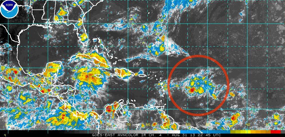
The National Hurricane Center continues to watch a disturbance with a low chance for development in the central Atlantic Ocean. The cluster of thunderstorms is moving west near 55° west about 350 miles east of the Lesser Antilles. A NOAA Gulfstream aircraft investigated the system and found no defined circulation. Development is unlikely in the next couple of days, but could occur in four or five days as it they system moves through the Caribbean Sea.

Computer model forecasts for Invest 97
SURFACE OBSERVATIONS AND DROPSONDE DATA FROM A NOAA GULFSTREAM
AIRCRAFT SHOW A BROAD AREA OF LOW PRESSURE ASSOCIATED WITH A
TROPICAL WAVE IS CENTERED ABOUT 350 MILES EAST OF THE LESSER
ANTILLES.  CLOUDINESS AND SHOWERS ASSOCIATED WITH THIS SYSTEM
REMAIN DISORGANIZED...AND THERE IS NO EVIDENCE OF A WELL-DEFINED
SURFACE WIND CIRCULATION. ENVIRONMENTAL CONDITIONS ARE NOT
CURRENTLY FAVORABLE FOR DEVELOPMENT...BUT COULD BECOME A LITTLE
MORE CONDUCIVE FOR SOME DEVELOPMENT WHEN THE WAVE REACHES THE
WESTERN CARIBBEAN SEA IN 4 OR 5 DAYS. THIS SYSTEM HAS A LOW
CHANCE...10 PERCENT...OF BECOMING A TROPICAL CYCLONE DURING THE
NEXT 48 HOURS...AND A LOW CHANCE...20 PERCENT...OF BECOMING A
TROPICAL CYCLONE DURING THE NEXT 5 DAYS. SHOWER ACTIVITY AND
LOCALLY GUSTY WINDS ASSOCIATED WITH THIS SYSTEM ARE EXPECTED TO
SPREAD OVER THE LESSER ANTILLES DURING THE NEXT DAY OR TWO.


