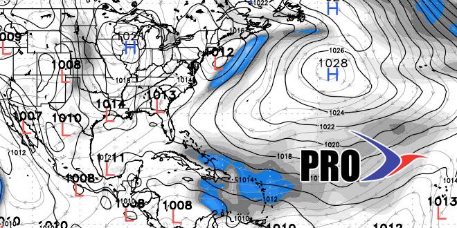
In case you have not noticed, the weather pattern in the Northeast has definitely flipped to much cooler and drier than the first three weeks of July! The temperature averaged near normal for the final ten days of the month, and the start of August is likely to be cooler than normal in Southern New England. A large area of high pressure will stay parked over the central Atlantic Ocean for the next 7-14 days. Meantime, there will be a general area of low pressure over central and eastern Canada. The upshot is slightly cool conditions for New England.
The jet stream will remain fairly progressive, so every few days there should be a cold front and a shower threat. We will continue to have to keep an eye on the Atlantic Seaboard for rogue storm development ahead of these cold fronts. The systems may not be tropical, but there is the potential for enhanced rainfall if any of these storms develop along the cold front as it passes.


