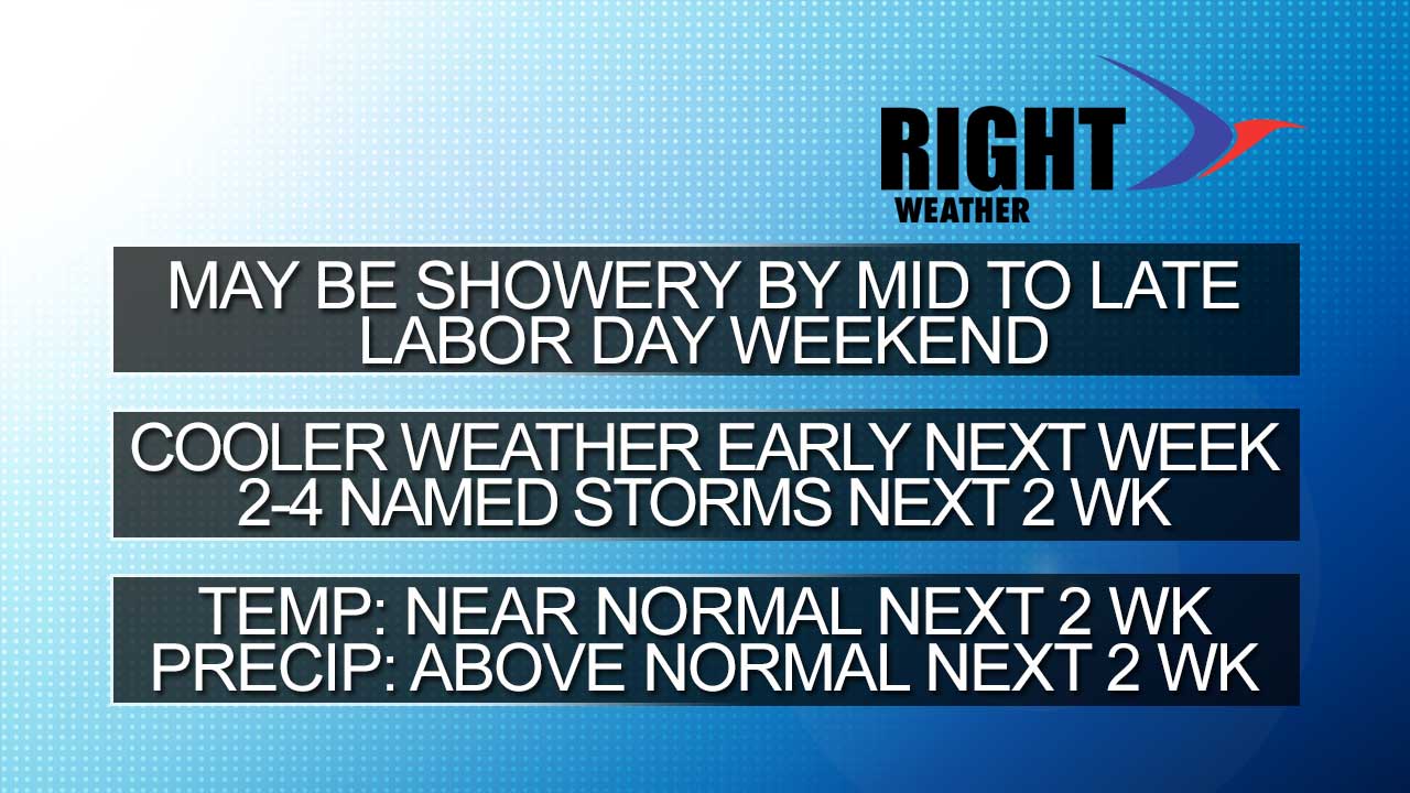
The Labor Day weekend forecast is looking a lot shakier than it did a few days ago. The European model continues to advertise a system that brings moderate to heavy showers to the Mid-Atlantic and Southern New England in the middle of the weekend – primarily on Sunday. The GFS model does not see it, and brings a cold front with showers/storms through on Labor Day. The Euro has been consistent for a few runs, and that has us fairly pessimistic about the Sunday forecast for Southern New England – especially near the coast. The European is a little slower with the cold front than the GFS is. After the Sunday rain, it doesn’t bring widespread showers/storms into the picture until late Monday and Monday night. There is still a lot to sort out with the weekend forecast in the next couple of days.
It should get seasonably cool early next week. As the kids head back to school on Tuesday, the weather will be drying out and turning pleasant for most of the school/work week. Highs will be in the 70s with lows in the 50s. A late-week cold front may reinforce the early fall feel for the first full weekend of September.
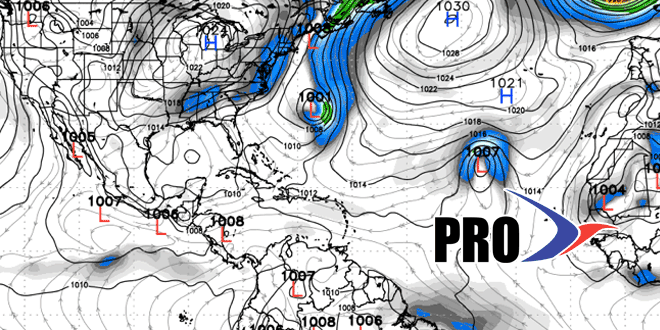
The action in the tropics should finally begin to pick up – particularly in the Atlantic Ocean. We expect 2-4 named storms to form in the next two weeks, which will take us to the peak of the hurricane season. There has not yet been a hurricane, but one should develop in the next 10 days. There are some computer models that bring a storm within shouting distance of the Eastern US in the first week of September. Most models curve the storm into the Atlantic Ocean before making landfall.