With the temperature running about 3° cooler than normal so far, and not much very warm weather in the forecast, it’s looking like a decent bet that Southern New England will see a cooler than normal month of August. It’s quite a turnaround after one of the hottest Julys on record. Not much has changed with the weather outlook for the Northeast since late-July. For the most part, it will be cooler than normal without an awful lot of humidity. In the next week, showers are likely on Friday and Tuesday. After Tuesday, a dry pattern may take shape for 6-10 days as a large area of high pressure gets locked in over the Northeast. One thing we’ll watch for is an inverted trough to set up along the Southeast U.S. coast. Eventually, that may drift far enough west that some rain arrives in Southern New England. It’s one of those patterns that could go from dry to wet in a hurry.
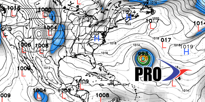
There’s nothing cooking in the tropics right now, but we expect the activity to pick up with at least one tropical system forming in the next two weeks. Climatologically, that is expected. If there is not another system in the next couple of weeks, a lot of us, including NOAA and CSU researchers, may be lowering the seasonal forecast considerably. The hurricane season peak is less about a month away.