Is your lawn turning brown? You’re not alone. Most of Southern New England has seen a rainfall deficit since July 1. Showers and thunderstorms have been in the forecast regularly in the past six weeks, but the end result has been localized rainfall leaving much of the area rather dry.
Most of Rhode Island, aside from a small area in the northwest corner of the state, has seen 25-90% of the normal rainfall from July 8 – August 8. It has been driest in the southern half of RI.
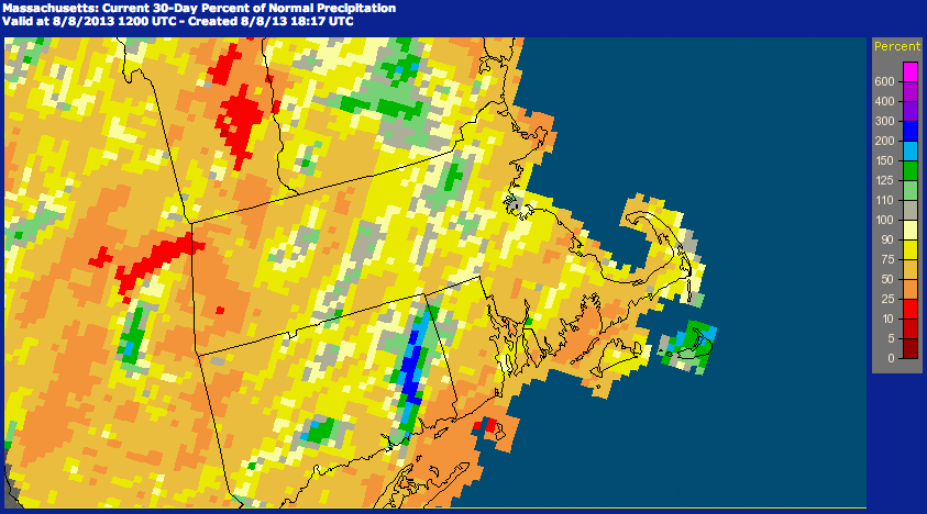
A few localized areas in Massachusetts have seen above normal rainfall. Nantucket and the I-495 area near Lowell have seen 110-200% of the normal rainfall. The rest of the state is primarily in the 25-75% range. The Berkshires, North Shore and Buzzards Bay area are the driest with 10-50% of normal rainfall since July 8.
Connecticut has wide range of rainfall amounts in the past 30 days. Flash flooding in late-July in Eastern CT pushed a large area to 150-300% of the normal rainfall. Most of the state, however, has been slightly dry. Interestingly, one of the driest areas is extreme SE CT, near Groton/New London, where there has only been 25-50% of the normal rain. The fact that just 15 away in Norwich, there has been 2-3 times the normal rainfall really illustrates the localized nature of summertime showers.

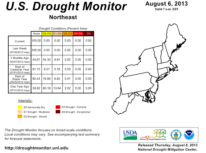
If you’re wondering about a drought, the latest Drought Monitor update has none of the Northeast in drought conditions.