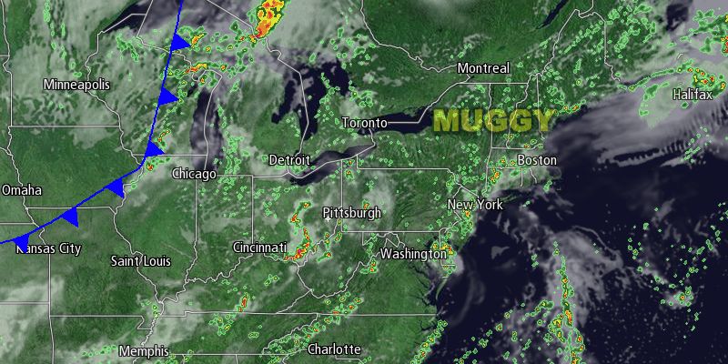
Extended stretches of sunshine were hard to come by in Southern New England on Saturday. Showers stayed away for the most part, but clouds were stubborn. In spite of the mostly cloudy sky, the temperature rose to about 80° inland. It was in the 70s near the coast. While not a particularly summery day, it certainly had summer-like humidity, with dew points in the low 70s. Scattered light showers moved through Southern New England through mid-afternoon. Heavy showers and storms developing in by late in the afternoon in NY and Western MA were moving southeast. Those showers/storms will threaten primarily inland Southern New England through the evening.

The weather pattern for the rest of the holiday weekend looks quite unsettled. Scattered showers and thunderstorms are possible on Sunday, especially in the morning. In a best-case scenario the shower and thunderstorms will move well inland Sunday afternoon, and there may be some breaks of sunshine. It will be a breezy and humid day. The high temperature is highly dependent on the amount of sunshine inland. It will be in the low to mid 70s near the coast, and most likely in the mid to upper 70s inland with limited sun.
Clouds, patchy fog, and possible showers are in the forecast for Sunday night. It will be mild and muggy, with lows in the mid to upper 60s. Monday looks similar, with a lot of clouds, and scattered showers and storms. The southerly wind will continue ahead of a cold front that is slated to move through Southern New England Tuesday morning. Highs will be in the 70s on Monday. The shower and thunderstorm threat, plus high humidity, continues through midday Tuesday. The front will finally get offshore Tuesday afternoon, and drier weather will follow for the midweek.
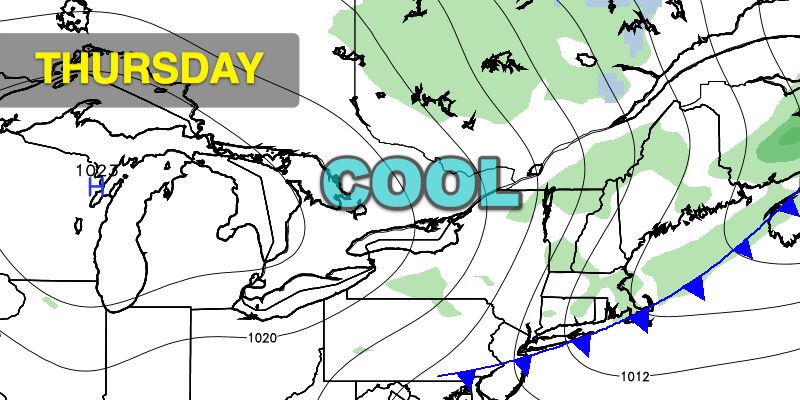
Wednesday through Friday looks mainly dry and gradually cooler as another cold front passes on Thursday. Highs will be in the mid to upper 70s on Wednesday, mid 70s on Thursday, and low 70s on Friday. Lows will fall to the low 50s by Friday morning. Needless to say, it will be a lot less humid with an airmass coming out of Canada. There will be a blend of sun and clouds during the day, with mainly clear skies at night.


