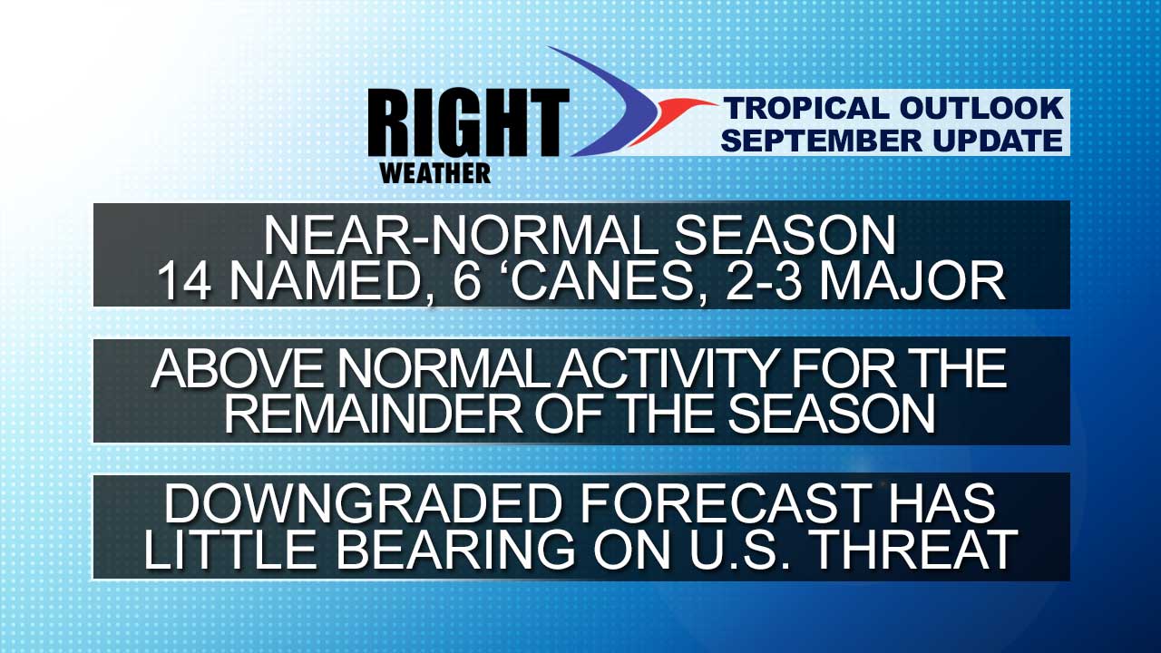
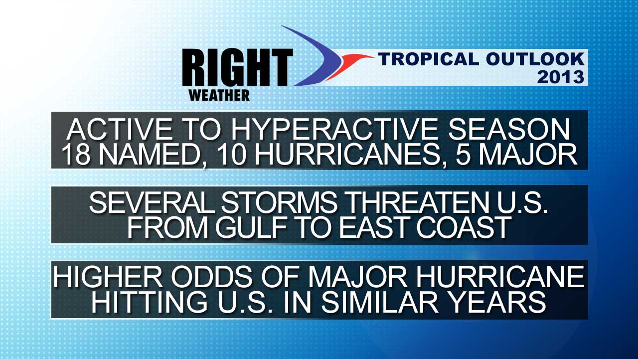
If the 2013 Atlantic hurricane season were a football game, we’d be down 21-3 at the half in a game we are favored to win by two touchdowns. The Right Weather forecast, along with many others, was for an active to hyperactive season with 18 named storms, 10 hurricanes, and 5 major hurricanes. So far, there have been six named storms and no hurricanes. This is the first time since 2002 that a hurricane has not formed in the Atlantic Basin before September 1.
As you can see, there have been 5 years since 1960 when the first hurricane formed after September 1. However, in each of those years, the season ended with at least four hurricanes. In two of the five years the season ended with at least an average (6.4) number of hurricanes. So, it’s a little too early to write this season off completely. It should be noted, though, that it would be unprecedented for the season to kick into high gear and have 10 hurricanes form after September 1.
| Year | First Hurricane | Total Hurricanes |
| 2002 | September 11 (Gustav) | 4 |
| 2001 | September 8 (Erin) | 9 |
| 1988 | September 2 (Debby) | 5 |
| 1984 | September 10 (Diana) | 5 |
| 1967 | September 2 (Arlene) | 6 |
There have been several factors limiting development of tropical cyclones this season. There has been a lot of dry, stable air over the central and eastern Atlantic Ocean. For a while in August the African wave train was suppressed farther south than the favored areas for tropical development. Other systems have fallen victim to a wealth of dry air and some wind shear over the central Atlantic Ocean. Conditions in the Gulf of Mexico have also been unfavorable for developing big storms, with Barry and Fernand developing close to the coast, limiting their opportunity for intensification before moving inland.
Looking ahead to the rest of the season, the African wave train looks fairly active for the foreseeable future, but in the next 6-10 days conditions will not be favorable in the Central and Eastern Atlantic to allow these disturbances to get cranking into significant tropical cyclones. There is a better chance of seeing the action pick up after September 10, which is the normal peak of the hurricane season. While the environment is not great for Cape Verde storms to form and intensify in the next 10 days, we also need to keep an eye on the Gulf of Mexico and Bahamas for tropical or subtropical storms to form closer to the coast.
At the start of the update I made the analogy to it being halftime of a football game because we are three months through the six month season. In reality, though, 60+% of the tropical activity occurs after September 1. September and October can both be active months, and, as we saw last year with Sandy, the U.S. is susceptible to major impacts from tropical systems late into the season. The slow start to the season has no bearing on the likelihood a tropical cyclone hitting anywhere in the United States. Climatologically, a lot of experts believe that we are in a pattern similar to the 1930s to 1950s with many U.S. and Northeast tropical storm impacts. The bottom-line is the preseason forecast is likely to bust, but the comeback should be on in the second half, and we may squeak out a narrow victory (more active than normal) while not covering the spread (preseason forecast).