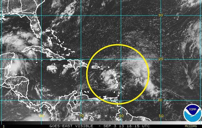
The cluster of showers and thunderstorms in the Eastern Caribbean looks better organized on Tuesday afternoon. The National Hurricane Center continues to watch it, and the forecast is for a 30% chance of it becoming a tropical cyclone in the next 48 hours, and a 50% chance of becoming one in the next five days. The disturbance will move west-northwest through the Caribbean in the next week, and may eventually reach the Bahamas as a tropical cyclone. At this point, it is no threat to the United States.
Computer model forecasts for Invest 97
TROPICAL WEATHER OUTLOOK
NWS NATIONAL HURRICANE CENTER MIAMI FL
ISSUED BY THE NWS WEATHER PREDICTION CENTER COLLEGE PARK MD
200 PM EDT TUE SEP 3 2013

FOR THE NORTH ATLANTIC...CARIBBEAN SEA AND THE GULF OF MEXICO...

SHOWERS AND THUNDERSTORMS CONTINUE IN ASSOCIATION WITH AN AREA OF
LOW PRESSURE CENTERED ABOUT 100 MILES WEST OF DOMINICA. UPPER-LEVEL
WINDS ARE EXPECTED TO REMAIN FAVORABLE FOR DEVELOPMENT OVER THE
NEXT FEW DAYS...BUT INTERACTION WITH THE LAND MASSES OF THE GREATER
ANTILLES COULD INHIBIT TROPICAL CYCLONE FORMATION AS THE SYSTEM
MOVES GENERALLY WEST-NORTHWESTWARD AT AROUND 10 MPH. THIS SYSTEM
HAS A MEDIUM CHANCE...30 PERCENT...OF BECOMING A TROPICAL CYCLONE
DURING THE NEXT 48 HOURS...AND A MEDIUM CHANCE...50 PERCENT...OF
BECOMING A TROPICAL CYCLONE DURING THE NEXT 5 DAYS. LOCALLY HEAVY
RAINFALL AND GUSTY WINDS ARE EXPECTED TO AFFECT PORTIONS OF THE
NORTHERN LESSER ANTILLES OVER THE NEXT DAY OR SO...AND SPREAD OVER
PUERTO RICO BY THURSDAY.


