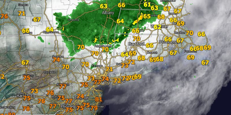
A slowly weakening cluster of showers and thunderstorms will have enough punch left to bring some rain to Southeastern New England as it dives southeast Tuesday afternoon. The showers represent the leading edge of very warm and muggy weather that will be arriving for a short stay in the middle of the week.
 The timing for showers on Tuesday is from early to mid afternoon in eastern CT, RI, and central and eastern MA. The showers will continue to break apart as they move southeast, and a lengthy period of steady rain is unlikely. It will continue getting muggier as the day progresses. Highs will be in the low to mid 70s with mostly cloudy skies.
Tuesday night looks mild and humid. Patchy fog is possible near the coast. Lows will be in the mid to upper 60s. Any low clouds and fog should burn off on Wednesday morning, and the temperature will jump into the 80s inland by mid-morning. With enough afternoon sunshine, highs on Wednesday may reach the low to mid 90s away from the coast. A strong southwesterly breeze will keep it in the upper 70s to low 80s near the coast.
More warm, muggy weather is in the forecast for Wednesday night. The low temperature will be near 70° in the cities, and it will be in the mid to upper 60s elsewhere. While not as hot, Thursday will still be very warm and humid. Highs inland will be in the low to mid 80s, with 70s near the coast. Showers and thunderstorms are possible late Thursday into early Friday as a strong cold front pushes through Southern New England.


