Right Weather Pro

Computer Model Trends: Coastal storm not dead yet

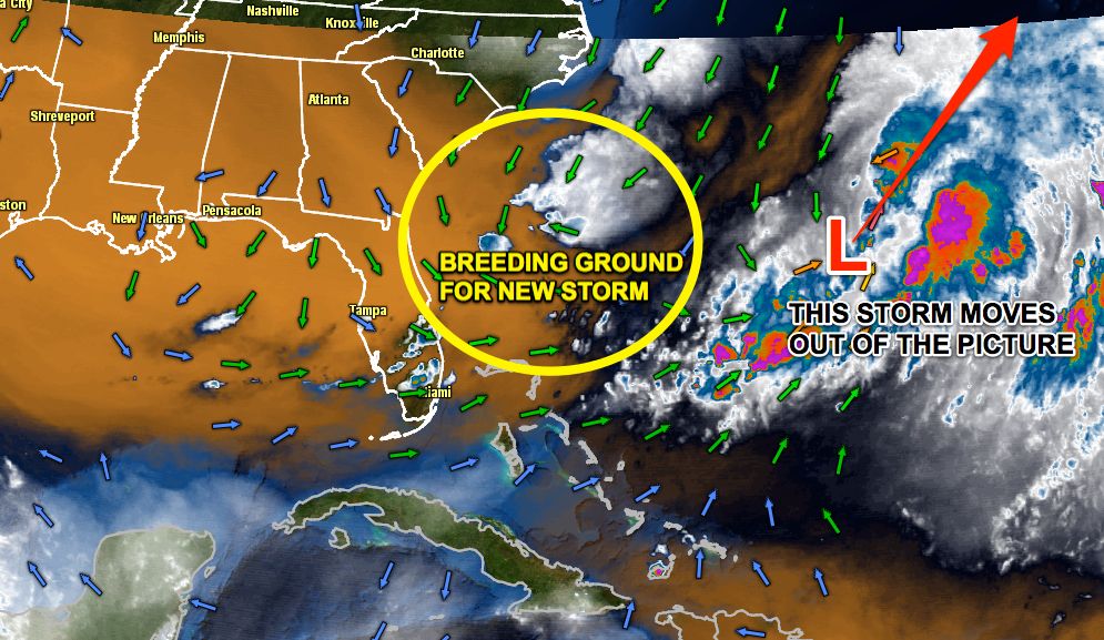
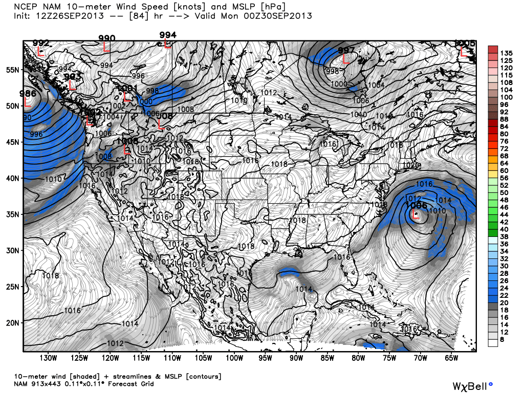
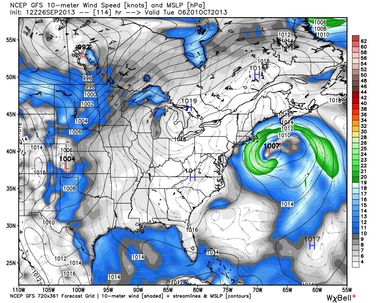
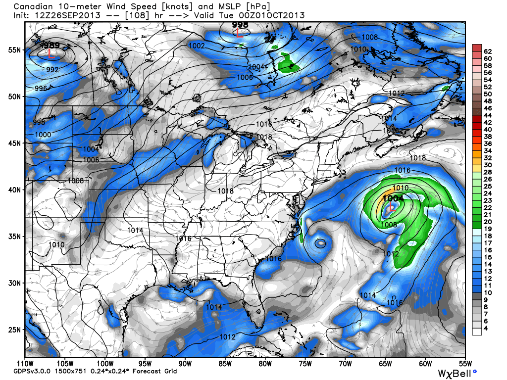
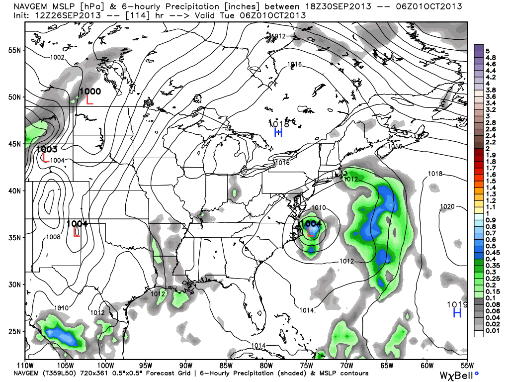
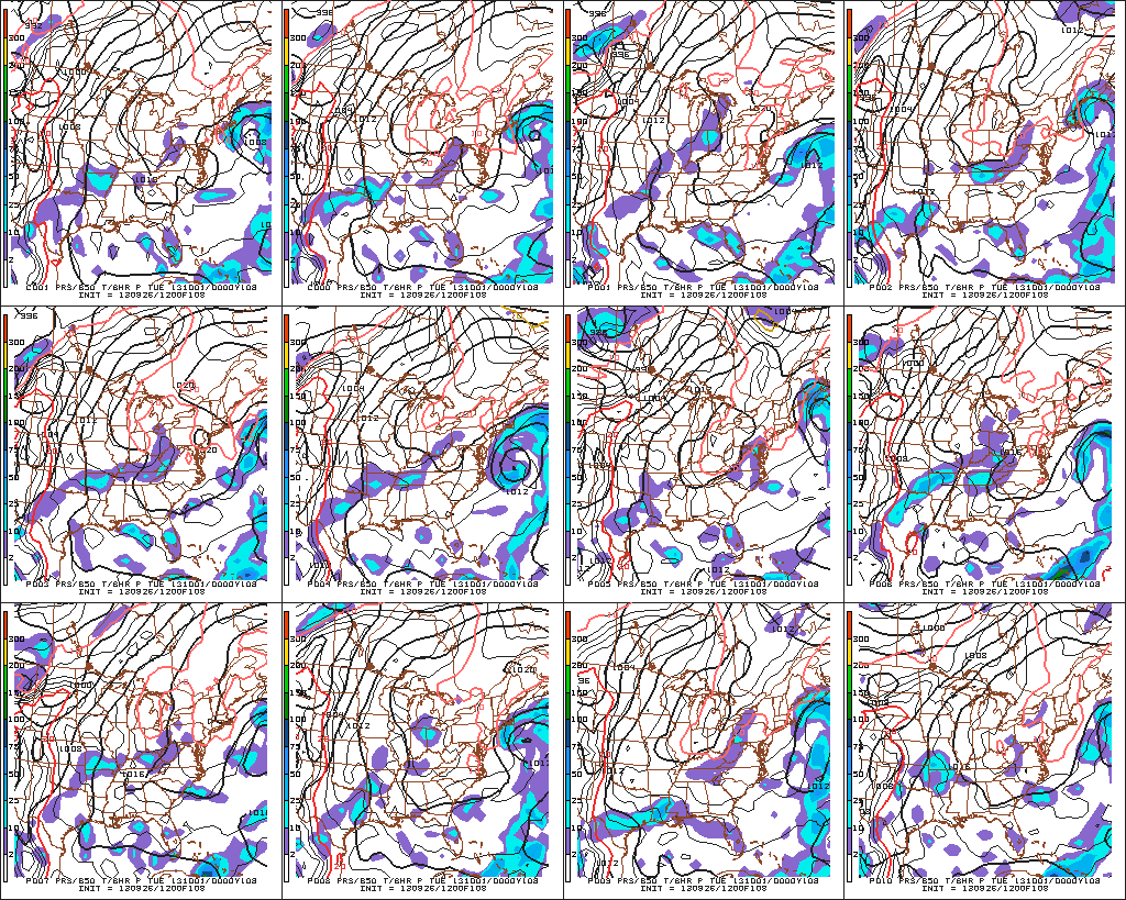
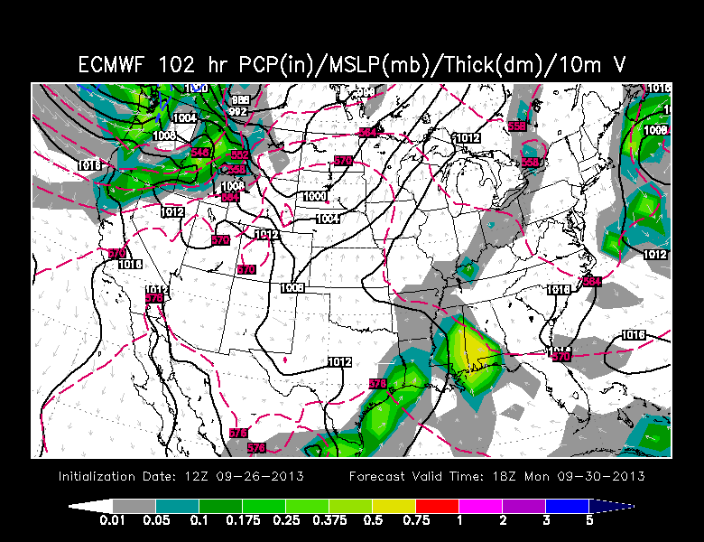
The forecast for a coastal storm early next week reminds me a lot of a relationship I had in college: on again, off again. Two days ago, the computer models were hot ‘n heavy on a storm bringing wind/rain to coastal Southern New England. Yesterday, the models dumped the idea of a storm coming close enough to bring any foul weather to New England. Today, it looks like they’re thinking about hooking up again. It makes one wonder if there is alcohol involved – sort of like my college relationship, but, enough about that…

The front-running storm is moving quickly away from the energy left behind. There should be enough to allow a trailing storm to spin up off the SE coast in the next couple of days.

The NAM model only extends out 84 hours, but it is clearly showing a track of the storm close to the coast. It has a reasonably strong ridge to the northeast of the storm that will prevent it from going out to sea.

The GFS is at its closest point with the 12Z run. Certainly not a major impact storm, but close enough for some rain/wind in SNE - especially on the Cape/Islands
The GFS is at its closest point with the 12Z run. Certainly not a major impact storm, but close enough for some rain/wind in SNE – especially on the Cape/Islands

The Canadian model still loses the storm out to sea

NAVGEM model has somewhat convoluted solution, but it keeps the energy close to the coast, somewhat supporting the NAM and GFS

About half the GFS Ensemble members support a low to medium impact storm in Eastern New England.

The European model has trended west, but not far enough west for a significant impact in New England.

The Bottom Line

We still believe the weather pattern supports a storm coming close enough for some impact in Eastern New England. It’s worth noting that none of the models have a very intense storm, so, odds are we’re not looking at a major impact storm. Given the time of year, however, it’s possible something could get more wound up than the models are projecting. There is a wealth of warm water off the East Coast.

I’m not dead!


Fred Campagna

President and Chief Meteorologist - Right Weather LLC AMS Certified Consulting Meteorologist #756 AMS Certified Broadcast Meteorologist #126

Related Articles

Back to top button