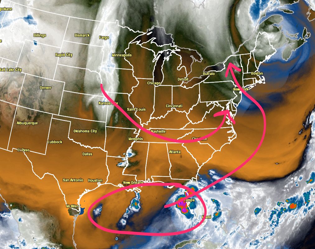
It is only one computer model run, but, in a pattern this quiet, it is sure to generate some buzz. We’re not trying to turn the crank on the hype machine, and it is still quite possible that this does not come together as some computer models are projecting. You may remember last week there was a computer model run that brought a nasty Nor’easter to the New England coast for early this week. Obviously, that did not pan out. In this pattern, however, that is the kind of scenario we should be watching for. There is a blocky jet stream and slightly negative NAO. If a storm forms off the Southeast coast, it can get sent up towards the Mid-Atlantic and Northeast.
The weather setup
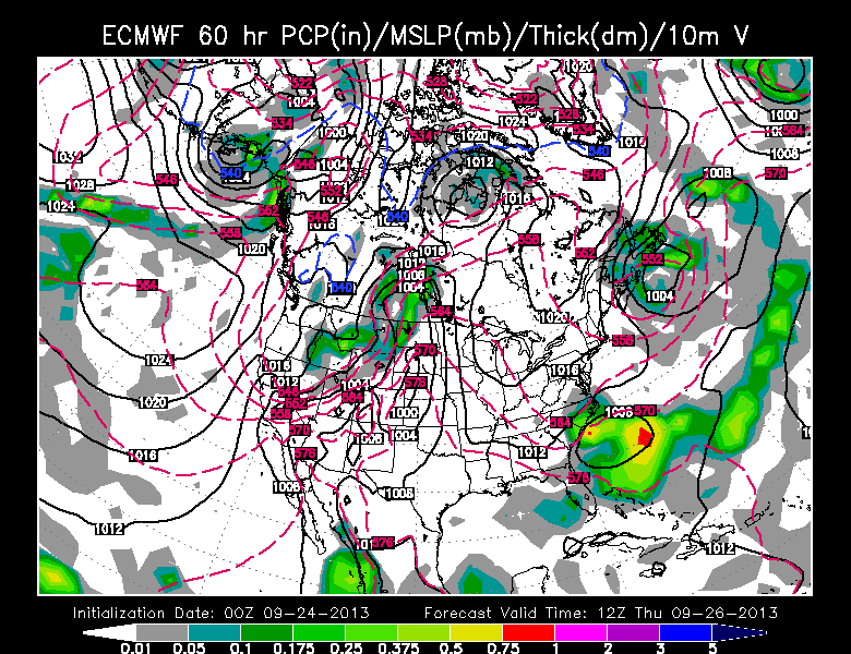
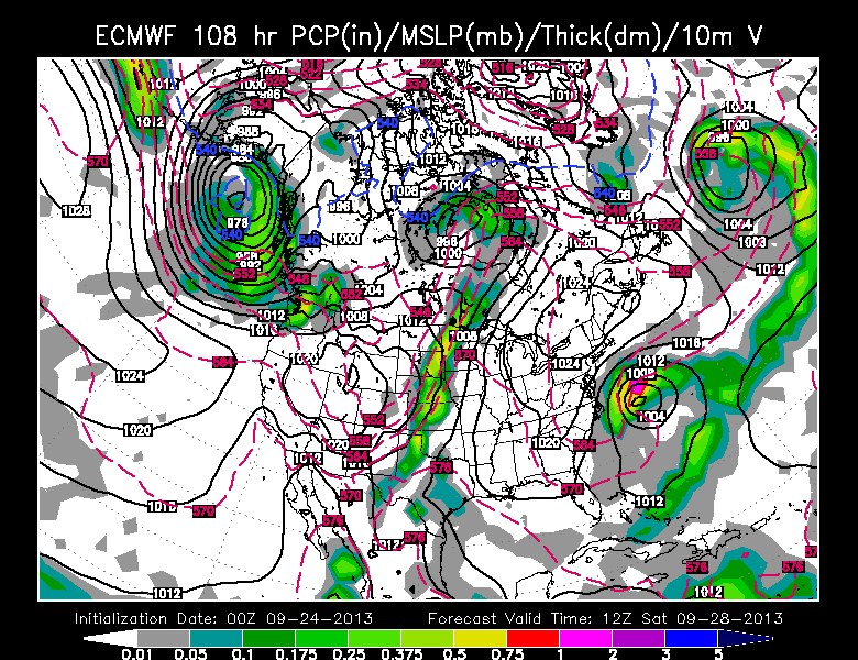
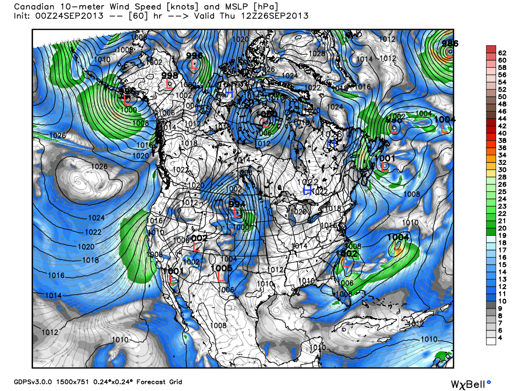
The models
ECMWF

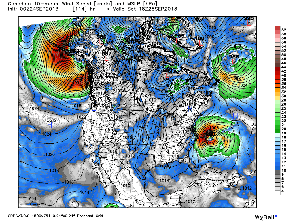
Canadian

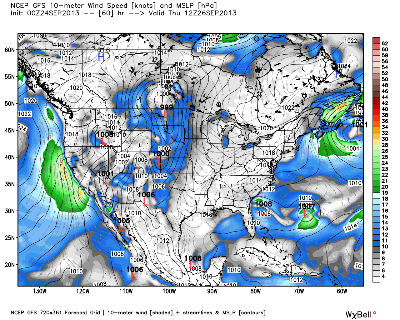
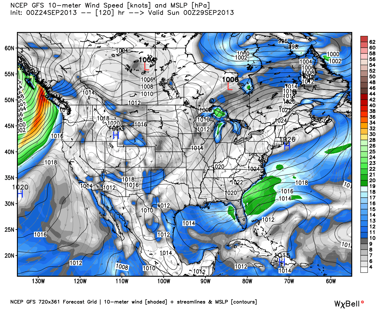
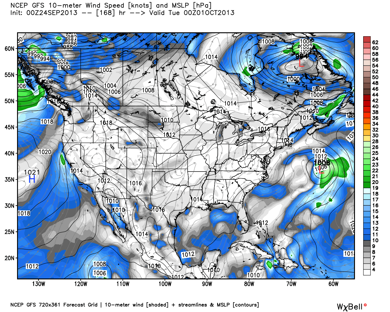
GFS
Bottom-line
It is still very early in the game. One run is one run, and it’s possible this is all for naught if the ECMWF and the Canadian are not handling the pattern correctly. Having said that, it’s a pattern that bears very close watching because of the strong blocking in place. We will be eagerly anticipating the next batch of computer model runs Tuesday afternoon.
For anyone that is thinking that this could be a Sandy sequel, there are some pretty big differences. First and foremost, Sandy was a mature tropical system in the Bahamas that grew into an extremely large and intense storm over the course of a week before reaching the United States. This storm is not forecast to be as large or intense as Sandy was, and it will not have as much time to strengthen. The final track of the ECMWF storm is similar to Sandy, but it is nowhere near as intense.


