Right Weather Pro

Computer Model Trends: Monday storm a watcher

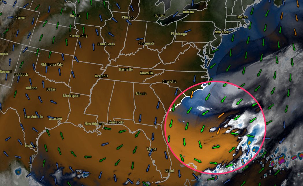
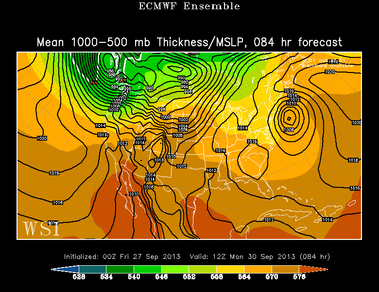
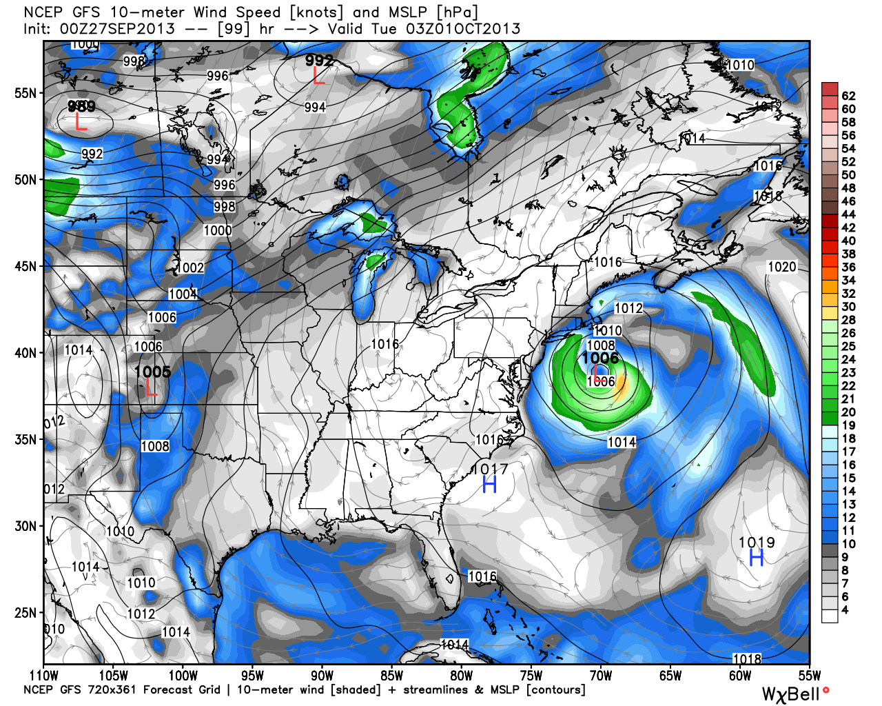
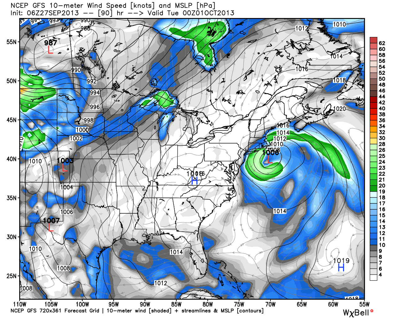
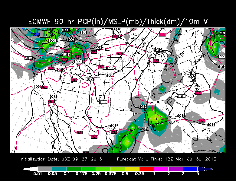
It will be interesting to see what spins up off the SE coast north of the Bahamas in the next couple of days. I think it will be a named storm, probably sub-tropical. With a block in the jet stream, it’s possible the storm is steered far enough west to bring the western edge of the storm over eastern New England early next week. It’s a scenario we’ve been monitoring all week, and, at this point, it looks like it is 50/50 or better that, at least, eastern MA will have some rain and gusty wind on Monday as the storm passes.

It’s still a little early to talk specifics because of the uncertainty with the track, but, now, it does not look like a high impact event. It is not in the same league as the named storms (Irene/Sandy) of the past two years, but it could be gusty Nor’easter with rain if the track is a little closer and the storm a bit stronger than the current model consensus.

The storm forming north of the Bahamas on Friday morning.

00Z GFS Ensemble. If your'e keeping score at home, that is 8 out of 12 members with rain/wind for eastern New England on Monday
00Z GFS Ensemble. If your’e keeping score at home, that is 8 out of 12 members with rain/wind for eastern New England on Monday

06Z NAM - just a bit too far offshore for an impact in New England
06Z NAM – just a bit too far offshore for an impact in New England

00Z ECMWF Ensemble Mean - stronger, closer than the operational European run
00Z ECMWF Ensemble Mean – stronger, much closer than the operational European run

A look at the precipitation output for the different European EPS members on Nantucket. Notice how most of them have some rain Mon-Tue. Also, notice how much more rain the ensemble mean gives Nantucket compared to the operational model.

00Z GFS - close enough for some rain/wind, but not close or strong enough for a major impact
00Z GFS – close enough for some rain/wind, but not close or strong enough for a major impact

06Z GFS - a little closer than the 00Z run. Still not a major event, but enough for a nasty day in eastern New England
06Z GFS – a little closer than the 00Z run. Still not a major event, but enough for a nasty day in eastern New England

00Z ECMWF is the outlier with a weak storm farthest east. The European has a great track record, so it will be interesting to see if this pans out.

00Z Canadian. A stronger storm than most. Far enough offshore that peak winds stay less than 30 kt for all of New England

The Bottom Line

Keep an eye on this forecast for the next 24 hours. I’d say we will know by midday Saturday if the storm is going to hit New England. To reiterate, as it is now projected it is not a high impact event, but anything developing over the Gulf Stream at this time of the year could wind up stronger than now forecasted. A stronger storm with a closer track would be a headache for mariners and could cause some tree damage.

Fred Campagna

President and Chief Meteorologist - Right Weather LLC AMS Certified Consulting Meteorologist #756 AMS Certified Broadcast Meteorologist #126

Related Articles

Back to top button