Right Weather Pro

Computer Model Trends: PM Update

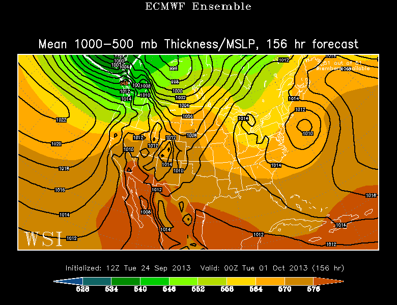
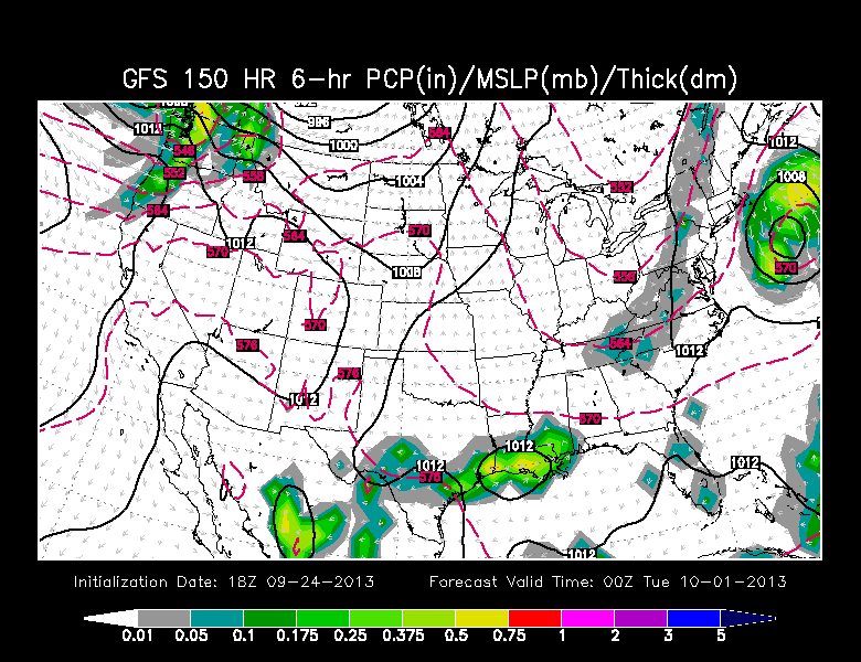
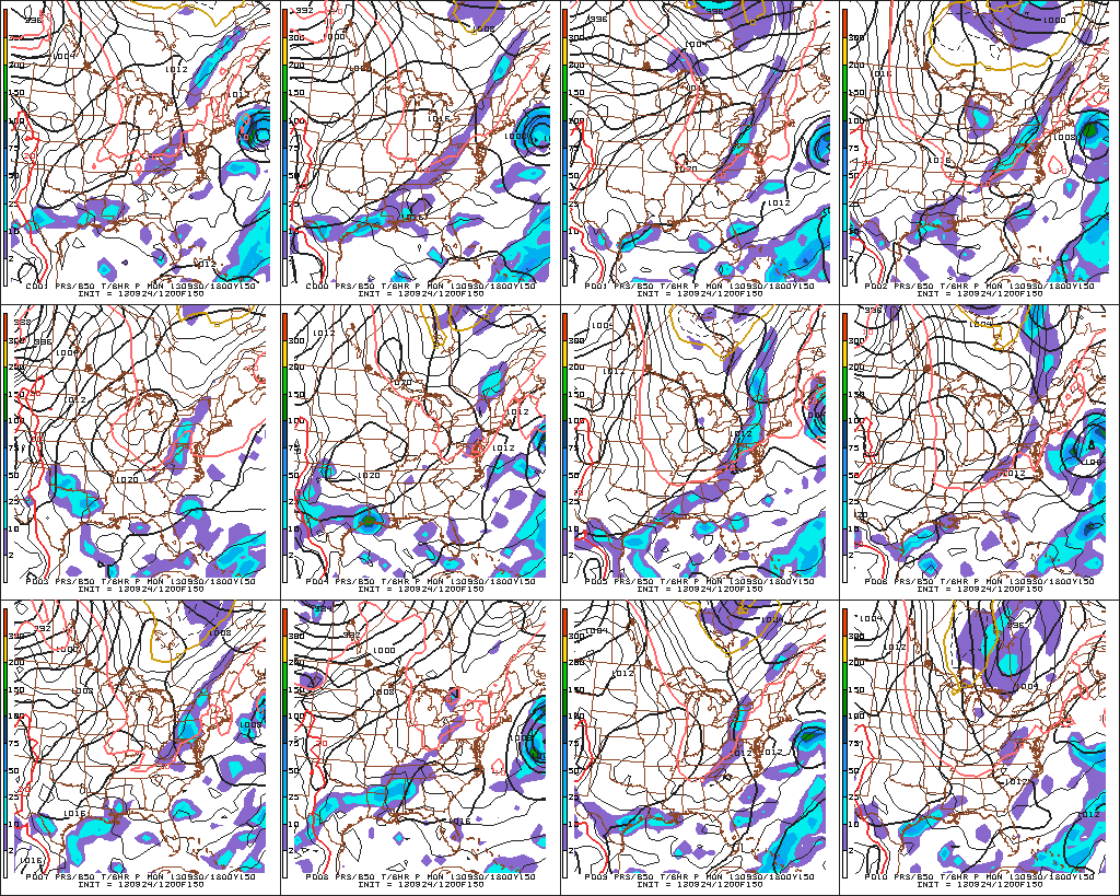
Well, it’s still there…the potential for a significant coastal storm early next week. The trend today has been farther east with the models that were west, and farther west with the models that were east. So, maybe they’re finding a middle ground. That middle ground, as of today, would have the storm bringing rain and wind to Southern New England Sunday night and Monday, with the worst weather on Cape Cod. Of course, that’s still five days away, and it’s too soon to talk specifics with the computer model spread yielding vastly different impacts (or lack thereof) depending on the track.

A few thoughts before the graphics….

  • There will be a storm off the Southeast coast that moves north this weekend. The question is whether it will move north-northwest or north-northeast. North-northeast takes it out to sea with no impact.
  • It is not a Sandy sequel, but could still be a formidable storm with damaging winds, coastal flooding and heavy rain – in a worst-case scenario.
  • Tropical or not? Probably a hybrid storm. Most likely sub-tropical. It will develop as a baroclinic (cold core) storm but may take on tropical (warm core) characteristics while intensifying off the SE coast.
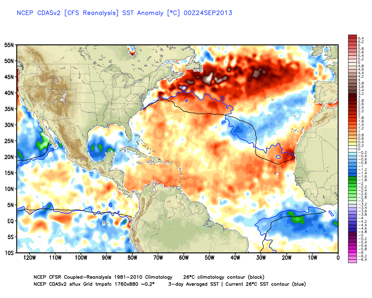
  • My biggest concern at this point is the storm being more intense than currently projected by the models. If it takes on tropical characteristics in a favorable environment for development it could strengthen over the warm water of the Gulf Stream.
Plenty of warm water along the Eastern Seaboard at this time of the year. It's actually warmer than normal in most places.
Plenty of warm water along the Eastern Seaboard at this time of the year. It’s actually warmer than normal in most places.

mthk_f156_bg_US
12Z ECMWF ensemble mean has a storm near the SNE coast early next week.


The 18Z GFS Operational is the closest the model has come to hitting SNE. It has had a westward trend for the past several runs.

GFS Ensembles are still not buying it. Most of the members have a minimal impact on the East Coast.

The strongly negative NAO is something we've talked about in the Long Range Forecast for a while. It's a VERY blocky jet stream, and is conducive to slow-moving weather systems - good and bad. We're getting the "good" right now.
The strongly negative NAO is something we’ve talked about in the Long Range Forecast for a while. It’s a VERY blocky jet stream, and is conducive to slow-moving weather systems – good and bad. We’re getting the “good” right now.

ECMWF is still projecting the biggest impact in SNE, but it has trended east with a lower impact in the Mid-Atlantic, but a bigger impact in SNE. The eastward trend is something to watch.

Canadian run shifted east with Tuesday's run and was a near-miss for SNE
Canadian run shifted east with Tuesday’s run and was a near-miss for most of SNE except Cape Cod & islands

The Bottom Line

Still in wait and see mode. Don’t pull the boat, don’t bring in the lawn furniture. Those are the kind of calls that can be made on Thursday, and executed over the weekend, if necessary. By that point, there should be fewer questions about the storm’s track and intensity.

Today’s trend was farther east, and tonight’s ECMWF is eagerly anticipated. If it’s continues trending east, we’re in good shape. If it flip-flops west, then we most likely will have a storm to deal with.

Fred Campagna

President and Chief Meteorologist - Right Weather LLC AMS Certified Consulting Meteorologist #756 AMS Certified Broadcast Meteorologist #126

Related Articles

Back to top button