Right Weather Pro

Computer Model Trends: Wednesday AM Update

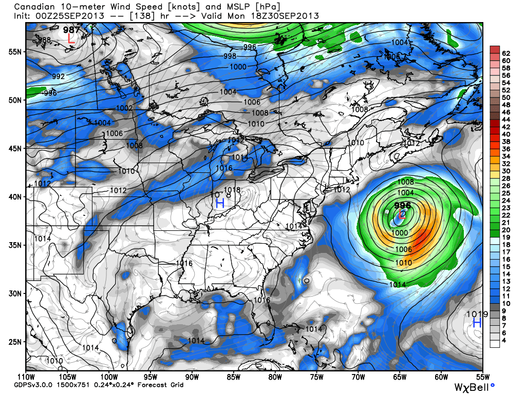
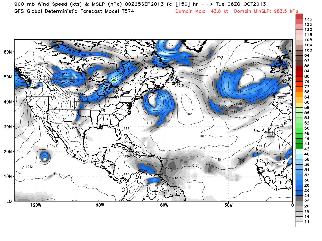
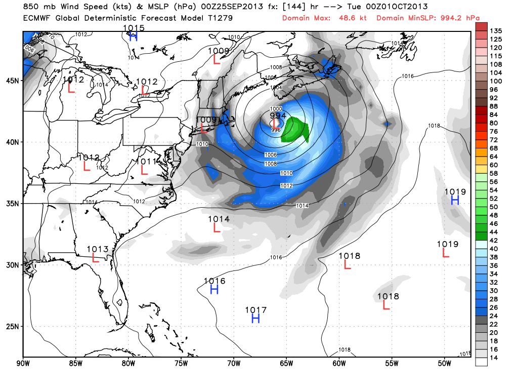
Score one for the GFS? Not yet, but the models are trending toward the GFS solution more than the original European solution. At this point, all the models track the storm east of Southern New England. Most of the models have a minor impact, at worst, for Southern New England, with the best chance of wind/rain on Cape Cod and the islands. Also, the timing of the storm is a little later. It looks like it will pass Southern New England on Monday, leaving fair weather all weekend – regardless of how close it comes to the coast.

Canadian still has the strongest storm. It is well east of SNE and moving NE. A non-factor.

UKMET model is well out to sea and not particularly strong. A little to no impact situation for SNE.

GFS Ensembles remain consistent with a minimal impact

ECMWF ensemble mean is closer to the operational than yesterday. Ensembles had been east of the operational. Now, they're both offshore.
ECMWF ensemble mean is closer to the operational than yesterday. Ensembles had been east of the operational. Now, they’re both offshore.

GFS operational shows the storm missing SNE to the east

ECMWF operational is close enough to the coast for a minor impact in eastern New England 20-30 kt wind on Cape Cod and the Islands.
ECMWF operational is close enough to the coast for a minor impact in eastern New England 20-30 kt wind on Cape Cod and the Islands. This track is hundreds of miles east of track from Tuesday morning’s ECMWF run that started the buzz on the potential storm. 

The bottom line

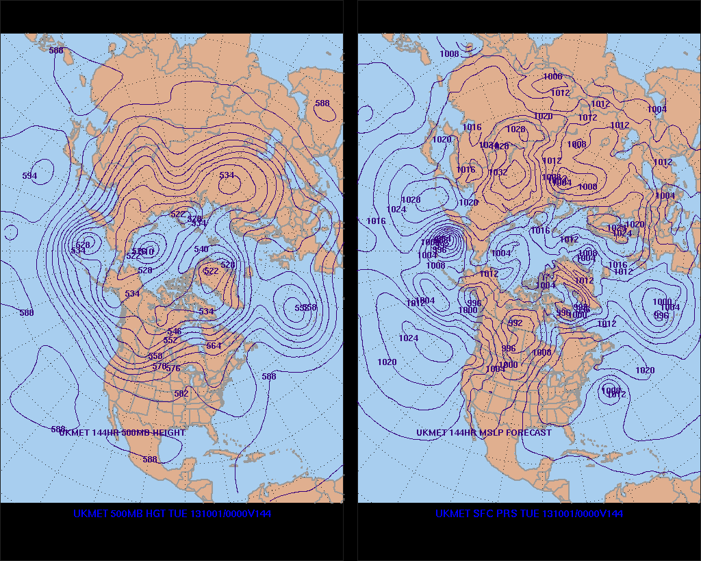
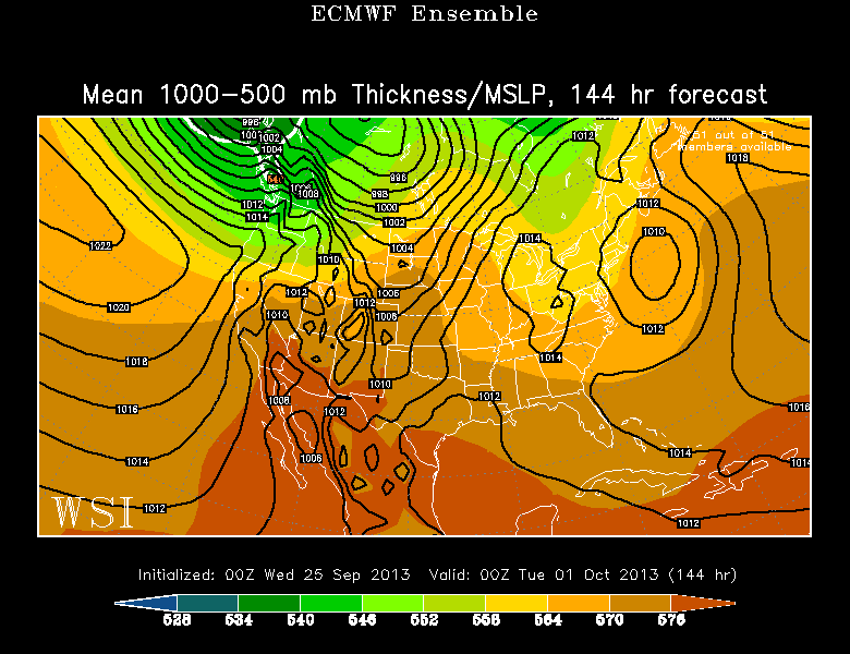
It looks like the upper low responsible for the development of the storm will be farther east and north than previously projected by the European. As a result, the storm has a better chance of escaping to the east away from the SNE coast. It is too early to sound the all clear, but the trend is definitely heading that way. We will update the computer model trends on Wednesday evening unless it is blatantly obvious that the storm will miss SNE completely.

Fred Campagna

President and Chief Meteorologist - Right Weather LLC AMS Certified Consulting Meteorologist #756 AMS Certified Broadcast Meteorologist #126

Related Articles

Back to top button