Thursday had to be in the handful of best days of the year in Southern New England. There was wall to wall sunshine and high temperatures that ranged from near 70° at the coast to near 80° in some inland locations. There was low humidity and a light onshore breeze. Thankfully, there is another great day in the forecast to round out the workweek. Friday morning will begin with sunshine, a touch of patchy fog, and temperatures in the mid 40s to mid 50s from the countryside to the coast.

Try to not be shocked, but there may actually be a few clouds over Southern New England on Friday! Don’t fret, they will be of the high, thin variety and will do little to obscure the sun. It looks like another seasonably mild afternoon, with highs in the mid to upper 70s inland, and low 70s near the coast. Once again, there will be a 5-10 mph sea breeze.
The fine weather hangs around into, but not through the weekend. Saturday will begin with patchy fog and mostly sunny skies. There will be a stronger southerly breeze on Saturday, which may gust over 20 mph in the afternoon. Clouds will gradually increase during the day. Highs will be in the low to mid 70s, with a hint of humidity by late in the day.+
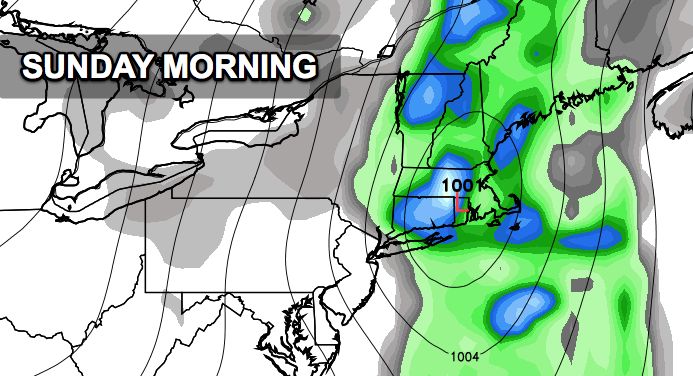
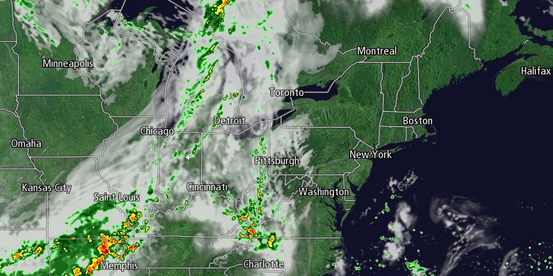
A sharp cold front will move through late in the weekend, and showers are likely sometime from Saturday evening through Sunday morning. Right now, it looks like the best bet for rain is from 2am-10am Sunday. There may be some embedded thunderstorms in the showers. The shower threat diminishes Sunday afternoon as the cold front moves offshore. If sunshine breaks out behind the front, the temperature may reach the low 70s. It’s a safe bet that most areas will be in the mid to upper 60s around midday Sunday. Fall arrives at 4:44 pm EDT on Sunday.
Dry weather is ahead for early next week. High pressure will move from the Great Lakes to Northern New England Monday into Tuesday. Look for mostly sunny skies with highs in the 60s and lows in the 40s to low 50s.


