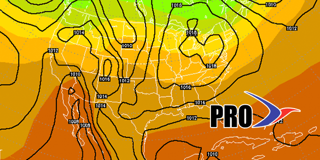
The pattern of cold fronts followed by Canadian highs will continue for the next 10-14 days in the Northeast. It does not look like the temperature swings will be as extreme as we’ve seen this week, but there will be ups and downs as the weather systems pass. Cooler, dry weather is ahead for the weekend, and another front will pass on Monday before there’s chance for much of a warm up. The middle of next week should be dry and seasonable after a cool shot on Tuesday.
Another front will bring showers late next week. The timeframe looks like this week – maybe a day later with rain Friday afternoon into Friday night. No significant weather events stand out from next weekend through the middle of the following week. Of course, at this time of the year we’re watching the tropics, and although the action is picking up, there is no current system that will directly impact the Northeast. We’re still expecting some development off the East Coast on a stalled boundary, but the pattern looks favorable to take anything that develops to the north-northeast, without much of an impact for the United States – at least through the next 10-14 days.


