UPDATE 6 AM WED
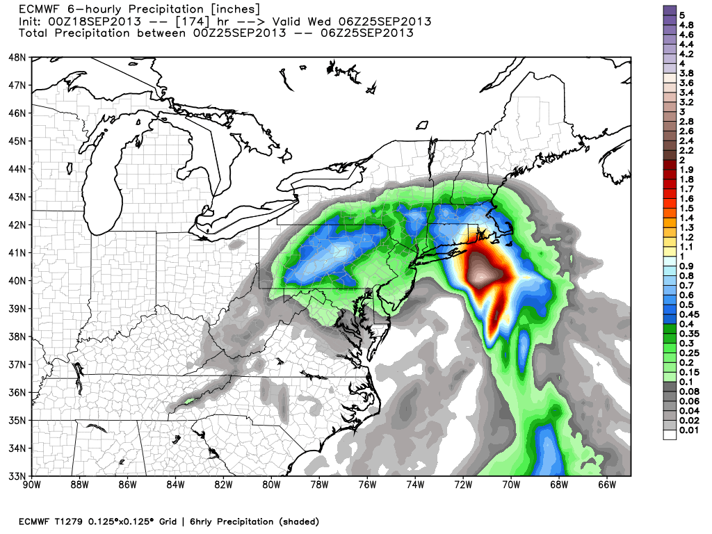
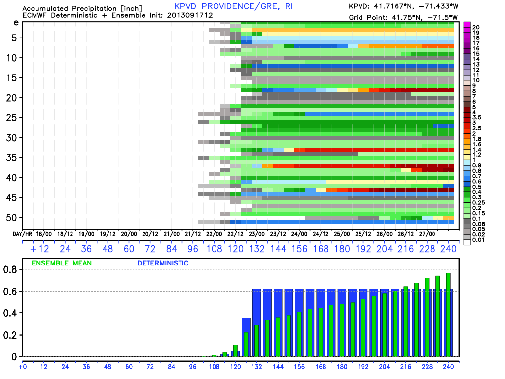
There have been significant changes in the way the models are handling the disturbances in the Gulf of Mexico. Last night’s computer model runs lean toward a scenario that blows the week two part of the Long Range Forecast out of the water. Rather than have high pressure move in from Canada and bring fair weather to New England, the models have the trough that is coming through late in the weekend pick up an already developed tropical system and bring it from the Gulf coast of Louisiana to the Mid-Atlantic coast, with plenty of rain along the path. In this scenario, Southern New England would see a gusty northeast wind and rain in the middle of next week.
While the operational models paint a far different picture than discussed below, the ensembles are not as dire.

The ECMWF mean keeps the system suppressed to the south. This is a situation to monitor closely in the next few days.
FROM 8PM TUE
The overall pattern is benign in the Northeastern United States through most, if not all, of next week. We’ll continue to keep an eye on developing action in the tropics, but it does not look like any of that will get to Southern New England before the last few days of September – if at all. After the weekend cold front brings showers, there should be an area of high pressure that slides in from Eastern Canada and sets up shop for most of next week. At the same time there will be developing weather systems in the Gulf of Mexico that bring rain to the Gulf Coast. It’s unclear if the system will be one organized tropical cyclone or several bundles of energy that never get too well organized. It’s a “blocky” jet stream pattern in the next 7-14 days, so the weather systems should move fairly slowly. That’s good news for anyone that wants dry weather in New England next week.
Temperature wise, we’re not expecting any major swings from the 90s to the 30s like we’ve seen in the past couple of weeks. For the most part, it should stay close to normal, with highs in the upper 60s to mid 70,s and lows in the upper 40s to mid 50s.


