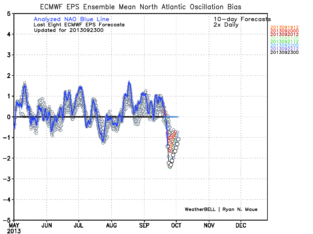
Zzzzzzz….the overall quiet September will continue to the end of the month. A large area of high pressure will control the weather in the Northeast for the next week. For the most part, it will be near to slightly below normal, with highs in the 60s and lows in the 40s. There is no rain in the forecast until at least late in the weekend, and possibly until the middle of next week. A blocky jet stream and negative NAO will keep it cool/dry for 6-10 days in New England.
In the tropics, energy from the Gulf of Mexico will move to through Florida to the Atlantic Ocean north of the Bahamas. This system may blow up into a tropical cyclone later this week, but it will move well off the Eastern Seaboard. It could be an issue for the Canadian Maritimes, but is of no concern in the Northeastern United States. There is not much going on in the Eastern Atlantic, and the generally sleepy hurricane season should continue into early October.
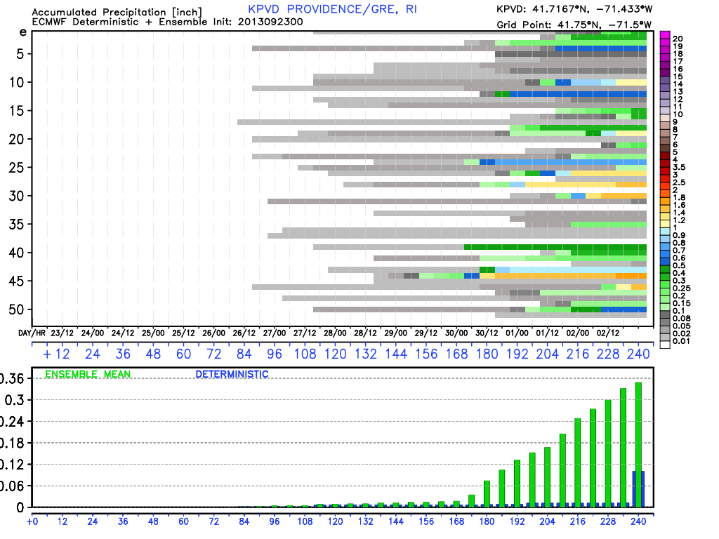
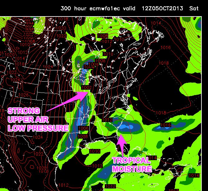
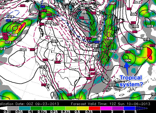
The next shot at rain comes early next week as another cold front moves into the Northeast. The “fronts and highs” theme that we identified in early September is still prevalent. Dry weather is likely in the end of next workweek, with the possibility of rain during the first weekend of October. The models project a large upper-level low pressure system moving from the Great Lakes to the Northeast. At the same time, there could be something tropical brewing in the Bahamas. We alluded to this in the last Long Range Forecast and, while a long shot to bring a direct hit to the Northeast, it is a feature of the weather pattern that needs to be watched.
Check the graphics below for more details.