The temperature rebounded nicely on Saturday after starting the day in the 40s in many places. TF Green Airport fell to 49° Saturday morning for the first time since May 28, 2013. The temperature hit the low to mid 70s Saturday afternoon with mostly sunny skies.
Clouds were advancing in from the west Saturday evening, and some showers are possible from late in the evening through midday Sunday. It does not look like there will be steady rain Sunday morning, and there will be some sunshine by mid to late morning and during the afternoon. Highs will be in the low to mid 70s.
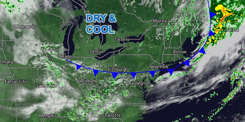
A cold front will move offshore Sunday night allowing cool, dry weather to move back into Southern New England. The temperature will dip into the 40s to low 50s by early Monday morning. Monday afternoon will be quite nice, with highs in the upper 60s under sunny skies. Fair weather is in the forecast through the middle of next week. It will gradually get warmer, too.
Tuesday will be partly cloudy as a warm front moves through in the morning. There could be a passing shower with the front, but it looks like most will stay dry. Tuesday afternoon will be seasonably warm, with highs in the mid to upper 70s. The warmest day of the week is likely to be Wednesday, with highs in the 80s inland. It will gradually get muggier, and that means the overnight low temperature will not be as cool as early in the week. It may not drop below 60° Tuesday night through Thursday night.
Thursday will begin with sunshine, but clouds and thunderstorms are possible in the afternoon and night as another strong cold front approaches from the Great Lakes. That front should be offshore by early in the weekend, and the extended outlook is for more decent weather next Saturday and Sunday.


