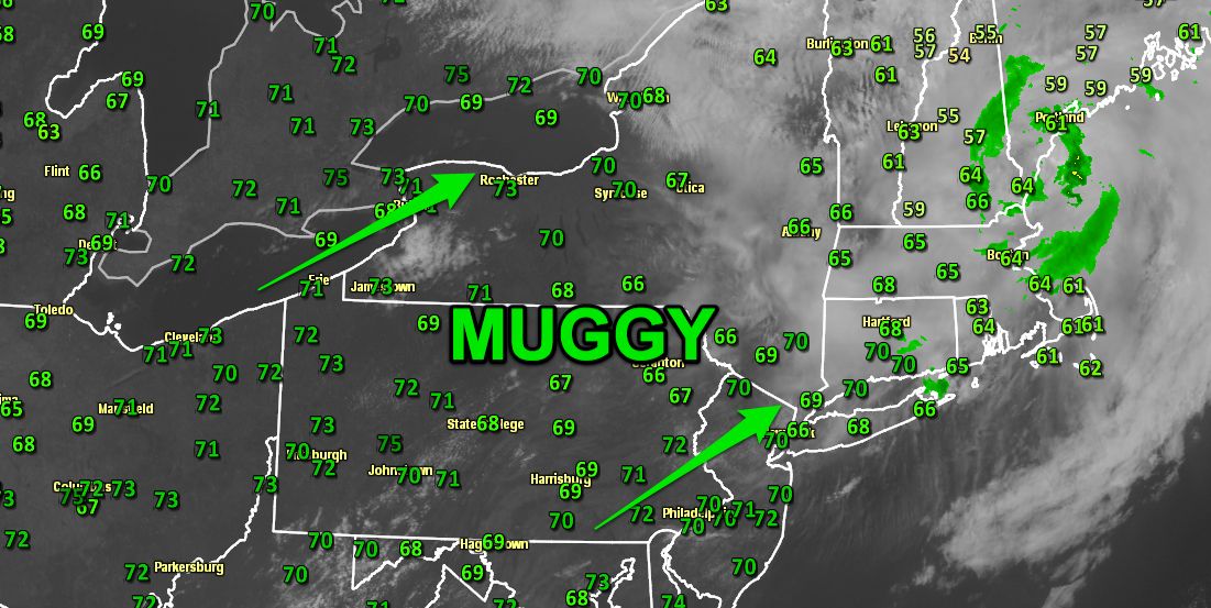
The dew point has crept steadily higher in the past 12 hours in Southern New England. Unfortunately, it will not stop rising until reaching the low 70s on Wednesday. A mid-summer airmass is moving out of the Ohio Valley into the Northeast ahead of a strong cold front.

In general, dew points in the 50s or lower are considered dry, 60s are muggy, and 70s are oppressive. The dew point from late Tuesday night through late Thursday night should range from the mid 60s to low 70s – most likely peaking late Wednesday afternoon. Combined heat and humidity inland on Wednesday will lead to a heat index in the mid to upper 90s, with air temperatures near 90°.

The good news is there is much drier weather in the forecast for this weekend. The dew point will come crashing through the 60s and 50s into the 40s by early Saturday. It will stay pleasant through, at least the middle of next week. With any luck, this stretch will be the last time the dew point reaches 70° in Southern New England until next summer.


