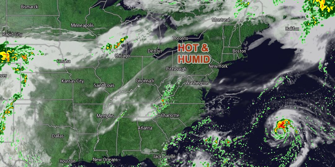
Anyone longing for another summer scorcher or two will certainly enjoy the weather in the next couple of days in Southern New England. Mid-summer heat and humidity is in the forecast for Wednesday, and it will stay warm and humid on Thursday. A weakening area of showers moved through Southern New England early Tuesday afternoon as a warm front eased through the Northeast. The temperature climbed into the low to mid 70s under mostly cloudy skies. Dew points rose from the 50s into the 60s, and will continue rising on Wednesday.
Tuesday night will be partly to mostly cloudy, muggy, and mild. Lows will be in the mid to upper 60s. Patchy fog is possible – especially near the coast. Any low clouds and fog should burn off by mid-morning on Wednesday, and it will be hazy, breezy, very warm and muggy in the afternoon. Highs inland will be in the upper 80s to low 90s. It will be in the upper 70s to mid 80s near the coast. The southwest wind will gust to 20-25 mph Wednesday afternoon.

Wednesday night looks very mild and muggy. Once again, patchy fog may form. Lows will be in the upper 60s to low 70s – 10-15° warmer than normal for mid-September. Thursday, while not as hot inland, will still be very warm and humid. Highs will be in the 80s inland and near 80 at the coast. There will continue to be a gusty southwesterly wind. Clouds will increase late in the day ahead of a cold front that will trigger showers and thunderstorms Thursday night into Friday. Right now, it looks like a chance of showers/storms for the Patriots-Jets game at Gillette Stadium, with a higher likelihood of rain after midnight.
As the cold front moves offshore it will capture rejuvenated Tropical Storm Gabrielle in the Atlantic Ocean. The interaction between the cold front and tropical system may be enough to keep the showers going through Friday morning. It will continue to be very muggy into Friday morning. Showers should end Friday afternoon, and drier air will come charging in behind the front Friday night.
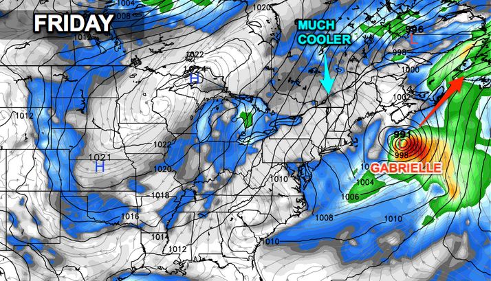
The weekend looks mainly dry and much cooler. Saturday’s highs will only be in the low to mid 60s with a blend of sun and clouds. A passing shower cannot be ruled out because of all the chilly air overhead. Sunday morning will be in the 30s and 40s, and Sunday afternoon looks pleasant with highs in the upper 60s.


