It warmed up nicely on Wednesday afternoon following early morning temperatures in the 30s and 40s. Highs reached 70° in many places, and there was not a cloud to be found! Clear skies Wednesday night offer a nice view of the full Harvest Moon. It will be a cool night, but not as chilly as Tuesday night. Lows Thursday morning will range from near 40° in the countryside, to the low 50s in the cities and near the coast.
Thursday should be a stunner. High pressure south of Southern New England will provide mostly sunny skies and a light southwesterly breeze. Highs will be near 70° at the coast, and in the low to mid 70s inland. The fine weather will stay around on Friday, too. It looks like mid 70s inland, and near 70 at the coast with partly to mostly sunny skies.

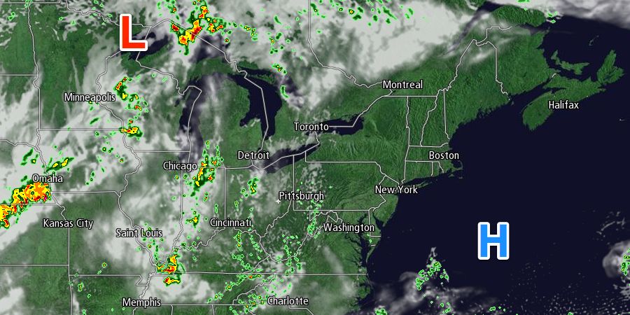
Clouds will begin to stream into the Northeast on Saturday ahead of a cold front that will bring showers by the end of the weekend. Saturday looks like a partly to mostly cloudy day, with highs in the upper 60s to low 70s. Low clouds are likely Saturday night with the temperature falling into the upper 50s to low 60s by early Sunday morning.
Showers will develop on Sunday ahead of the cold front and a developing storm. It’s unclear if they will be light and scattered or if there will be steady rain in Southern New England. It all hinges on how the storm develops along the cold front. We should have a better idea about that forecast in the next day or two. In any event, expect at least a bit of rain on Sunday. Highs will be in the 60s. It looks like there is a better shot of rain in the afternoon and evening.
Monday’s forecast is also somewhat uncertain because of the potential for a storm to form along the front. If it develops, then showers will linger on Monday. If it does not develop, high pressure will begin to move in from Canada setting the stage for drier weather. Highs will be in the 60s.
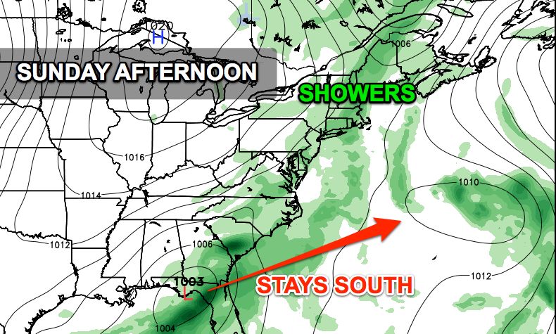
We’ll keep an eye on a storm over the Southeastern United States late this weekend into early next week. Right now, it seems that storm will head out to sea in the middle of next week with little to no impact in Southern New England. It is still several days away, and the forecast may change. At this point, it looks dry and seasonably cool Tuesday and Wednesday.


