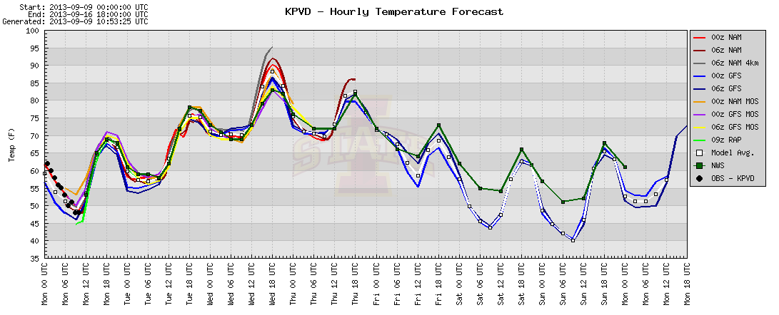
September is a transitional month as summer gives way to fall, and with that transition can come some wild temperature swings. This week will be a perfect example of that in Southern New England. The low temperature Monday morning was in the 30s and 40s in most places. It was the coolest temperature in Providence since late-May.
Some 30s in the mix this morning in N RI and interior SE MA. Should be near 70 in those spots this afternoon. pic.twitter.com/sY5qWz1ELE
— Right Weather (@RightWeather) September 9, 2013
By the middle of the week it will feel a lot more like mid-summer than mid-September as 90°+ heat arrives away from the coast. Widespread 90-95° readings are possible inland on Wednesday afternoon with a west-southwest wind and plenty of sunshine. It will be humid, too, making it feel even hotter. The last 90°+ day in Providence was July 20.

The summer-like heat will not be staying around for too long, and when a strong cold front comes through on Thursday the temperature will begin another free fall that will likely have it in the 40s again by Saturday or Sunday morning.
Extreme weather is not uncommon in September, but it is somewhat unusual to be 6-8° from record lows and record highs in a two-day span. The low temperature on September 9 at TF Green was 48°, the record for the date is 42°. Wednesday’s record is 100°, it is expected to be in the low 90s.


