A large and vigorous weather system will be moving into the Eastern United States over the next couple of days. Most of Halloween should be dry and increasingly breezy and mild. The high temperature will be in the upper 50s to low 60s after starting the day in the low to mid 40s. Early sunshine will give way to clouds as a warm front approaches. The wind will swing around to the south-southwest and pick up to 10-25 mph in the afternoon. A few, stray showers are possible during trick or treating early in the evening.

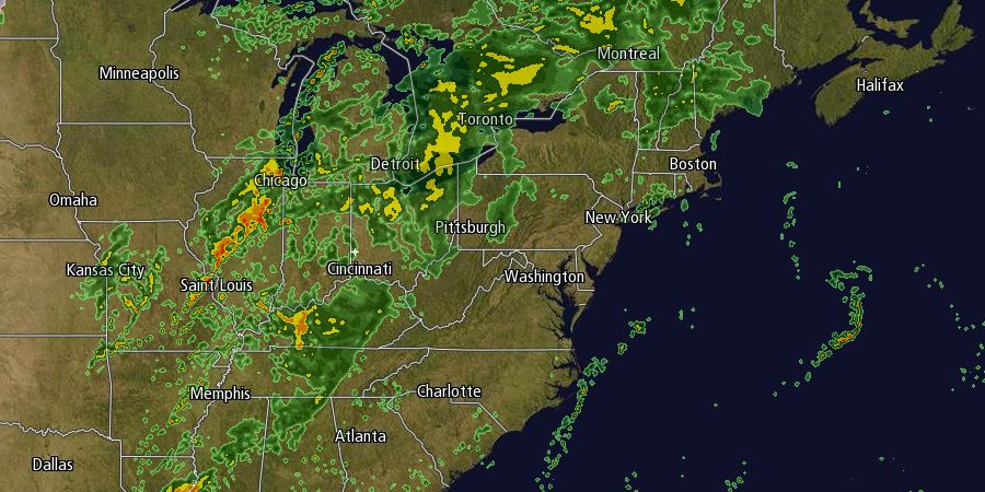
It looks wet, mild, and very windy late Thursday night through midday Friday. Showers will move from west to east across Southern New England as a cold front slowly slides through. The wind will howl out of the southwest, and some damaging wind gusts are possible. Peak gusts should exceed 40 mph near the coast Friday morning. Scattered heavy downpours are possible, and the morning commute could be slowed by the rain/wind combination. It will stay very mild Thursday night though Friday. The temperature will be in the low to mid 60s in spite of the strong winds and rain. The rain threat diminishes around midday Friday, with cloudy, damp conditions lingering in the afternoon.
The weekend should turn out to be decent provided the cold front that moves through Friday gets far enough offshore to prevent a developing storm from clipping Southeastern New England with more showers. Right now, it looks like the front will be far enough away that even if a storm forms it will not come close enough to bring rain. We’ll continue to watch it. The forecast for Saturday is for partly to mostly cloudy skies with highs in the low to mid 60s – quite mild for early November!
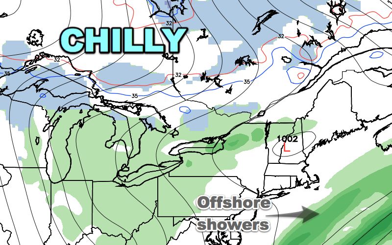
A second cold front will move through New England Saturday night opening the door to chilly weather for Sunday. There should be a lot of bulky clouds on Sunday, and a passing shower cannot be ruled out. The wind will be active out of the northwest, with gusts over 30 mph possible. Cool air continues to funnel into Southern New England into early next week. The high temperature on Monday may not reach 50°, and lows Monday and Tuesday will be in the 20s to low 30s. It will stay fair and get a bit milder in the midweek.


