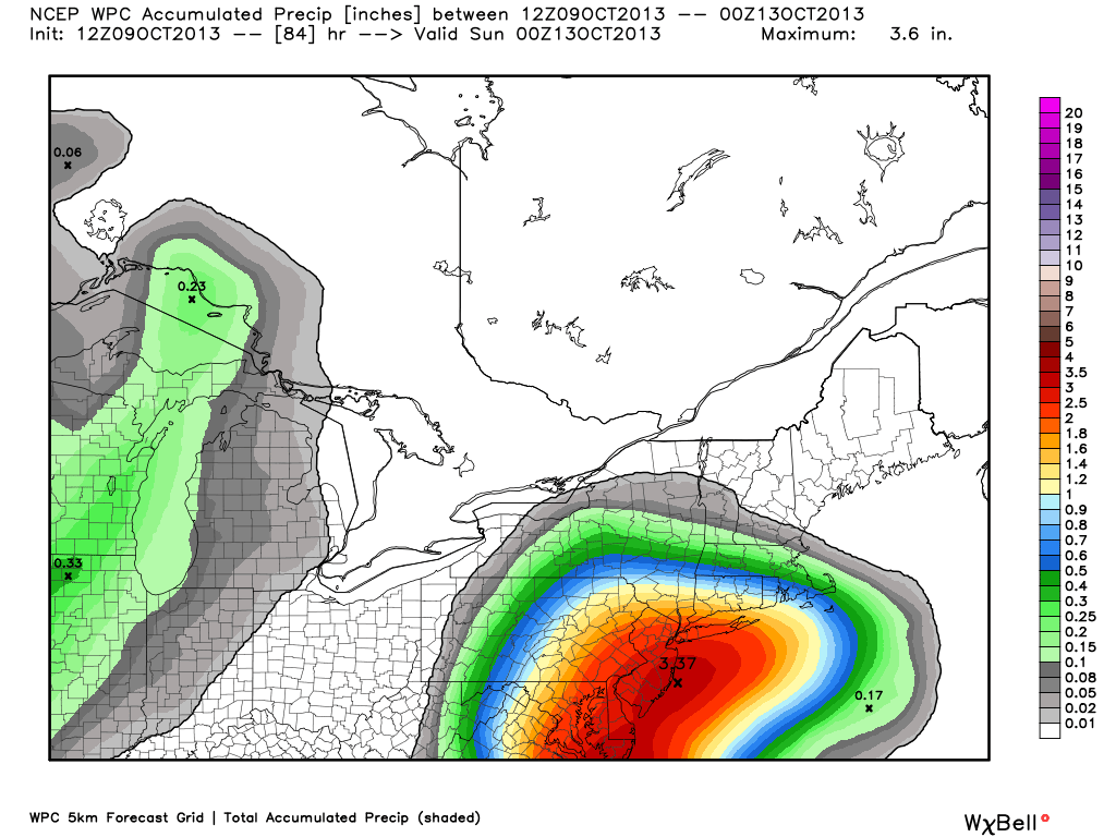
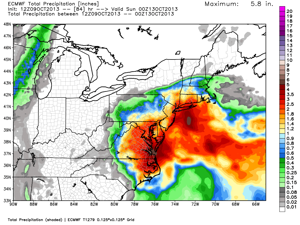
The forecast for Thursday-Saturday in the Northeast is tricky. A storm will come close enough to the Mid-Atlantic to bring heavy showers, gusty winds, and coastal flooding. How far north the storm gets is still a question. As you can see from the images below, the computer model forecasts range from a soaking in RI and CT, with steady rain in MA, to showers for RI/CT, and little rain in MA. The NOAA Weather Prediction Center forecast seems to be a blend of the models with a little more weight given to the wetter solutions for SNE.
We should have a good idea by midday tomorrow which set of models is accurately predicting what will happen with this storm. The wetter models bring steady rain to SNE by late in the day. The other models keep it dry during the day with a few showers at night. At this point, the Right Weather forecast leans toward the drier models, with less than 0.5″ of rain for most of RI and SE MA. The exception could be coastal RI, especially the SW corner of the state.
The biggest differences in the models lie in W RI and CT. Most models agree on lighter rain for E MA.
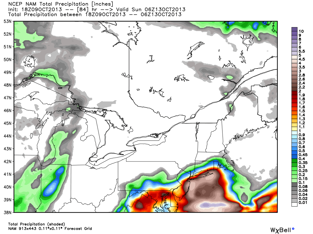
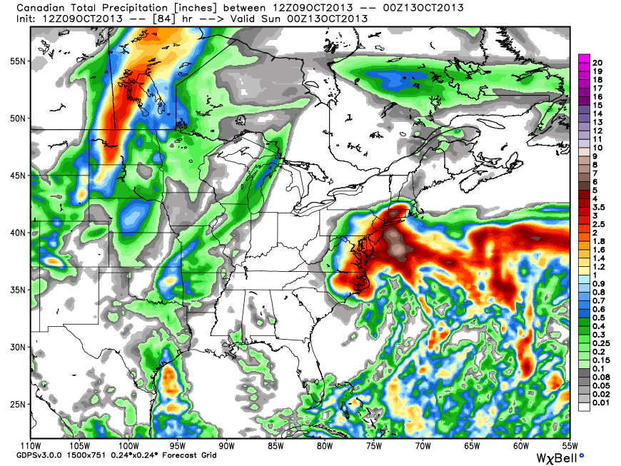

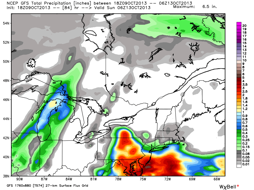
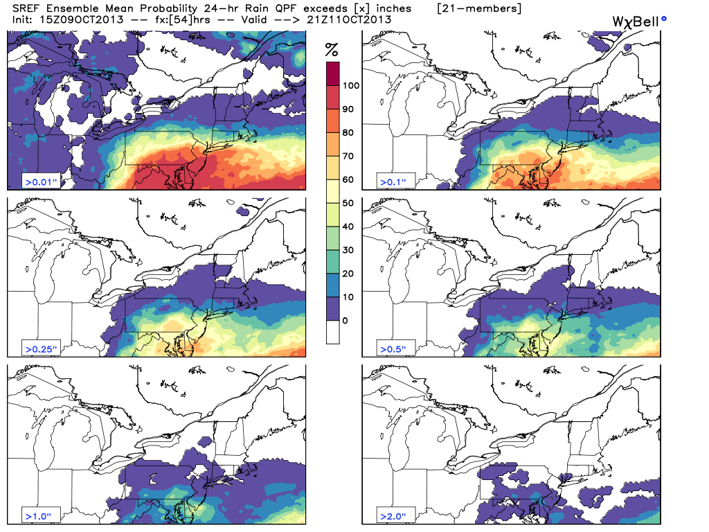
Graphics from weatherbell.com


